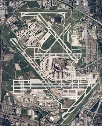
See O'Hare International Airport, Chicago, on the map
Directions to O'Hare International Airport (Chicago) with public transportation
The following transit lines have routes that pass near O'Hare International Airport
 Bus:
Bus: - Chicago 'L':
How to get to O'Hare International Airport by bus?
Click on the bus route to see step by step directions with maps, line arrival times and updated time schedules.
How to get to O'Hare International Airport by Chicago 'L'?
Click on the Chicago 'L' route to see step by step directions with maps, line arrival times and updated time schedules.
Chicago 'l' stations near O'Hare International Airport in Chicago
- O'Hare,5 min walk,
What are the closest stations to O'Hare International Airport?
The closest stations to O'Hare International Airport are:
- O'Hare is 378 yards away, 5 min walk.
Which bus lines stop near O'Hare International Airport?
These bus lines stop near O'Hare International Airport: 250, 330.
Which Chicago 'L' line stops near O'Hare International Airport?
BLUE LINE
What’s the nearest Chicago 'L' station to O'Hare International Airport in Chicago?
The nearest Chicago 'L' station to O'Hare International Airport in Chicago is O'Hare. It’s a 5 min walk away.
See O'Hare International Airport, Chicago, on the map
Public Transit to O'Hare International Airport in Chicago
Wondering how to get to O'Hare International Airport in Chicago, United States? Moovit helps you find the best way to get to O'Hare International Airport with step-by-step directions from the nearest public transit station.
Moovit provides free maps and live directions to help you navigate through your city. View schedules, routes, timetables, and find out how long does it take to get to O'Hare International Airport in real time.
Looking for the nearest stop or station to O'Hare International Airport? Check out this list of stops closest to your destination: O'Hare.
Bus:Chicago 'L':
Want to see if there’s another route that gets you there at an earlier time? Moovit helps you find alternative routes or times. Get directions from and directions to O'Hare International Airport easily from the Moovit App or Website.
We make riding to O'Hare International Airport easy, which is why over 1.5 million users, including users in Chicago, trust Moovit as the best app for public transit. You don’t need to download an individual bus app or train app, Moovit is your all-in-one transit app that helps you find the best bus time or train time available.
For information on prices of bus and Chicago 'L', costs and ride fares to O'Hare International Airport, please check the Moovit app.
Use the app to navigate to popular places including to the airport, hospital, stadium, grocery store, mall, coffee shop, school, college, and university.
O'Hare International Airport Address: O'Hare International Airport (ORD), 10000 W O'Hare Ave, Chicago, IL 60666, USA street in Chicago
Attractions near O'Hare International Airport
Chicago O'Hare International Airport,United Club,Delta Sky Club,Hudson News,Delta Air Lines Ticket Counter,Delta ORD In-Flight Service Lounge,Aa 1578 Chicago To La,canadian terminal (ORD),Concourse E,Skybridge AKA the Greek place,Expressjet Crew Room,Gate F10,Skybridge Restaurant & Bar,United Flight 4427 ORD-LNK,Concourse F,Gate F24,Mesa Crew Room,Gate F12C,United Airlines Flight 6187 (ORD to ROC),S5 ORD Flight Attendant Domicile / Crew RoomHow to get to popular attractions in Chicago with public transit
Lockport, IL, Lockport,Garrett Popcorn Shops, Chicago,Metra - Tinley Park / 80th Ave, Tinley Park,Zurich North America, Schaumburg,Naperville Riverwalk, Naperville,LEGOLAND Discovery Center, Schaumburg,Brookdale, Naperville,Al Bawadi Grill, Bridgeview,Jewel-Osco,360 Chicago, Chicago,Saint Xavier University (Warde Academic Center), Chicago,Texas Roadhouse, Naperville,Chicago Marriott Naperville, Naperville,River Grove, River Grove,Chicago Ridge Mall, Chicago Ridge,Portage Park Neighborhood, Chicago,Maggiano's Little Italy, Schaumburg,127th St, Cicero Ave & I-294, Alsip,10 S Lasalle, Chicago,Holiday Inn Express & Suites Chicago O'Hare, RosemontGet around Chicago by public transit!
Traveling around Chicago has never been so easy. See step by step directions as you travel to any attraction, street or major public transit station. View bus and train schedules, arrival times, service alerts and detailed routes on a map, so you know exactly how to get to anywhere in Chicago.
When traveling to any destination around Chicago use Moovit's Live Directions with Get Off Notifications to know exactly where and how far to walk, how long to wait for your line, and how many stops are left. Moovit will alert you when it's time to get off — no need to constantly re-check whether yours is the next stop.
Wondering how to use public transit in Chicago or how to pay for public transit in Chicago? Moovit public transit app can help you navigate your way with public transit easily, and at minimum cost. It includes public transit fees, ticket prices, and costs. Looking for a map of Chicago public transit lines? Moovit public transit app shows all public transit maps in Chicago with all bus or Chicago 'L' routes and stops on an interactive map.
Chicago has 2 transit type(s), including: bus or Chicago 'L', operated by several transit agencies, including CTA 'L', Metra, Northern Indiana Commuter Transportation District, CTA, PACE, O'Hare International Airport Shuttle Bus, Gary Public Transit, Amtrak, River Valley Metro, Valpo Transit, DeKalb Public Transit, FlixBus-us, Greyhound-us, Van Galder (Coach USA) and Wisconsin Coach Lines