Directions to Oakland Cemetery (Randolph) with public transportation
The following transit lines have routes that pass near Oakland Cemetery
 Bus: 12, 238, 240.
- Train: FALL RIVER/NEW BEDFORD.
How to get to Oakland Cemetery by bus?
Click on the bus route to see step by step directions with maps, line arrival times and updated time schedules.
From Academy Of the Pacific Rim Charter Public School, Boston
107 minFrom Staybridge Suites Boston-Quincy, Quincy
76 minFrom South Shore Hospital Outpatient Center, Weymouth Town
99 minFrom Wollaston Beach, Quincy
94 minFrom South Shore Hospital- Pratt 5, Weymouth Town
114 minFrom Brockton, MA, Brockton
53 minFrom Beth Israel Deaconess Hospital-Milton, Milton
35 minFrom Lower Mills, Boston
42 min
How to get to Oakland Cemetery by train?
Click on the train route to see step by step directions with maps, line arrival times and updated time schedules.
Bus stops near Oakland Cemetery in Randolph
Bus lines to Oakland Cemetery in Randolph
What are the closest stations to Oakland Cemetery?
The closest stations to Oakland Cemetery are:
- North St @ Teed Dr is 314 yards away, 4 min walk.
- 571 N Main St (Jones) is 1173 yards away, 14 min walk.
Which bus lines stop near Oakland Cemetery?
These bus lines stop near Oakland Cemetery: 12, 238, 240.
Which train line stops near Oakland Cemetery?
FALL RIVER/NEW BEDFORD (#2011 | New Bedford)
What’s the nearest bus station to Oakland Cemetery in Randolph?
The nearest bus station to Oakland Cemetery in Randolph is North St @ Teed Dr. It’s a 4 min walk away.
What time is the first bus to Oakland Cemetery in Randolph?
The 240 is the first bus that goes to Oakland Cemetery in Randolph. It stops nearby at 4:43 AM.
What time is the last bus to Oakland Cemetery in Randolph?
The 240 is the last bus that goes to Oakland Cemetery in Randolph. It stops nearby at 12:27 AM.
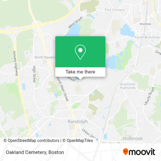
See Oakland Cemetery, Randolph, on the map
Public Transit to Oakland Cemetery in Randolph
Wondering how to get to Oakland Cemetery in Randolph? Moovit helps you find the best way to get to Oakland Cemetery with step-by-step directions from the nearest public transit station.
Moovit provides free maps and live directions to help you navigate through your city. View schedules, routes, timetables, and find out how long does it take to get to Oakland Cemetery in real time.
Looking for the nearest stop or station to Oakland Cemetery? Check out this list of stops closest to your destination: North St @ Teed Dr; 571 N Main St (Jones).
Bus: 12, 238, 240.Train: FALL RIVER/NEW BEDFORD.
Want to see if there’s another route that gets you there at an earlier time? Moovit helps you find alternative routes or times. Get directions from and directions to Oakland Cemetery easily from the Moovit App or Website.
We make riding to Oakland Cemetery easy, which is why over 1.7 million users, including users in Randolph, trust Moovit as the best app for public transit. You don’t need to download an individual bus app or train app, Moovit is your all-in-one transit app that helps you find the best bus time or train time available.
For information on prices of bus, train and subway, costs and ride fares to Oakland Cemetery, please check the Moovit app.
Use the app to navigate to popular places including to the airport, hospital, stadium, grocery store, mall, coffee shop, school, college, and university.
Oakland Cemetery Address: Oak St street in Randolph
- Elizabeth G Lyons Elementary,
- Home Properties,
- Groupe Missionnarrie Pelerins,
- Judie A Paulauski,
- Sztuk Painting,
- Crowley Insurance Agency,
- South Shore Mental Health,
- Amramp,
- Riteway Construction,
- Antonia's Cleaning,
- Bug Swamp Galore,
- Blue Lion Chimneys,
- Mr Twister,
- Fo Carpentry Works,
- Almeida Lawn Care Services,
- Royalty Construction,
- 3mc Appliance Repair,
- 3mc Appliance and Services,
- Qualiplus Cleaning,
- Prosper National Group
Places Near Oakland Cemetery (Randolph)
- Prudential Center, Boston,
- Boston Convention & Exhibition Center, Boston,
- Cheers, Boston,
- Seaport District, Boston,
- Leader Bank Pavilion (Leader Bank Pavillion), Boston,
- Quincy Market, Boston,
- Massachusetts General Hospital, Boston,
- Museum Of Science, Boston,
- Mgm Music Hall, Boston,
- Faneuil Hall, Boston,
- Wilbur Theatre, Boston,
- House Of Blues, Boston,
- Td Garden, Boston,
- Isabella Stewart Gardner Museum, Boston,
- Boston Medical Center, Boston,
- Boston Children's Hospital, Boston,
- Castle Island, Boston,
- Wang Theater, Boston,
- Boston Common, Boston,
- North End, Boston
How to get to popular places in Boston with public transit
Get around Randolph by public transit!
Traveling around Randolph has never been so easy. See step by step directions as you travel to any attraction, street or major public transit station. View bus and train schedules, arrival times, service alerts and detailed routes on a map, so you know exactly how to get to anywhere in Randolph.
When traveling to any destination around Randolph use Moovit's Live Directions with Get Off Notifications to know exactly where and how far to walk, how long to wait for your line, and how many stops are left. Moovit will alert you when it's time to get off — no need to constantly re-check whether yours is the next stop.
Wondering how to use public transit in Randolph or how to pay for public transit in Randolph? Moovit public transit app can help you navigate your way with public transit easily, and at minimum cost. It includes public transit fees, ticket prices, and costs. Looking for a map of Randolph public transit lines? Moovit public transit app shows all public transit maps in Randolph with all Bus, Train, Subway and Ferry routes and stops on an interactive map.
Boston has 4 transit type(s), including: Bus, Train, Subway and Ferry, operated by several transit agencies, including MBTA, Southeastern Regional Transit Authority, MetroWest Regional Transit Authority, Rhode Island Public Transit Authority, WRTA, Lowell Regional Transit Authority, Merrimack Valley Transit, Montachusett Regional Transit Authority, Cape Cod Regional Transit Authority, Brockton Area Transit Authority, Martha's Vineyard Transit Authority, the WAVE - Nantucket Regional Transit Authority, GATRA, Cape Ann Transportation Authority and Massport