Oakville Go Station stop - Thursday schedule
| Line | Direction | Time |
|---|---|---|
| 11 | Clarkson Go | 5:55 AM |
| 13 | Bronte Go | 6:00 AM |
| 5 | Dundas/407 Carpool Via Dundas West | 6:00 AM |
| 1 | Trafalgar/407 Go Carpool | 6:05 AM |
| 14A | Appleby Go Via Burloak | 6:05 AM |
| 14A | Oakville Go | 6:08 AM |
| 18 | Bronte Go | 6:10 AM |
| 19 | Uptown Core | 6:10 AM |
| 15 | South Oakville Centre | 6:10 AM |
| 28 | Bronte Go | 6:10 AM |
| 24 | South Common Centre | 6:10 AM |
| 20 | Uptown Core | 6:10 AM |
| 5 | Dundas/407 Carpool Via Dundas West | 6:15 AM |
| 4 | East - Clarkson Go | 6:22 AM |
| 5 | Oakville Go Via Dundas West | 6:23 AM |
| 14 | Appleby Go Via Great Lakes | 6:25 AM |
| 1 | Oakville Go | 6:26 AM |
| 24 | South Common Centre | 6:30 AM |
| 5 | Dundas/407 Carpool Via Dundas West | 6:30 AM |
| 13 | Oakville Go | 6:35 AM |
| 13 | Bronte Go | 6:35 AM |
| 120 | Laird & Ridgeway | 6:35 AM |
| 19 | Oakville Go | 6:35 AM |
| 20 | Oakville Go | 6:38 AM |
| 5 | Oakville Go Via Dundas West | 6:38 AM |
Directions to Oakville Go Station stop with public transit
The following transit lines have routes that pass near Oakville Go Station
How to get to Oakville Go Station stop by bus?
Click on the bus route to see step by step directions with maps, line arrival times and updated time schedules.
How to get to Oakville Go Station stop by train?
Click on the train route to see step by step directions with maps, line arrival times and updated time schedules.
Bus stops near Oakville Go Station stop
- Cross Ave + Argus Rd, 2 min walk,
- Oakville Go, 3 min walk,
- Trafalgar Rd North Of South Service Rd East, 5 min walk,
- Cornwall Rd + Reynolds St, 8 min walk,
Train stations near Oakville Go Station station
- Oakville, 9 min walk,
Bus lines to Oakville Go Station stop
- 4, West - Oakville Go,
- 10, Bronte Go,
- 14, Appleby Go Via Great Lakes,
- 14A, To Burloak & Rebecca Only,
- 15, South Oakville Centre,
- 18, Oakville Go,
- 28, Oakville Go,
- 83, Oakville Go Via Kerr,
- LW, # | Niagara Falls Go,
- 18, 18h - Oakville Go,
- 22, 22 - Oakville Go,
- 56, 56b - Hwy. 407 Bus Term,
- 1, Trafalgar,
- 5, Dundas,
- 13, Westoak Trails,
- 19, River Oaks,
- 20, Northridge,
- 24, South Common,
- 26, Falgarwood,
- 120, East Industrial,
What are the closest stations to Oakville Go Station?
The closest stations to Oakville Go Station are:
- Cross Ave + Argus Rd is 139 meters away, 2 min walk.
- Oakville Go is 205 meters away, 3 min walk.
- Trafalgar Rd North Of South Service Rd East is 376 meters away, 5 min walk.
- Cornwall Rd + Reynolds St is 557 meters away, 8 min walk.
- Oakville is 660 meters away, 9 min walk.
Which bus lines stop near Oakville Go Station?
These bus lines stop near Oakville Go Station: 14, 19, 24, 4, 5, 5A.
Which train line stops near Oakville Go Station?
LW
What’s the nearest train station to Oakville Go Station?
The nearest train station to Oakville Go Station is Oakville. It’s a 9 min walk away.
What’s the nearest bus station to Oakville Go Station?
The nearest bus station to Oakville Go Station is Cross Ave + Argus Rd. It’s a 2 min walk away.
What time is the first train to Oakville Go Station?
The LW is the first train that goes to Oakville Go Station. It stops nearby at 5:17 AM.
What time is the last train to Oakville Go Station?
The LW is the last train that goes to Oakville Go Station. It stops nearby at 1:00 AM.
What time is the first bus to Oakville Go Station?
The 18 is the first bus that goes to Oakville Go Station. It stops nearby at 3:17 AM.
What time is the last bus to Oakville Go Station?
The 18 is the last bus that goes to Oakville Go Station. It stops nearby at 3:17 AM.
How much is the rail fare to Oakville Go Station?
The rail fare to Oakville Go Station costs about $3.70 - $11.46.
How much is the bus fare to Oakville Go Station?
The bus fare to Oakville Go Station costs about $2.75 - $14.54.
See Oakville Go Station stop on the map
Public transit to Oakville Go Station stop (ID: 3172)
Looking for directions to Oakville Go Station in Oakville, Canada?
Download the Moovit App to find the current schedule and step-by-step directions for Bus or Train routes that pass through Oakville Go Station.
Looking for the nearest stops closest to Oakville Go Station ? Check out this list of closest stops to your destination: Cross Ave + Argus Rd; Oakville Go; Trafalgar Rd North Of South Service Rd East; Cornwall Rd + Reynolds St; Oakville.
Bus: 14, 19, 24, 4, 5, 5A, 10, 14A, 15, LW, 18, 22, 56, 1, 13, 20, 11.Train: LW, VIA RAIL, VIA RAIL.
We make riding on public transit to Oakville Go Station easy, which is why over 1.5 million users, including users in Oakville trust Moovit as the best app for public transit.
Use the app to navigate to popular places including to the airport, hospital, stadium, grocery store, mall, coffee shop, school, college, and university.
Oakville Go Station stop’s code is 3172
The first line to this stop is 11, at 5:55 AM, and the last line is 24 at 12:19 AM.
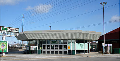
214 Cross Ave, Oakville, ON, Canada
This stop serves Oakville Transit’s lines
Popular routes from Oakville Go Station stop
Bus stops near Oakville Go Station stop
Train station near Oakville Go Station station
Popular public transit stations in Oakville
Get around Oakville by public transit!
Traveling around Oakville has never been so easy. See step by step directions as you travel to any attraction, street or major public transit station. View bus and train schedules, arrival times, service alerts and detailed routes on a map, so you know exactly how to get to anywhere in Oakville.
When traveling to any destination around Oakville use Moovit's Live Directions with Get Off Notifications to know exactly where and how far to walk, how long to wait for your line, and how many stops are left. Moovit will alert you when it's time to get off — no need to constantly re-check whether yours is the next stop.
Wondering how to use public transit in Oakville or how to pay for public transit in Oakville? Moovit public transit app can help you navigate your way with public transit easily, and at minimum cost. It includes public transit fees, ticket prices, and costs. Looking for a map of Oakville public transit lines? Moovit public transit app shows all public transit maps in Oakville with all Bus, Train, Subway, Streetcar and Ferry routes and stops on an interactive map.
Toronto has 5 transit type(s), including: Bus, Train, Subway, Streetcar and Ferry, operated by several transit agencies, including TTC, TTC Streetcar, Toronto Subway, GO Transit Bus, GO Transit, Hamilton Street Railway, Grand River Transit, MiWay, Burlington Transit, Guelph Transit, Oakville Transit, Brampton Transit, York Region Transit, UP Express and Barrie Transit