Directions to Oakwood Avenue (Toronto) with public transportation
The following transit lines have routes that pass near Oakwood Avenue
How to get to Oakwood Avenue by bus?
Click on the bus route to see step by step directions with maps, line arrival times and updated time schedules.
How to get to Oakwood Avenue by subway?
Click on the subway route to see step by step directions with maps, line arrival times and updated time schedules.
Bus stations near Oakwood Avenue in Toronto
- Oakwood Ave At Vaughan Rd,1 min walk,
- Vaughan Rd At Oakwood Ave East Side,2 min walk,
Bus lines to Oakwood Avenue in Toronto
- 63A,OSSINGTON,
- 363,OSSINGTON NIGHT BUS,
- 90C,Vaughan Rd at Oakwood Ave East Side,
What are the closest stations to Oakwood Avenue?
The closest stations to Oakwood Avenue are:
- Oakwood Ave At Vaughan Rd is 34 meters away, 1 min walk.
- Vaughan Rd At Oakwood Ave East Side is 97 meters away, 2 min walk.
Which bus lines stop near Oakwood Avenue?
These bus lines stop near Oakwood Avenue: 32, 63.
Which subway line stops near Oakwood Avenue?
1
What’s the nearest bus stop to Oakwood Avenue in Toronto?
The nearest bus stop to Oakwood Avenue in Toronto is Oakwood Ave At Vaughan Rd. It’s a 1 min walk away.
See Oakwood Avenue, Toronto, on the map
Public Transit to Oakwood Avenue in Toronto
Wondering how to get to Oakwood Avenue in Toronto, Canada? Moovit helps you find the best way to get to Oakwood Avenue with step-by-step directions from the nearest public transit station.
Moovit provides free maps and live directions to help you navigate through your city. View schedules, routes, timetables, and find out how long does it take to get to Oakwood Avenue in real time.
Looking for the nearest stop or station to Oakwood Avenue? Check out this list of stops closest to your destination: Oakwood Ave At Vaughan Rd; Vaughan Rd At Oakwood Ave East Side.
Bus:326363A36390CSubway:1
Want to see if there’s another route that gets you there at an earlier time? Moovit helps you find alternative routes or times. Get directions from and directions to Oakwood Avenue easily from the Moovit App or Website.
We make riding to Oakwood Avenue easy, which is why over 1.5 million users, including users in Toronto, trust Moovit as the best app for public transit. You don’t need to download an individual bus app or train app, Moovit is your all-in-one transit app that helps you find the best bus time or train time available.
For information on prices of bus and subway, costs and ride fares to Oakwood Avenue, please check the Moovit app.
Use the app to navigate to popular places including to the airport, hospital, stadium, grocery store, mall, coffee shop, school, college, and university.
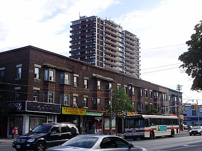
Oakwood Avenue Address: Oakwood Ave & Vaughan Rd, Toronto, ON M6E, Canada street in Toronto
Attractions near Oakwood Avenue
Vaughan Road & Oakwood Avenue,Kaydee's Men's Boutique,The 501 Centre,Arawak Business Ctr,Ken's Auto Svc Ctr,Churasqueira,Seg'z Restaurant,Superior Beauty Supplies,Supernatural,M6E 2X3,Pita Ikram,Arawak Business Centre/ Law Office,One Love Sports Bar,La Fiesta Catering Restaurant,Talento Italiano Gifts Records,Bonamico Cafe,Piazza Sports Bar,Luxury Hair Care Empire Ltd,Tony's Sports Bar,Flamboyant Beauty SalonHow to get to popular attractions in Toronto with public transit
Square One Bus Terminal, Mississauga,Ontario Tech University, Oshawa,Lahore Tikka House, Toronto,Aldershot VIA/GO Station, Burlington,The Keg Steakhouse + Bar - Keg Mansion, Toronto,Canada's Wonderland, Vaughan,Newmarket, Ontario, Newmarket,Cn Tower, Toronto,Jack Astor's Bar & Grill, Toronto,GoodLife Fitness Centres, Toronto,Walmart Supercentre, Burlington,Oliver & Bonacini Café Grill, Yonge and Front, Toronto,City of Hamilton, Hamilton,Union Restaurant, Toronto,City of Burlington, Burlington,Mcmaster University, Hamilton,York University, Toronto,Durham College (Oshawa Campus), Oshawa,Outlet Collection at Niagara, Niagara-On-The-Lake,Stoney Creek, Ontario, HamiltonGet around Toronto by public transit!
Traveling around Toronto has never been so easy. See step by step directions as you travel to any attraction, street or major public transit station. View bus and train schedules, arrival times, service alerts and detailed routes on a map, so you know exactly how to get to anywhere in Toronto.
When traveling to any destination around Toronto use Moovit's Live Directions with Get Off Notifications to know exactly where and how far to walk, how long to wait for your line, and how many stops are left. Moovit will alert you when it's time to get off — no need to constantly re-check whether yours is the next stop.
Wondering how to use public transit in Toronto or how to pay for public transit in Toronto? Moovit public transit app can help you navigate your way with public transit easily, and at minimum cost. It includes public transit fees, ticket prices, and costs. Looking for a map of Toronto public transit lines? Moovit public transit app shows all public transit maps in Toronto with all bus or subway routes and stops on an interactive map.
Toronto has 2 transit type(s), including: bus or subway, operated by several transit agencies, including TTC, TTC Streetcar, Toronto Subway, GO Transit Bus, GO Transit, Amtrak, York Region Transit, Grand River Transit, Guelph Transit, grt, Hamilton Street Railway, MiWay, Brampton Transit, Burlington Transit and Oakville Transit