Directions to Occlusion Prosthetics (Barnstable Town) with public transportation
The following transit lines have routes that pass near Occlusion Prosthetics
 Bus: BARNSTABLE VILLAGER, HYANNIS CROSSTOWN, PETER PAN.
- Train: CAPEFLYER.
How to get to Occlusion Prosthetics by bus?
Click on the bus route to see step by step directions with maps, line arrival times and updated time schedules.
Bus stop near Occlusion Prosthetics in Barnstable Town
- Harbor Community Health Center, 14 min walk,VIEW
Train station near Occlusion Prosthetics in Barnstable Town
- Hyannis, 35 min walk,VIEW
Bus lines to Occlusion Prosthetics in Barnstable Town
What are the closest stations to Occlusion Prosthetics?
The closest stations to Occlusion Prosthetics are:
- Harbor Community Health Center is 1166 yards away, 14 min walk.
- Hyannis is 2944 yards away, 35 min walk.
Which bus lines stop near Occlusion Prosthetics?
These bus lines stop near Occlusion Prosthetics: BARNSTABLE VILLAGER, HYANNIS CROSSTOWN, PETER PAN.
What’s the nearest bus station to Occlusion Prosthetics in Barnstable Town?
The nearest bus station to Occlusion Prosthetics in Barnstable Town is Harbor Community Health Center. It’s a 14 min walk away.
What time is the first bus to Occlusion Prosthetics in Barnstable Town?
The HYANNIS CROSSTOWN is the first bus that goes to Occlusion Prosthetics in Barnstable Town. It stops nearby at 8:35 AM.
What time is the last bus to Occlusion Prosthetics in Barnstable Town?
The HYANNIS CROSSTOWN is the last bus that goes to Occlusion Prosthetics in Barnstable Town. It stops nearby at 7:15 PM.
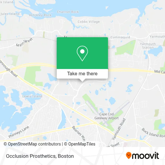
See Occlusion Prosthetics, Barnstable Town, on the map
Public Transit to Occlusion Prosthetics in Barnstable Town
Wondering how to get to Occlusion Prosthetics in Barnstable Town? Moovit helps you find the best way to get to Occlusion Prosthetics with step-by-step directions from the nearest public transit station.
Moovit provides free maps and live directions to help you navigate through your city. View schedules, routes, timetables, and find out how long does it take to get to Occlusion Prosthetics in real time.
Looking for the nearest stop or station to Occlusion Prosthetics? Check out this list of stops closest to your destination: Harbor Community Health Center; Hyannis.
Bus: BARNSTABLE VILLAGER, HYANNIS CROSSTOWN, PETER PAN.Train: CAPEFLYER.
Want to see if there’s another route that gets you there at an earlier time? Moovit helps you find alternative routes or times. Get directions from and directions to Occlusion Prosthetics easily from the Moovit App or Website.
We make riding to Occlusion Prosthetics easy, which is why over 1.7 million users, including users in Barnstable Town, trust Moovit as the best app for public transit. You don’t need to download an individual bus app or train app, Moovit is your all-in-one transit app that helps you find the best bus time or train time available.
For information on prices of bus and train, costs and ride fares to Occlusion Prosthetics, please check the Moovit app.
Use the app to navigate to popular places including to the airport, hospital, stadium, grocery store, mall, coffee shop, school, college, and university.
Occlusion Prosthetics Address: 270 Communication Way street in Barnstable Town
- Hyannis Inn,
- Cape Cod Chips,
- Interstate Batteries,
- JG Auto Sales & Repair,
- Oceanside Restoration,
- Physicians Emerald,
- Infinium,
- Sencorp,
- Cape Cod Healthcare Financial Services,
- Interstate Batteries,
- Break Room Cafe,
- Dish Network,
- ChargePoint,
- Wilkens Outpatient Medical Complex, Hyannis,
- Sherlock Holmes Cleaning Services,
- Naomi J. Kalliath, do,
- Keyme,
- Citizens Bank,
- Main Street Beauty Bar,
- Carrier Totaline
Places Near Occlusion Prosthetics (Barnstable Town)
- Museum Of Science, Boston,
- Castle Island, Boston,
- Faneuil Hall, Boston,
- Isabella Stewart Gardner Museum, Boston,
- Cheers, Boston,
- Td Garden, Boston,
- Seaport District, Boston,
- Mgm Music Hall, Boston,
- Leader Bank Pavilion (Leader Bank Pavillion), Boston,
- Wang Theater, Boston,
- Boston Medical Center, Boston,
- Wilbur Theatre, Boston,
- Prudential Center, Boston,
- North End, Boston,
- Massachusetts General Hospital, Boston,
- House Of Blues, Boston,
- Boston Convention & Exhibition Center, Boston,
- Boston Common, Boston,
- Quincy Market, Boston,
- Boston Children's Hospital, Boston
How to get to popular places in Boston with public transit
Get around Barnstable Town by public transit!
Traveling around Barnstable Town has never been so easy. See step by step directions as you travel to any attraction, street or major public transit station. View bus and train schedules, arrival times, service alerts and detailed routes on a map, so you know exactly how to get to anywhere in Barnstable Town.
When traveling to any destination around Barnstable Town use Moovit's Live Directions with Get Off Notifications to know exactly where and how far to walk, how long to wait for your line, and how many stops are left. Moovit will alert you when it's time to get off — no need to constantly re-check whether yours is the next stop.
Wondering how to use public transit in Barnstable Town or how to pay for public transit in Barnstable Town? Moovit public transit app can help you navigate your way with public transit easily, and at minimum cost. It includes public transit fees, ticket prices, and costs. Looking for a map of Barnstable Town public transit lines? Moovit public transit app shows all public transit maps in Barnstable Town with all Bus, Train, Subway and Ferry routes and stops on an interactive map.
Boston has 4 transit type(s), including: Bus, Train, Subway and Ferry, operated by several transit agencies, including MBTA, Southeastern Regional Transit Authority, MetroWest Regional Transit Authority, Rhode Island Public Transit Authority, WRTA, Lowell Regional Transit Authority, Merrimack Valley Transit, Montachusett Regional Transit Authority, Cape Cod Regional Transit Authority, Brockton Area Transit Authority, Martha's Vineyard Transit Authority, the WAVE - Nantucket Regional Transit Authority, GATRA, Cape Ann Transportation Authority and Massport