How to get to Ohio State University by bus?
Click on the bus route to see step by step directions with maps, line arrival times and updated time schedules.
How to get to Ohio State University by train?
Click on the train route to see step by step directions with maps, line arrival times and updated time schedules.
Bus stops near Ohio State University in Lowell
Bus lines to Ohio State University in Lowell
What are the closest stations to Ohio State University?
The closest stations to Ohio State University are:
- Lawrence St & Cady St is 98 yards away, 2 min walk.
- High St & Oak St is 281 yards away, 4 min walk.
- Andover St & High St is 305 yards away, 4 min walk.
Which bus lines stop near Ohio State University?
These bus lines stop near Ohio State University: 12, 24.
Which train line stops near Ohio State University?
LOWELL (#331 | Lowell)
What’s the nearest bus station to Ohio State University in Lowell?
The nearest bus station to Ohio State University in Lowell is Lawrence St & Cady St. It’s a 2 min walk away.
What time is the first bus to Ohio State University in Lowell?
The 24 is the first bus that goes to Ohio State University in Lowell. It stops nearby at 5:35 AM.
What time is the last bus to Ohio State University in Lowell?
The 24 is the last bus that goes to Ohio State University in Lowell. It stops nearby at 9:35 PM.
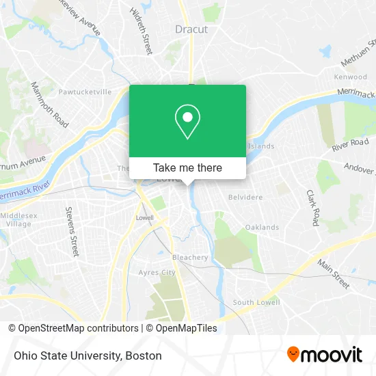
See Ohio State University, Lowell, on the map
Public Transit to Ohio State University in Lowell
Wondering how to get to Ohio State University in Lowell? Moovit helps you find the best way to get to Ohio State University with step-by-step directions from the nearest public transit station.
Moovit provides free maps and live directions to help you navigate through your city. View schedules, routes, timetables, and find out how long does it take to get to Ohio State University in real time.
Looking for the nearest stop or station to Ohio State University? Check out this list of stops closest to your destination: Lawrence St & Cady St; High St & Oak St; Andover St & High St.
Bus: 12, 24, 3, 2, 9, 11.Train: LOWELL.
Want to see if there’s another route that gets you there at an earlier time? Moovit helps you find alternative routes or times. Get directions from and directions to Ohio State University easily from the Moovit App or Website.
We make riding to Ohio State University easy, which is why over 1.7 million users, including users in Lowell, trust Moovit as the best app for public transit. You don’t need to download an individual bus app or train app, Moovit is your all-in-one transit app that helps you find the best bus time or train time available.
For information on prices of bus and train, costs and ride fares to Ohio State University, please check the Moovit app.
Use the app to navigate to popular places including to the airport, hospital, stadium, grocery store, mall, coffee shop, school, college, and university.
Ohio State University Address: 70 Lawrence St street in Lowell
- Iglesia Arca De Refugió Lowell MA,
- Assembléia de Deus Ministério de Cristo,
- Aurea Vestes,
- Lowell Portuguese Seventh-Day Adventist Church,
- Colburn School,
- Exxon,
- Liberty Hotel,
- Axe Shack,
- Abc Nail Spa & Eyelash,
- Sage Bank,
- Locksmith Around The Clock,
- US Army,
- Ma Baptist Multicultural Ministries,
- Arise City Church,
- African Community Center Of Lowell,
- Massachusetts Baptist Multicultural Ministries,
- Cac,
- Northeast Rehabilitation Outpatient Clinic,
- Nrgtree,
- United States Government
Places Near Ohio State University (Lowell)
- Boston Children's Hospital, Boston,
- Leader Bank Pavilion (Leader Bank Pavillion), Boston,
- Mgm Music Hall, Boston,
- Castle Island, Boston,
- Boston Common, Boston,
- Wang Theater, Boston,
- Boston Convention & Exhibition Center, Boston,
- Boston Medical Center, Boston,
- Museum Of Science, Boston,
- Faneuil Hall, Boston,
- Massachusetts General Hospital, Boston,
- Td Garden, Boston,
- Prudential Center, Boston,
- Quincy Market, Boston,
- House Of Blues, Boston,
- Wilbur Theatre, Boston,
- Seaport District, Boston,
- North End, Boston,
- Isabella Stewart Gardner Museum, Boston,
- Cheers, Boston
How to get to popular places in Boston with public transit
Get around Lowell by public transit!
Traveling around Lowell has never been so easy. See step by step directions as you travel to any attraction, street or major public transit station. View bus and train schedules, arrival times, service alerts and detailed routes on a map, so you know exactly how to get to anywhere in Lowell.
When traveling to any destination around Lowell use Moovit's Live Directions with Get Off Notifications to know exactly where and how far to walk, how long to wait for your line, and how many stops are left. Moovit will alert you when it's time to get off — no need to constantly re-check whether yours is the next stop.
Wondering how to use public transit in Lowell or how to pay for public transit in Lowell? Moovit public transit app can help you navigate your way with public transit easily, and at minimum cost. It includes public transit fees, ticket prices, and costs. Looking for a map of Lowell public transit lines? Moovit public transit app shows all public transit maps in Lowell with all Bus, Train, Subway and Ferry routes and stops on an interactive map.
Boston has 4 transit type(s), including: Bus, Train, Subway and Ferry, operated by several transit agencies, including MBTA, Southeastern Regional Transit Authority, MetroWest Regional Transit Authority, Rhode Island Public Transit Authority, WRTA, Lowell Regional Transit Authority, Merrimack Valley Transit, Montachusett Regional Transit Authority, Cape Cod Regional Transit Authority, Brockton Area Transit Authority, Martha's Vineyard Transit Authority, the WAVE - Nantucket Regional Transit Authority, GATRA, Cape Ann Transportation Authority and Massport