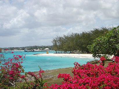
See Oistins, Christ Church, on the map
Directions to Oistins (Christ Church) with public transportation
The following transit lines have routes that pass near Oistins
 Bus:
Bus:
How to get to Oistins by bus?
Click on the bus route to see step by step directions with maps, line arrival times and updated time schedules.
Bus stations near Oistins in Christ Church
- Oistins (Terminal),4 min walk,
- Church Hill (Christ Church),7 min walk,
- Water Street,18 min walk,
Bus lines to Oistins in Christ Church
- 13,Silver Sands To Fairchild Street Terminal,
- 26,Oistins To College Savannah,
- 27,Speightstown Terminal To Silver Sands,
- 28,St. George Church To Oistins,
- 31,Silver Sands To St. George Church,
- 32,White Hill To Silver Sands,
- 34,Oistins To Oistins,
- 54,Speightstown Terminal To Oistins,
- 12A,Sam Lords Castle To Fairchild Street Terminal,
- 30A,Silver Sands To Rock Dundo,
- 31A,Rock Hall To Oistins,
- 13B,St. Christopher To Oistins,
- 12D,Fairchild Street Terminal To Kirtons 3 And Crane,
- 27D,Wanstead To Sam Lords Castle,
- 27E,Oistins To Wanstead,
- 12F,Fairchild Street Terminal To Fairy Valley,
- SE 12,Weymouth To Sliver Sands/Fairy Valley/Sam Lord's Castle,
- 16B,Fairchild Street Terminal To Silver Hill,
- 16A,Fairchild Street Terminal To St. Patricks,
- 16D,Fairchild Street Terminal To Lowlands,
What are the closest stations to Oistins?
The closest stations to Oistins are:
- Oistins (Terminal) is 258 meters away, 4 min walk.
- Church Hill (Christ Church) is 457 meters away, 7 min walk.
- Water Street is 1342 meters away, 18 min walk.
Which bus lines stop near Oistins?
These bus lines stop near Oistins: 12A, 27.
What’s the nearest bus stop to Oistins in Christ Church?
The nearest bus stop to Oistins in Christ Church is Oistins (Terminal). It’s a 4 min walk away.
What time is the first bus to Oistins in Christ Church?
The 27E is the first bus that goes to Oistins in Christ Church. It stops nearby at 4:56 AM.
What time is the last bus to Oistins in Christ Church?
The 27 is the last bus that goes to Oistins in Christ Church. It stops nearby at 1:20 AM.
See Oistins, Christ Church, on the map
Public Transit to Oistins in Christ Church
Wondering how to get to Oistins in Christ Church, Barbados? Moovit helps you find the best way to get to Oistins with step-by-step directions from the nearest public transit station.
Moovit provides free maps and live directions to help you navigate through your city. View schedules, routes, timetables, and find out how long does it take to get to Oistins in real time.
Looking for the nearest stop or station to Oistins? Check out this list of stops closest to your destination: Oistins (Terminal); Church Hill (Christ Church); Water Street.
Bus:
Want to see if there’s another route that gets you there at an earlier time? Moovit helps you find alternative routes or times. Get directions from and directions to Oistins easily from the Moovit App or Website.
We make riding to Oistins easy, which is why over 1.5 million users, including users in Christ Church, trust Moovit as the best app for public transit. You don’t need to download an individual bus app or train app, Moovit is your all-in-one transit app that helps you find the best bus time or train time available.
For information on prices of bus, costs and ride fares to Oistins, please check the Moovit app.
Use the app to navigate to popular places including to the airport, hospital, stadium, grocery store, mall, coffee shop, school, college, and university.
Oistins Address: Oistins, Highway 7, Oistins, Barbados street in Christ Church
Attractions near Oistins
Oistins Fish Market,Oistin's Friday Night Fish Fry,Wolverine Ice,chillin & grillin,Highway 7,Oistins Bay Garden,Anne's Bar And Grill,Joe's Pharmacy,Oistins Bus Terminal,Dicia's Bar,Barbados Licensing Authority,Randall Phillips Polyclinic,Barbados Revenue Authority (Bra) - Oistins,Avida Pharmacy,Southern Plaza Shopping Centre,Butterfly Beach Hotel,Oistins Public Library,Christ Church Foundation School,Cane Vale,Christ Church Foundation SchoolHow to get to popular attractions in Christ Church with public transit
Deacon's Primary School, Bridgetown,Maxwell Beach, Christ Church,Wickham Lewis Boardwalk, Bridgetown,St. James, Barbados, Saint James,Massy Stores- Supermarket, Saint Michael,Leadvale, Christ Church,Digicel Barbados Limited Corporate office, Saint Michael,National Insurance Building, Bridgetown,Deighton Griffith Secondary School, Christ Church,St. Lawrence Gap, Bridgetown,Collins Limited Wholesale, Saint Michael,Reggae Lounge, Christ Church,Sol, Saint Thomas,Sky Mall Food Court, Bridgetown,Grantley Adams International Airport (BGI), Christ Church,Bridgetown, Bridgetown,Dover Beach Park, Christ Church,Ruby, St. Philip, Saint Philip,Baobab Tower, Saint Michael,Olympus Theatres, Christ ChurchGet around Christ Church by public transit!
Traveling around Christ Church has never been so easy. See step by step directions as you travel to any attraction, street or major public transit station. View bus and train schedules, arrival times, service alerts and detailed routes on a map, so you know exactly how to get to anywhere in Christ Church.
When traveling to any destination around Christ Church use Moovit's Live Directions with Get Off Notifications to know exactly where and how far to walk, how long to wait for your line, and how many stops are left. Moovit will alert you when it's time to get off — no need to constantly re-check whether yours is the next stop.
Wondering how to use public transit in Christ Church or how to pay for public transit in Christ Church? Moovit public transit app can help you navigate your way with public transit easily, and at minimum cost. It includes public transit fees, ticket prices, and costs. Looking for a map of Christ Church public transit lines? Moovit public transit app shows all public transit maps in Christ Church with all bus routes and stops on an interactive map.
Christ Church has 1 transit type(s), including: bus, operated by several transit agencies, including Transport Board