
Find the best routes to Old Croton Aqueduct Walk, Bronx

Directions to Old Croton Aqueduct Walk (Bronx) with public transportation

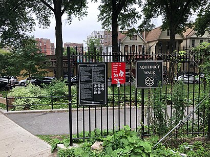
The following transit lines have routes that pass near Old Croton Aqueduct Walk

    BusBus: BX12-SBS, BX3, BXM3, BX32, BX12.TrainTrain: HUDSON.SubwaySubway: 4, B, D.

How to get to Old Croton Aqueduct Walk by bus?

Click on the bus route to see step by step directions with maps, line arrival times and updated time schedules.

How to get to Old Croton Aqueduct Walk by train?

Click on the train route to see step by step directions with maps, line arrival times and updated time schedules.

How to get to Old Croton Aqueduct Walk by subway?

Click on the subway route to see step by step directions with maps, line arrival times and updated time schedules.

Bus stops near Old Croton Aqueduct Walk in Bronx

  • University Av/W 183 St, 2 min walk,
  • Jerome Av/W 183 St, 5 min walk,
  • West Fordham Rd/Sedgwick Av, 9 min walk,
  • West Fordham Road 172, 9 min walk,

Subway stations near Old Croton Aqueduct Walk in Bronx

  • 183 St, 5 min walk,
  • 182-183 Sts, 9 min walk,

Train stations near Old Croton Aqueduct Walk in Bronx

  • University Heights, 15 min walk,

Bus lines to Old Croton Aqueduct Walk in Bronx

  • BX3, Riverdale Bway-238 St,
  • BX32, Kingsbridge V A Hospital,
  • BX12, Sedwick Av Via Pelham Pky Via Fordham Rd,
  • BX12-SBS, Select Bus Broadway Inwood,
Questions & Answers
  • What are the closest stations to Old Croton Aqueduct Walk?

    The closest stations to Old Croton Aqueduct Walk are:

    • University Av/W 183 St is 144 yards away, 2 min walk.
    • 183 St is 386 yards away, 5 min walk.
    • Jerome Av/W 183 St is 404 yards away, 5 min walk.
    • West Fordham Rd/Sedgwick Av is 725 yards away, 9 min walk.
    • West Fordham Road 172 is 752 yards away, 9 min walk.
    • 182-183 Sts is 764 yards away, 9 min walk.
    • University Heights is 1266 yards away, 15 min walk.
  • Which bus lines stop near Old Croton Aqueduct Walk?

    These bus lines stop near Old Croton Aqueduct Walk: BX12-SBS, BX3, BXM3.

  • Which train line stops near Old Croton Aqueduct Walk?

    HUDSON

  • Which subway lines stop near Old Croton Aqueduct Walk?

    These subway lines stop near Old Croton Aqueduct Walk: 4, B.

  • What’s the nearest subway station to Old Croton Aqueduct Walk in Bronx?

    The nearest subway station to Old Croton Aqueduct Walk in Bronx is 183 St. It’s a 5 min walk away.

  • What’s the nearest train station to Old Croton Aqueduct Walk in Bronx?

    The nearest train station to Old Croton Aqueduct Walk in Bronx is University Heights. It’s a 15 min walk away.

  • What’s the nearest bus stop to Old Croton Aqueduct Walk in Bronx?

    The nearest bus stop to Old Croton Aqueduct Walk in Bronx is University Av/W 183 St. It’s a 2 min walk away.

  • What time is the first subway to Old Croton Aqueduct Walk in Bronx?

    The 4 is the first subway that goes to Old Croton Aqueduct Walk in Bronx. It stops nearby at 3:02 AM.

  • What time is the last subway to Old Croton Aqueduct Walk in Bronx?

    The D is the last subway that goes to Old Croton Aqueduct Walk in Bronx. It stops nearby at 4:26 AM.

  • What time is the first train to Old Croton Aqueduct Walk in Bronx?

    The HUDSON is the first train that goes to Old Croton Aqueduct Walk in Bronx. It stops nearby at 5:54 AM.

  • What time is the last train to Old Croton Aqueduct Walk in Bronx?

    The HUDSON is the last train that goes to Old Croton Aqueduct Walk in Bronx. It stops nearby at 2:11 AM.

  • What time is the first bus to Old Croton Aqueduct Walk in Bronx?

    The BX12 is the first bus that goes to Old Croton Aqueduct Walk in Bronx. It stops nearby at 3:18 AM.

  • What time is the last bus to Old Croton Aqueduct Walk in Bronx?

    The BX12 is the last bus that goes to Old Croton Aqueduct Walk in Bronx. It stops nearby at 3:19 AM.

See Old Croton Aqueduct Walk, Bronx, on the map

Public Transit to Old Croton Aqueduct Walk in Bronx

How to get to Old Croton Aqueduct Walk in Bronx, United States?

It’s easy with Moovit. Type in your street address and Moovit’s route finder will locate the fastest way to get you there! Not sure where to get off on the street? Download the Moovit App to find live directions (including where to get off on Old Croton Aqueduct Walk), see timetables and get the estimated arrival times for your favorite subway, bus or train lines.

Looking for the nearest stop or station to Old Croton Aqueduct Walk? Check out this list of closest stops available to your destination: University Av/W 183 St; 183 St; Jerome Av/W 183 St; West Fordham Rd/Sedgwick Av; West Fordham Road 172; 182-183 Sts; University Heights.

Bus: BX12-SBS, BX3, BXM3, BX32, BX12.Train: HUDSON.Subway: 4, B, D.

Download the Moovit App to see the current schedule and routes available for Bronx. No need to install a special bus app to check the bus time or a train app to get train time. Moovit is the only all-in-one transit app that helps you get where you need to go.

We make riding on public transit to Old Croton Aqueduct Walk easy, which is why over 1.5 million users, including users in Bronx trust Moovit as the best app for public transit.

Use the app to navigate to popular places including to the airport, hospital, stadium, grocery store, mall, coffee shop, school, college, and university.

Location: Bronx, New York - New Jersey

Old Croton Aqueduct Walk, Bronx

Get around New York - New Jersey by public transit!

Traveling around New York - New Jersey has never been so easy. See step by step directions as you travel to any attraction, street or major public transit station. View bus and train schedules, arrival times, service alerts and detailed routes on a map, so you know exactly how to get to anywhere in New York - New Jersey.

When traveling to any destination around New York - New Jersey use Moovit's Live Directions with Get Off Notifications to know exactly where and how far to walk, how long to wait for your line, and how many stops are left. Moovit will alert you when it's time to get off — no need to constantly re-check whether yours is the next stop.

Wondering how to use public transit in New York - New Jersey or how to pay for public transit in New York - New Jersey? Moovit public transit app can help you navigate your way with public transit easily, and at minimum cost. It includes public transit fees, ticket prices, and costs. Looking for a map of New York - New Jersey public transit lines? Moovit public transit app shows all public transit maps in New York - New Jersey with all Bus, Train, Subway, Light Rail, Ferry and Cable Car routes and stops on an interactive map.

New York - New Jersey has 6 transit type(s), including: Bus, Train, Subway, Light Rail, Ferry and Cable Car, operated by several transit agencies, including MTA Subway, Metro-North Railroad, LIRR, PATH, Shore Line East, MTA Bus Company, MTA New York City Transit - Express routes, MTA Bus, NJ Transit, NYC Ferry, NICE bus, Bee-Line Bus, NJ Transit Rail, Norwalk Transit District, CTTransit - Waterbury-Meriden

Public transit lines with stations closest to Old Croton Aqueduct Walk in Bronx

Subway lines with stations closest to Old Croton Aqueduct Walk in Bronx

Train lines with stations closest to Old Croton Aqueduct Walk in Bronx

Bus lines with stations closest to Old Croton Aqueduct Walk in Bronx