See Old Cutler Rd, Miami, on the map
Directions to Old Cutler Rd (Miami) with public transportation
The following transit lines have routes that pass near Old Cutler Rd
 Bus:
Bus:
How to get to Old Cutler Rd by bus?
Click on the bus route to see step by step directions with maps, line arrival times and updated time schedules.
Bus stations near Old Cutler Rd in Miami
- Old Culter Rd & Sw 92 Ave,1 min walk,
Bus lines to Old Cutler Rd in Miami
- 500,500 - Cutler Bay Circulator,
What are the closest stations to Old Cutler Rd?
The closest stations to Old Cutler Rd are:
- Old Culter Rd & Sw 92 Ave is 37 yards away, 1 min walk.
Which bus line stops near Old Cutler Rd?
200
What’s the nearest bus stop to Old Cutler Rd in Miami?
The nearest bus stop to Old Cutler Rd in Miami is Old Culter Rd & Sw 92 Ave. It’s a 1 min walk away.
See Old Cutler Rd, Miami, on the map
Public Transit to Old Cutler Rd in Miami
Wondering how to get to Old Cutler Rd in Miami, United States? Moovit helps you find the best way to get to Old Cutler Rd with step-by-step directions from the nearest public transit station.
Moovit provides free maps and live directions to help you navigate through your city. View schedules, routes, timetables, and find out how long does it take to get to Old Cutler Rd in real time.
Looking for the nearest stop or station to Old Cutler Rd? Check out this list of stops closest to your destination: Old Culter Rd & Sw 92 Ave.
Bus:
Want to see if there’s another route that gets you there at an earlier time? Moovit helps you find alternative routes or times. Get directions from and directions to Old Cutler Rd easily from the Moovit App or Website.
We make riding to Old Cutler Rd easy, which is why over 1.5 million users, including users in Miami, trust Moovit as the best app for public transit. You don’t need to download an individual bus app or train app, Moovit is your all-in-one transit app that helps you find the best bus time or train time available.
For information on prices of bus and subway, costs and ride fares to Old Cutler Rd, please check the Moovit app.
Use the app to navigate to popular places including to the airport, hospital, stadium, grocery store, mall, coffee shop, school, college, and university.
Old Cutler Rd Address: Miami, FL 33190 street in Miami
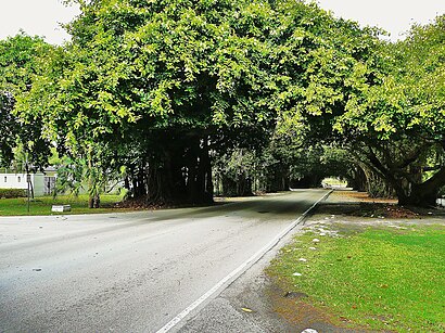
Old Cutler Road is an off-grid plan, 14.9-mile (24.0 km) main northeast–southwest road running south of downtown Miami in Miami-Dade County, Florida, United States.Wiki
Attractions near Old Cutler Rd
Backflip Burgers,Zoe Dry Cleaners,Health and Wellness Center of Miami,Blooming Gardens,Bark Club,Ace Hardware,Chevron,Rodbenders Rawbar,The Outsider Art Gallery,HealthSouth Rehabilitation Hospital of Miami,Crossfit React,Cold Stone Creamery,R&B Barber Shop,Anacapri Italian Restaurant,DNA Fitness,Wingstop,Burger King,Asian Nail Spa,Anacapri To Go,Allure Nail Salon & SpaHow to get to popular attractions in Miami with public transit
The Home Depot, Fort Lauderdale,Lauderdale-By-The-Sea Beach, Fort Lauderdale,Bougainvillea's Old Florida Tavern, Miami,Apple The Galleria, Fort Lauderdale,Starbucks, Fort Lauderdale,Holiday Inn Express Miami Airport Doral Area, North Westside,Publix, Fort Lauderdale,Coral Springs, FL, Coral Springs-Margate,Venetian Pool, Miami,City of Delray Beach, Boynton Beach-Delray Beach,Target, Deerfield Beach,Red Lobster, Kendall-Palmetto Bay,IHOP, Miami,City of Sunrise, Plantation,Palm Beach County Convention Center, West Palm Beach,Pollo Tropical, Miami,Whole Foods Market, Boca Raton,The Diplomat Beach Resort, Hollywood,City of Wilton Manors, Fort Lauderdale,LIV Miami, Miami BeachGet around Miami by public transit!
Traveling around Miami has never been so easy. See step by step directions as you travel to any attraction, street or major public transit station. View bus and train schedules, arrival times, service alerts and detailed routes on a map, so you know exactly how to get to anywhere in Miami.
When traveling to any destination around Miami use Moovit's Live Directions with Get Off Notifications to know exactly where and how far to walk, how long to wait for your line, and how many stops are left. Moovit will alert you when it's time to get off — no need to constantly re-check whether yours is the next stop.
Wondering how to use public transit in Miami or how to pay for public transit in Miami? Moovit public transit app can help you navigate your way with public transit easily, and at minimum cost. It includes public transit fees, ticket prices, and costs. Looking for a map of Miami public transit lines? Moovit public transit app shows all public transit maps in Miami with all bus or subway routes and stops on an interactive map.
Miami has 2 transit type(s), including: bus or subway, operated by several transit agencies, including Miami-Dade Transit, Miami-Dade Transit, Miami Dade Transit-Rail, Tri-Rail, Miami-Dade Transit, Broward County Transit, Palm Tran, Brightline, Brightline, MARTY, City of Homestead Trolley, Key West Transit, Treasure Coast Connector, GoLine IRT and Amtrak