Directions to Old Fort Erie with public transportation
The following transit lines have routes that pass near Old Fort Erie
How to get to Old Fort Erie by bus?
Click on the bus route to see step by step directions with maps, line arrival times and updated time schedules.
Which bus line stops near Old Fort Erie?
EAST
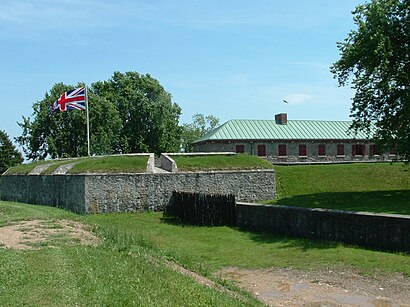
See Old Fort Erie on the map
Public Transportation to Old Fort Erie
Wondering how to get to Old Fort Erie, Canada? Moovit helps you find the best way to get to Old Fort Erie with step-by-step directions from the nearest public transit station.
Moovit provides free maps and live directions to help you navigate through your city. View schedules, routes, timetables, and find out how long does it take to get to Old Fort Erie in real time.
Bus:EAST
Want to see if there’s another route that gets you there at an earlier time? Moovit helps you find alternative routes or times. Get directions from and directions to Old Fort Erie easily from the Moovit App or Website.
We make riding to Old Fort Erie easy, which is why over 1.5 million users, including users in Fort Erie, trust Moovit as the best app for public transit. You don’t need to download an individual bus app or train app, Moovit is your all-in-one transit app that helps you find the best bus time or train time available.
For information on prices of bus, costs and ride fares to Old Fort Erie, please check the Moovit app.
Use the app to navigate to popular places including to the airport, hospital, stadium, grocery store, mall, coffee shop, school, college, and university.
Old Fort Erie Address: Lakeshore Road street in Fort Erie
Attractions near Old Fort Erie
Vieux Fort Erie (Old Fort Erie),Historic Fort Erie,Canadiana Pier Ruins,Friendship Trail,Broken Gate,Fort Erie Fry Truck,Canada Drive,Bordertowne Co-op,Zellers,GARRISON ROAD,Freedom Park,Crystal Beach Tennis & Yacht Club,Garrison Place,Canadian Tire,Work,the place to meat,Pet Valu,Chef Tobalo,First Choice Haircutters,Rexall Pharma PlusHow to get to popular attractions in Fort Erie with public transit
Insomnia Restaurant and Lounge, Toronto,Starbucks, Toronto,The Pilot Tavern, Toronto,Starbucks, Waterloo,Humber College - Lakeshore Campus, Toronto,Cineplex Cinemas Oakville and VIP, Oakville,Yorkdale Shopping Centre, Toronto,IKEA, Burlington,Burlington Bay James N. Allan Skyway, Hamilton,Oliver & Bonacini Café Grill, Yonge and Front, Toronto,McMaster University, Hamilton,Ontario Tech University, Oshawa,Orangeville, Ontario, Orangeville,GoodLife Fitness Centres, Toronto,Destiny 緣續園, Richmond Hill,CF Fairview Park, Kitchener,Earls Kitchen & Bar, Toronto,Aldershot VIA/GO Station, Burlington,Sheppard West Subway Station, Toronto,Starbucks, TorontoGet around Fort Erie by public transit!
Traveling around Fort Erie has never been so easy. See step by step directions as you travel to any attraction, street or major public transit station. View bus and train schedules, arrival times, service alerts and detailed routes on a map, so you know exactly how to get to anywhere in Fort Erie.
When traveling to any destination around Fort Erie use Moovit's Live Directions with Get Off Notifications to know exactly where and how far to walk, how long to wait for your line, and how many stops are left. Moovit will alert you when it's time to get off — no need to constantly re-check whether yours is the next stop.
Wondering how to use public transit in Fort Erie or how to pay for public transit in Fort Erie? Moovit public transit app can help you navigate your way with public transit easily, and at minimum cost. It includes public transit fees, ticket prices, and costs. Looking for a map of Fort Erie public transit lines? Moovit public transit app shows all public transit maps in Fort Erie with all bus routes and stops on an interactive map.
Fort Erie has 1 transit type(s), including: bus, operated by several transit agencies, including TTC, TTC Streetcar, Toronto Subway, GO Transit Bus, GO Transit, Amtrak, York Region Transit, Grand River Transit, Guelph Transit, grt, Hamilton Street Railway, MiWay, Brampton Transit, Burlington Transit and Oakville Transit