Directions to Old Toronto with public transportation
The following transit lines have routes that pass near Old Toronto
How to get to Old Toronto by bus?
Click on the bus route to see step by step directions with maps, line arrival times and updated time schedules.
How to get to Old Toronto by train?
Click on the train route to see step by step directions with maps, line arrival times and updated time schedules.
How to get to Old Toronto by subway?
Click on the subway route to see step by step directions with maps, line arrival times and updated time schedules.
Streetcar stations near Old Toronto
- King St West At Bay St West Side,1 min walk,
- King St West At Bay St East Side,1 min walk,
Bus stations near Old Toronto
- Bay St At King St West,1 min walk,
Bus lines to Old Toronto
- 19,Bay St at Cumberland St - Bay Station,
- 97C,Eglinton Station,
What are the closest stations to Old Toronto?
The closest stations to Old Toronto are:
- King St West At Bay St West Side is 36 meters away, 1 min walk.
- King St West At Bay St East Side is 47 meters away, 1 min walk.
- Bay St At King St West is 57 meters away, 1 min walk.
Which bus lines stop near Old Toronto?
These bus lines stop near Old Toronto: 143, 144, 26, 6, 97.
Which train lines stop near Old Toronto?
These train lines stop near Old Toronto: KI, LW, ST.
Which subway line stops near Old Toronto?
1
Which Streetcar line stops near Old Toronto?
504
What’s the nearest Streetcar station to Old Toronto?
The nearest Streetcar stations to Old Toronto are King St West At Bay St West Side and King St West At Bay St East Side. The closest one is a 1 min walk away.
What’s the nearest bus stop to Old Toronto?
The nearest bus stop to Old Toronto is Bay St At King St West. It’s a 1 min walk away.
See Old Toronto on the map
Public Transportation to Old Toronto
Wondering how to get to Old Toronto, Canada? Moovit helps you find the best way to get to Old Toronto with step-by-step directions from the nearest public transit station.
Moovit provides free maps and live directions to help you navigate through your city. View schedules, routes, timetables, and find out how long does it take to get to Old Toronto in real time.
Looking for the nearest stop or station to Old Toronto? Check out this list of stops closest to your destination: King St West At Bay St West Side; King St West At Bay St East Side; Bay St At King St West.
Bus:143144266971997CTrain:KILWSTSubway:1Streetcar:504
Want to see if there’s another route that gets you there at an earlier time? Moovit helps you find alternative routes or times. Get directions from and directions to Old Toronto easily from the Moovit App or Website.
We make riding to Old Toronto easy, which is why over 1.5 million users, including users in Toronto, trust Moovit as the best app for public transit. You don’t need to download an individual bus app or train app, Moovit is your all-in-one transit app that helps you find the best bus time or train time available.
For information on prices of bus, subway, train and Streetcar, costs and ride fares to Old Toronto, please check the Moovit app.
Use the app to navigate to popular places including to the airport, hospital, stadium, grocery store, mall, coffee shop, school, college, and university.
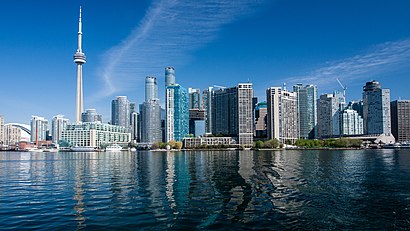
Old Toronto Address: Old Toronto, Toronto, ON, Canada street in Toronto
Attractions near Old Toronto
Financial District,Osler, Hoskin & Harcourt,Bay Street,Cleveland Clinic Canada,GO Train - Kitchener Line,PATH Underground,6 First Canadian Pl,234 Bay Street,Maman Toronto,Ruby Thai,Metro Toronto Board of Trade,Indigospirit 1st Canadian Place,Studio 4,Pretzel Twister,You Send me,503 york Streetcar,Pistil Flowers,King St West at Bay St West Side,King St West at Bay St,Clipper CafeHow to get to popular attractions in Toronto with public transit
Four Seasons Centre for the Performing Arts, Toronto,Kensington Market, Toronto,Canadian Tire Motorsport Park, Clarington,Ripley's Aquarium of Canada, Toronto,Bloor Street West, Toronto,Taste Of Manila, Toronto,John Bassett Theatre, Toronto,Algoma University, Brampton,Radha Soami Society Beas Canada, Milton,Nbc Universal, Toronto,Cloverdale Mall, Toronto,Fairview Mall GO Bus Stop, St. Catharines,Woodbine Mall, Toronto,Cookstown Outlet Mall, Innisfil,2 Eireann Quay, Toronto,Markham Fairgrounds, Markham,El Mocambo, Toronto,Niagara Fallsview Casino, Niagara Falls,Oakville Trafalgar Memorial Hospital, Oakville,CNE Casino, TorontoGet around Toronto by public transit!
Traveling around Toronto has never been so easy. See step by step directions as you travel to any attraction, street or major public transit station. View bus and train schedules, arrival times, service alerts and detailed routes on a map, so you know exactly how to get to anywhere in Toronto.
When traveling to any destination around Toronto use Moovit's Live Directions with Get Off Notifications to know exactly where and how far to walk, how long to wait for your line, and how many stops are left. Moovit will alert you when it's time to get off — no need to constantly re-check whether yours is the next stop.
Wondering how to use public transit in Toronto or how to pay for public transit in Toronto? Moovit public transit app can help you navigate your way with public transit easily, and at minimum cost. It includes public transit fees, ticket prices, and costs. Looking for a map of Toronto public transit lines? Moovit public transit app shows all public transit maps in Toronto with all bus, subway, train or Streetcar routes and stops on an interactive map.
Toronto has 4 transit type(s), including: bus, subway, train or Streetcar, operated by several transit agencies, including TTC, TTC Streetcar, Toronto Subway, GO Transit Bus, GO Transit, Amtrak, York Region Transit, Grand River Transit, Guelph Transit, grt, Hamilton Street Railway, MiWay, Brampton Transit, Burlington Transit and Oakville Transit