Directions to Oliver's Nightclub @ Cask (Boston) with public transportation
The following transit lines have routes that pass near Oliver's Nightclub @ Cask
 Bus: 19, 57, 65, 8, 85.
- Train: FRAMINGHAM/WORCESTER.
- Subway: GREEN LINE B, GREEN LINE C, GREEN LINE D.
How to get to Oliver's Nightclub @ Cask by bus?
Click on the bus route to see step by step directions with maps, line arrival times and updated time schedules.
From Codman Square, Boston
65 minFrom Best Western Adams Inn Quincy - Boston, Quincy
85 minFrom Melrose Wakefield Hospital, Malden
103 minFrom VA Hospital, Boston
66 minFrom Wollaston Beach, Quincy
120 minFrom West Roxbury VA Medical Center, Boston
71 minFrom Edic Pier, Boston
70 minFrom Marina Bay, Quincy
134 minFrom Milton Academy, Milton
97 min
How to get to Oliver's Nightclub @ Cask by train?
Click on the train route to see step by step directions with maps, line arrival times and updated time schedules.
How to get to Oliver's Nightclub @ Cask by subway?
Click on the subway route to see step by step directions with maps, line arrival times and updated time schedules.
Bus stops near Oliver's Nightclub @ Cask in Boston
Subway stations near Oliver's Nightclub @ Cask in Boston
Train station near Oliver's Nightclub @ Cask in Boston
- Lansdowne, 6 min walk,VIEW
Bus lines to Oliver's Nightclub @ Cask in Boston
- 55, West Fenway,VIEW
- 8, Kenmore via South Bay Center - Harbor Point via South Bay Center,VIEW
- 9, Copley - City Point,VIEW
- 19, Kenmore - Fields Corner,VIEW
- 60, Kenmore - Chestnut Hill Mall,VIEW
- 65, Kenmore - Brighton Center,VIEW
- 1 BU (CHARLES RIVER-MEDICAL CAMPUS), 1 BU (Charles River-Medical Campus),VIEW
- COMM AVE, Comm Ave,VIEW
- 57, Kenmore - Watertown Yard,VIEW
- GREEN LINE B SHUTTLE, Boston College - Blandford Street,VIEW
- GREEN LINE B SHUTTLE, Washington Street - Blandford Street,VIEW
- GREEN LINE B SHUTTLE, Boston College - Back Bay (Shuttle),VIEW
- GREEN LINE B SHUTTLE, Babcock Street - Kenmore,VIEW
- GREEN LINE B SHUTTLE, Babcock Street - Blandford Street,VIEW
- GREEN LINE B SHUTTLE, Washington Street - Kenmore,VIEW
- GREEN LINE B SHUTTLE, Babcock Street - Back Bay via Copley (Shuttle),VIEW
- GREEN LINE B SHUTTLE, Boston University East - Back Bay,VIEW
- GREEN LINE B SHUTTLE, Babcock Street - Back Bay,VIEW
- GREEN LINE SHUTTLE, Boston University East - Park Street,VIEW
- SHUTTLE, Boston College - Kenmore (Shuttle),VIEW
What are the closest stations to Oliver's Nightclub @ Cask?
The closest stations to Oliver's Nightclub @ Cask are:
- Ipswich St @ Lansdowne St is 32 yards away, 1 min walk.
- Fenway is 250 yards away, 4 min walk.
- Brookline Ave @ Jersey St is 276 yards away, 4 min walk.
- Lansdowne is 414 yards away, 6 min walk.
- Commonwealth Ave @ Silber Way is 507 yards away, 7 min walk.
- Kenmore is 616 yards away, 8 min walk.
- Blandford Street is 732 yards away, 10 min walk.
Which bus lines stop near Oliver's Nightclub @ Cask?
These bus lines stop near Oliver's Nightclub @ Cask: 19, 57, 65, 8, 85.
Which train line stops near Oliver's Nightclub @ Cask?
FRAMINGHAM/WORCESTER (#525 | Worcester)
Which subway lines stop near Oliver's Nightclub @ Cask?
These subway lines stop near Oliver's Nightclub @ Cask: GREEN LINE B, GREEN LINE C, GREEN LINE D.
What’s the nearest subway station to Oliver's Nightclub @ Cask in Boston?
The nearest subway station to Oliver's Nightclub @ Cask in Boston is Fenway. It’s a 4 min walk away.
What’s the nearest train station to Oliver's Nightclub @ Cask in Boston?
The nearest train station to Oliver's Nightclub @ Cask in Boston is Lansdowne. It’s a 6 min walk away.
What’s the nearest bus station to Oliver's Nightclub @ Cask in Boston?
The nearest bus station to Oliver's Nightclub @ Cask in Boston is Ipswich St @ Lansdowne St. It’s a 1 min walk away.
What time is the first subway to Oliver's Nightclub @ Cask in Boston?
The GREEN LINE D is the first subway that goes to Oliver's Nightclub @ Cask in Boston. It stops nearby at 4:56 AM.
What time is the last subway to Oliver's Nightclub @ Cask in Boston?
The GREEN LINE D is the last subway that goes to Oliver's Nightclub @ Cask in Boston. It stops nearby at 2:21 AM.
What time is the first train to Oliver's Nightclub @ Cask in Boston?
The FRAMINGHAM/WORCESTER is the first train that goes to Oliver's Nightclub @ Cask in Boston. It stops nearby at 4:55 AM.
What time is the last train to Oliver's Nightclub @ Cask in Boston?
The FRAMINGHAM/WORCESTER is the last train that goes to Oliver's Nightclub @ Cask in Boston. It stops nearby at 12:06 AM.
What time is the first bus to Oliver's Nightclub @ Cask in Boston?
The 57 is the first bus that goes to Oliver's Nightclub @ Cask in Boston. It stops nearby at 4:45 AM.
What time is the last bus to Oliver's Nightclub @ Cask in Boston?
The 57 is the last bus that goes to Oliver's Nightclub @ Cask in Boston. It stops nearby at 2:11 AM.
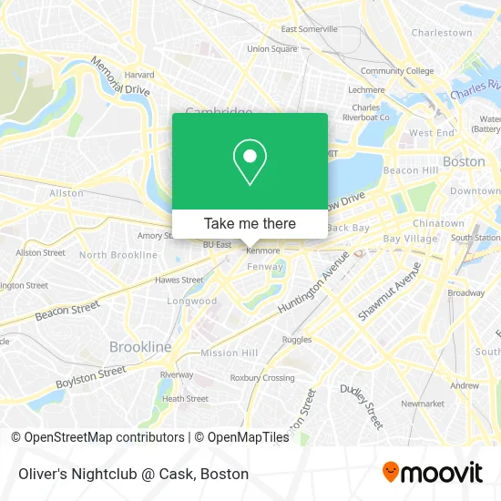
See Oliver's Nightclub @ Cask, Boston, on the map
Public Transit to Oliver's Nightclub @ Cask in Boston
Wondering how to get to Oliver's Nightclub @ Cask in Boston? Moovit helps you find the best way to get to Oliver's Nightclub @ Cask with step-by-step directions from the nearest public transit station.
Moovit provides free maps and live directions to help you navigate through your city. View schedules, routes, timetables, and find out how long does it take to get to Oliver's Nightclub @ Cask in real time.
Looking for the nearest stop or station to Oliver's Nightclub @ Cask? Check out this list of stops closest to your destination: Ipswich St @ Lansdowne St; Fenway; Brookline Ave @ Jersey St; Lansdowne; Commonwealth Ave @ Silber Way; Kenmore; Blandford Street.
Bus: 19, 57, 65, 8, 85, 55, 9, 60.Train: FRAMINGHAM/WORCESTER.Subway: GREEN LINE B, GREEN LINE C, GREEN LINE D.
Want to see if there’s another route that gets you there at an earlier time? Moovit helps you find alternative routes or times. Get directions from and directions to Oliver's Nightclub @ Cask easily from the Moovit App or Website.
We make riding to Oliver's Nightclub @ Cask easy, which is why over 1.7 million users, including users in Boston, trust Moovit as the best app for public transit. You don’t need to download an individual bus app or train app, Moovit is your all-in-one transit app that helps you find the best bus time or train time available.
For information on prices of bus, subway and train, costs and ride fares to Oliver's Nightclub @ Cask, please check the Moovit app.
Use the app to navigate to popular places including to the airport, hospital, stadium, grocery store, mall, coffee shop, school, college, and university.
Oliver's Nightclub @ Cask Address: 62 Brookline Ave street in Boston
- 10 Brookline Place,
- New Dia,
- Cask 'N Flagon,
- Coca-Cola Pavilion,
- David Ortiz bridge,
- MBTA-Lansdowne,
- 3rd Base Deck,
- Xfinity/Comcast,
- Center for Computational Neuroscience & Neural Technology,
- Mercantile Bank,
- 24 Hr A Locksmith Service,
- Beerworks,
- KVH Kosher Certification,
- Lucky Spa,
- Fenway Park Tickets,
- C13 B,
- Pavb,
- VB,
- VRF,
- Media
Places Near Oliver's Nightclub @ Cask (Boston)
- Quincy Market, Boston,
- Museum Of Science, Boston,
- Td Garden, Boston,
- Wang Theater, Boston,
- Boston Children's Hospital, Boston,
- Castle Island, Boston,
- Wilbur Theatre, Boston,
- Massachusetts General Hospital, Boston,
- Cheers, Boston,
- Prudential Center, Boston,
- Faneuil Hall, Boston,
- Boston Common, Boston,
- Boston Convention & Exhibition Center, Boston,
- Mgm Music Hall, Boston,
- Boston Medical Center, Boston,
- House Of Blues, Boston,
- Isabella Stewart Gardner Museum, Boston,
- North End, Boston,
- Seaport District, Boston,
- Leader Bank Pavilion (Leader Bank Pavillion), Boston
How to get to popular places in Boston with public transit
Get around Boston by public transit!
Traveling around Boston has never been so easy. See step by step directions as you travel to any attraction, street or major public transit station. View bus and train schedules, arrival times, service alerts and detailed routes on a map, so you know exactly how to get to anywhere in Boston.
When traveling to any destination around Boston use Moovit's Live Directions with Get Off Notifications to know exactly where and how far to walk, how long to wait for your line, and how many stops are left. Moovit will alert you when it's time to get off — no need to constantly re-check whether yours is the next stop.
Wondering how to use public transit in Boston or how to pay for public transit in Boston? Moovit public transit app can help you navigate your way with public transit easily, and at minimum cost. It includes public transit fees, ticket prices, and costs. Looking for a map of Boston public transit lines? Moovit public transit app shows all public transit maps in Boston with all Bus, Train, Subway and Ferry routes and stops on an interactive map.
Boston has 4 transit type(s), including: Bus, Train, Subway and Ferry, operated by several transit agencies, including MBTA, Southeastern Regional Transit Authority, MetroWest Regional Transit Authority, Rhode Island Public Transit Authority, WRTA, Lowell Regional Transit Authority, Merrimack Valley Transit, Montachusett Regional Transit Authority, Cape Cod Regional Transit Authority, Brockton Area Transit Authority, Martha's Vineyard Transit Authority, the WAVE - Nantucket Regional Transit Authority, GATRA, Cape Ann Transportation Authority and Massport