Directions to On Labs Boston with public transportation
The following transit lines have routes that pass near On Labs Boston
 Bus: 1, 57, BB, 1 BU (CHARLES RIVER-MEDICAL CAMPUS), GREEN LINE B SHUTTLE.
- Train: FRAMINGHAM/WORCESTER, NEEDHAM.
- Subway: GREEN LINE B, GREEN LINE D, ORANGE LINE, GREEN LINE C, GREEN LINE E.
How to get to On Labs Boston by bus?
Click on the bus route to see step by step directions with maps, line arrival times and updated time schedules.
From Forest Hills Station MBTA
39 minFrom Six Flags New England
57 minFrom Ac Hotel Cambridge
66 minFrom Uscis Biometrics Office
68 minFrom Milton Academy
99 minFrom Chevalier Theater
63 minFrom Comfort Inn & Suites Logan International Airport
69 minFrom 7F Everett Street
68 minFrom Heartbreak Hill
48 minFrom USS Constitution
41 min
How to get to On Labs Boston by train?
Click on the train route to see step by step directions with maps, line arrival times and updated time schedules.
How to get to On Labs Boston by subway?
Click on the subway route to see step by step directions with maps, line arrival times and updated time schedules.
Bus stops near On Labs Boston
- Massachusetts Ave @ Newbury St, 1 min walk,VIEW
- Hynes T Station (To Crc), 1 min walk,VIEW
- Boylston St @ Massachusetts Ave, 2 min walk,VIEW
- Hynes - Commonwealth Ave @ Massachusetts Ave, 2 min walk,VIEW
- Hynes Convention Center - Commonwealth Ave @ Massachusetts Ave, 3 min walk,VIEW
- Announcement #3 - Airport To Back Bay, 4 min walk,VIEW
Subway stations near On Labs Boston
Bus lines to On Labs Boston
- 1, Harvard,VIEW
- 57, Watertown Via Kenmore,VIEW
- GREEN LINE B SHUTTLE, Back Bay (Shuttle),VIEW
- GREEN LINE C SHUTTLE, Saint Mary's Street (Shuttle),VIEW
- GREEN LINE SHUTTLE, Park Street (Shuttle),VIEW
- 1 BU (CHARLES RIVER-MEDICAL CAMPUS), Comm Ave @ Buick St,VIEW
- 55, Arlington,VIEW
- GREEN LINE B SHUTTLE, Babcock Street - Back Bay,VIEW
- GREEN LINE B SHUTTLE, Babcock Street - Copley,VIEW
- GREEN LINE B SHUTTLE, Boston College - Back Bay (Shuttle),VIEW
- GREEN LINE B SHUTTLE, Babcock Street - Back Bay via Copley (Shuttle),VIEW
- GREEN LINE B SHUTTLE, Kenmore - Back Bay via Copley (Shuttle),VIEW
- GREEN LINE D SHUTTLE, Brookline Hills - Back Bay (Shuttle),VIEW
- GREEN LINE SHUTTLE, Kenmore - Back Bay,VIEW
- GREEN LINE SHUTTLE, Kenmore (Shuttle),VIEW
- BB, Back Bay,VIEW
What are the closest stations to On Labs Boston?
The closest stations to On Labs Boston are:
- Massachusetts Ave @ Newbury St is 15 yards away, 1 min walk.
- Hynes T Station (To Crc) is 16 yards away, 1 min walk.
- Boylston St @ Massachusetts Ave is 108 yards away, 2 min walk.
- Hynes - Commonwealth Ave @ Massachusetts Ave is 129 yards away, 2 min walk.
- Hynes Convention Center - Commonwealth Ave @ Massachusetts Ave is 195 yards away, 3 min walk.
- Announcement #3 - Airport To Back Bay is 290 yards away, 4 min walk.
- Kenmore is 428 yards away, 6 min walk.
- Symphony is 643 yards away, 8 min walk.
- Massachusetts Ave. is 886 yards away, 11 min walk.
Which bus lines stop near On Labs Boston?
These bus lines stop near On Labs Boston: 1, 57, BB.
Which train lines stop near On Labs Boston?
These train lines stop near On Labs Boston: FRAMINGHAM/WORCESTER, NEEDHAM.
Which subway lines stop near On Labs Boston?
These subway lines stop near On Labs Boston: GREEN LINE B, GREEN LINE D, ORANGE LINE.
What’s the nearest subway station to On Labs Boston?
The nearest subway station to On Labs Boston is Kenmore. It’s a 6 min walk away.
What’s the nearest bus station to On Labs Boston?
The nearest bus stations to On Labs Boston are Massachusetts Ave @ Newbury St and Hynes T Station (To Crc). The closest one is a 1 min walk away.
What time is the first subway to On Labs Boston?
The GREEN LINE D is the first subway that goes to On Labs Boston. It stops nearby at 5:00 AM.
What time is the last subway to On Labs Boston?
The GREEN LINE D is the last subway that goes to On Labs Boston. It stops nearby at 2:18 AM.
What time is the first bus to On Labs Boston?
The 1 is the first bus that goes to On Labs Boston. It stops nearby at 4:49 AM.
What time is the last bus to On Labs Boston?
The 1 is the last bus that goes to On Labs Boston. It stops nearby at 2:32 AM.
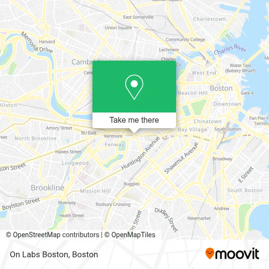
See On Labs Boston on the map
Public Transportation to On Labs Boston
Wondering how to get to On Labs Boston? Moovit helps you find the best way to get to On Labs Boston with step-by-step directions from the nearest public transit station.
Moovit provides free maps and live directions to help you navigate through your city. View schedules, routes, timetables, and find out how long does it take to get to On Labs Boston in real time.
Looking for the nearest stop or station to On Labs Boston? Check out this list of stops closest to your destination: Massachusetts Ave @ Newbury St; Hynes T Station (To Crc); Boylston St @ Massachusetts Ave; Hynes - Commonwealth Ave @ Massachusetts Ave; Hynes Convention Center - Commonwealth Ave @ Massachusetts Ave; Announcement #3 - Airport To Back Bay; Kenmore; Symphony; Massachusetts Ave..
Bus: 1, 57, BB, 1 BU (CHARLES RIVER-MEDICAL CAMPUS), GREEN LINE B SHUTTLE, GREEN LINE C SHUTTLE, GREEN LINE SHUTTLE, 55.Train: FRAMINGHAM/WORCESTER, NEEDHAM.Subway: GREEN LINE B, GREEN LINE D, ORANGE LINE, GREEN LINE C, GREEN LINE E.
Want to see if there’s another route that gets you there at an earlier time? Moovit helps you find alternative routes or times. Get directions from and directions to On Labs Boston easily from the Moovit App or Website.
We make riding to On Labs Boston easy, which is why over 1.7 million users, including users in Boston, trust Moovit as the best app for public transit. You don’t need to download an individual bus app or train app, Moovit is your all-in-one transit app that helps you find the best bus time or train time available.
For information on prices of subway, bus and train, costs and ride fares to On Labs Boston, please check the Moovit app.
Use the app to navigate to popular places including to the airport, hospital, stadium, grocery store, mall, coffee shop, school, college, and university.
On Labs Boston Address: 400 Newbury St street in Boston
- Citizenm Boston Back Bay Hotel,
- Lyrik,
- Rivian,
- Hynes Convention Center Station,
- TJ Maxx,
- MBTA Bus Route 1,
- MUJI 無印良品,
- Medicare Insurance Advisors Boston,
- Partners 90 Mass Ave I,
- Urban Outfitters,
- 100 Mass Ave (Boston Architectural College),
- Food for Thought Dining,
- Muji,
- 360 Newbury,
- White & Associates,
- Calloway Graphix, Printing, Marketing, Inc.,
- Sommet Nannies,
- Copley Square Psychic,
- Loc'd on the Vineyard,
- Bravesportzwear
Places Near On Labs Boston
- Boston Medical Center, Boston,
- Museum Of Science, Boston,
- Isabella Stewart Gardner Museum, Boston,
- Massachusetts General Hospital, Boston,
- Boston Convention & Exhibition Center, Boston,
- Boston Common, Boston,
- Faneuil Hall, Boston,
- Td Garden, Boston,
- House Of Blues, Boston,
- Leader Bank Pavilion (Leader Bank Pavillion), Boston,
- Mgm Music Hall, Boston,
- Prudential Center, Boston,
- Boston Children's Hospital, Boston,
- Castle Island, Boston,
- Cheers, Boston,
- Wilbur Theatre, Boston,
- North End, Boston,
- Seaport District, Boston,
- Quincy Market, Boston,
- Wang Theater, Boston
How to get to popular places in Boston with public transit
Get around Boston by public transit!
Traveling around Boston has never been so easy. See step by step directions as you travel to any attraction, street or major public transit station. View bus and train schedules, arrival times, service alerts and detailed routes on a map, so you know exactly how to get to anywhere in Boston.
When traveling to any destination around Boston use Moovit's Live Directions with Get Off Notifications to know exactly where and how far to walk, how long to wait for your line, and how many stops are left. Moovit will alert you when it's time to get off — no need to constantly re-check whether yours is the next stop.
Wondering how to use public transit in Boston or how to pay for public transit in Boston? Moovit public transit app can help you navigate your way with public transit easily, and at minimum cost. It includes public transit fees, ticket prices, and costs. Looking for a map of Boston public transit lines? Moovit public transit app shows all public transit maps in Boston with all Bus, Train, Subway and Ferry routes and stops on an interactive map.
Boston has 4 transit type(s), including: Bus, Train, Subway and Ferry, operated by several transit agencies, including MBTA, Southeastern Regional Transit Authority, MetroWest Regional Transit Authority, Rhode Island Public Transit Authority, WRTA, Lowell Regional Transit Authority, Merrimack Valley Transit, Montachusett Regional Transit Authority, Cape Cod Regional Transit Authority, Brockton Area Transit Authority, Martha's Vineyard Transit Authority, the WAVE - Nantucket Regional Transit Authority, GATRA, Cape Ann Transportation Authority and Massport