Directions to One Percent For America (Boston) with public transportation
The following transit lines have routes that pass near One Percent For America
 Bus: 22, 39, 42, 44, 29.
- Train: PROVIDENCE/STOUGHTON.
- Subway: ORANGE LINE, GREEN LINE E.
How to get to One Percent For America by bus?
Click on the bus route to see step by step directions with maps, line arrival times and updated time schedules.
From Fresh Pond Mall, Cambridge
83 minFrom Courtyard by Marriott Boston Logan Airport, Boston
70 minFrom Sheraton-Needham Hotel (Sheraton Boston Needham Hotel), Needham
110 minFrom Chelsea, MA, Chelsea
84 minFrom Homewood Suites by Hilton Boston Logan Airport Chelsea, Chelsea
84 minFrom PwC, Boston
60 minFrom Boston Harbor, Boston
62 minFrom Bunker Hill, Boston
86 minFrom Massachusetts Water Resource Authority (MWRA), Chelsea
79 minFrom Omni Parker House, Boston
37 min
How to get to One Percent For America by train?
Click on the train route to see step by step directions with maps, line arrival times and updated time schedules.
How to get to One Percent For America by subway?
Click on the subway route to see step by step directions with maps, line arrival times and updated time schedules.
Bus stops near One Percent For America in Boston
Subway stations near One Percent For America in Boston
Bus lines to One Percent For America in Boston
- 22, Kenmore Via Ruggles,VIEW
- 29, Mattapan Via Franklin Field,VIEW
- 44, Ruggles,VIEW
- 42, Nubian,VIEW
- 41, Jfk/Umass,VIEW
- 14, Heath St,VIEW
- ORANGE LINE SHUTTLE, Forest Hills (Shuttle),VIEW
- ORANGE LINE SHUTTLE, Copley (Shuttle),VIEW
- ORANGE LINE SHUTTLE, Back Bay (Shuttle),VIEW
- ORANGE LINE SHUTTLE, Forest Hills - Jackson Square (Shuttle),VIEW
- ORANGE LINE SHUTTLE, Forest Hills - Jackson Square,VIEW
- ORANGE LINE SHUTTLE, Forest Hills - Back Bay via Copley (Shuttle),VIEW
- ORANGE LINE SHUTTLE, Forest Hills - Copley,VIEW
- ORANGE LINE SHUTTLE, Forest Hills - Back Bay (Shuttle),VIEW
- ORANGE LINE SHUTTLE, Forest Hills - Back Bay via Ruggles Busway (Shuttle),VIEW
What are the closest stations to One Percent For America?
The closest stations to One Percent For America are:
- Columbus Ave Opp Bray St is 143 yards away, 2 min walk.
- Washington St @ Bray St is 178 yards away, 3 min walk.
- Centre St @ Bickford St is 366 yards away, 5 min walk.
- Jackson Square is 401 yards away, 5 min walk.
- Jackson Square - Centre St Opp Jackson Square Busway is 463 yards away, 6 min walk.
- Roxbury Crossing is 848 yards away, 11 min walk.
- Heath Street is 2044 yards away, 25 min walk.
Which bus lines stop near One Percent For America?
These bus lines stop near One Percent For America: 22, 39, 42, 44.
Which train line stops near One Percent For America?
PROVIDENCE/STOUGHTON (#825 | Providence)
Which subway line stops near One Percent For America?
ORANGE LINE (Forest Hills)
What’s the nearest subway station to One Percent For America in Boston?
The nearest subway station to One Percent For America in Boston is Roxbury Crossing. It’s a 11 min walk away.
What’s the nearest bus station to One Percent For America in Boston?
The nearest bus station to One Percent For America in Boston is Columbus Ave Opp Bray St. It’s a 2 min walk away.
What time is the first subway to One Percent For America in Boston?
The ORANGE LINE is the first subway that goes to One Percent For America in Boston. It stops nearby at 5:16 AM.
What time is the last subway to One Percent For America in Boston?
The GREEN LINE E is the last subway that goes to One Percent For America in Boston. It stops nearby at 2:00 AM.
What time is the first bus to One Percent For America in Boston?
The 42 is the first bus that goes to One Percent For America in Boston. It stops nearby at 5:02 AM.
What time is the last bus to One Percent For America in Boston?
The 22 is the last bus that goes to One Percent For America in Boston. It stops nearby at 2:15 AM.
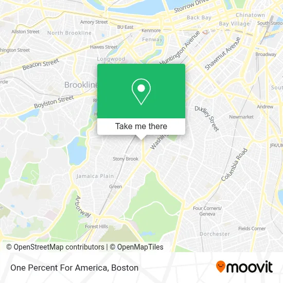
See One Percent For America, Boston, on the map
Public Transit to One Percent For America in Boston
Wondering how to get to One Percent For America in Boston? Moovit helps you find the best way to get to One Percent For America with step-by-step directions from the nearest public transit station.
Moovit provides free maps and live directions to help you navigate through your city. View schedules, routes, timetables, and find out how long does it take to get to One Percent For America in real time.
Looking for the nearest stop or station to One Percent For America? Check out this list of stops closest to your destination: Columbus Ave Opp Bray St; Washington St @ Bray St; Centre St @ Bickford St; Jackson Square; Jackson Square - Centre St Opp Jackson Square Busway; Roxbury Crossing; Heath Street.
Bus: 22, 39, 42, 44, 29, 41, 14, ORANGE LINE SHUTTLE, ORANGE LINE SHUTTLE, ORANGE LINE SHUTTLE.Train: PROVIDENCE/STOUGHTON.Subway: ORANGE LINE, GREEN LINE E.
Want to see if there’s another route that gets you there at an earlier time? Moovit helps you find alternative routes or times. Get directions from and directions to One Percent For America easily from the Moovit App or Website.
We make riding to One Percent For America easy, which is why over 1.7 million users, including users in Boston, trust Moovit as the best app for public transit. You don’t need to download an individual bus app or train app, Moovit is your all-in-one transit app that helps you find the best bus time or train time available.
For information on prices of bus, subway and train, costs and ride fares to One Percent For America, please check the Moovit app.
Use the app to navigate to popular places including to the airport, hospital, stadium, grocery store, mall, coffee shop, school, college, and university.
One Percent For America Address: 1785 Columbus Ave street in Boston
- Youthbuild USA,
- Diamond Masonry and Construction,
- Old Jamaica Plain Scrap Yard & Foundry,
- Dimock Comm Health Ctr,
- Dimock Youth & Family Services (Dimock Early Head Start, Head Start, and School Readiness Programs),
- Aaron's,
- Chin, Richard T, Od,
- Gas Line Repair & Installation Plumbing,
- Evelyn Dougherty, Licsw,
- The Dimock Center,
- Dimock Community Health Center (Fogg, Jane, MD - Dimock Center),
- CVS/pharmacy,
- Mary Eliza Mahoney House Family Shelter,
- Ula Cafe,
- Boston-Suffolk County Family Resource Center,
- Goddard Learning Center,
- Dimock Community Health Center,
- Jackie Jenkins-Scott Building,
- Little Seed Christian Daycare,
- Sarah C. Phillips, MD
Places Near One Percent For America (Boston)
- Prudential Center, Boston,
- Castle Island, Boston,
- North End, Boston,
- Seaport District, Boston,
- House Of Blues, Boston,
- Boston Convention & Exhibition Center, Boston,
- Quincy Market, Boston,
- Td Garden, Boston,
- Faneuil Hall, Boston,
- Boston Medical Center, Boston,
- Mgm Music Hall, Boston,
- Museum Of Science, Boston,
- Cheers, Boston,
- Leader Bank Pavilion (Leader Bank Pavillion), Boston,
- Wang Theater, Boston,
- Massachusetts General Hospital, Boston,
- Wilbur Theatre, Boston,
- Boston Children's Hospital, Boston,
- Boston Common, Boston,
- Isabella Stewart Gardner Museum, Boston
How to get to popular places in Boston with public transit
Get around Boston by public transit!
Traveling around Boston has never been so easy. See step by step directions as you travel to any attraction, street or major public transit station. View bus and train schedules, arrival times, service alerts and detailed routes on a map, so you know exactly how to get to anywhere in Boston.
When traveling to any destination around Boston use Moovit's Live Directions with Get Off Notifications to know exactly where and how far to walk, how long to wait for your line, and how many stops are left. Moovit will alert you when it's time to get off — no need to constantly re-check whether yours is the next stop.
Wondering how to use public transit in Boston or how to pay for public transit in Boston? Moovit public transit app can help you navigate your way with public transit easily, and at minimum cost. It includes public transit fees, ticket prices, and costs. Looking for a map of Boston public transit lines? Moovit public transit app shows all public transit maps in Boston with all Bus, Train, Subway and Ferry routes and stops on an interactive map.
Boston has 4 transit type(s), including: Bus, Train, Subway and Ferry, operated by several transit agencies, including MBTA, Southeastern Regional Transit Authority, MetroWest Regional Transit Authority, Rhode Island Public Transit Authority, WRTA, Lowell Regional Transit Authority, Merrimack Valley Transit, Montachusett Regional Transit Authority, Cape Cod Regional Transit Authority, Brockton Area Transit Authority, Martha's Vineyard Transit Authority, the WAVE - Nantucket Regional Transit Authority, GATRA, Cape Ann Transportation Authority and Massport