How to get to Onpage Corporation by bus?
Click on the bus route to see step by step directions with maps, line arrival times and updated time schedules.
From Brighton, Boston
60 minFrom Ac Hotel Cambridge, Cambridge
108 minFrom Brighton, Boston
85 minFrom Heartbreak Hill, Newton
82 minFrom MBTA Alewife Station, Cambridge
101 minFrom Brighton District Court, Boston
79 minFrom Lasell College, Newton
70 minFrom New Balance, Boston
73 minFrom MBTA / Alewife #6, Cambridge
101 minFrom I-95 / Route 128 & Route 16 Interchange (Exit 21), Newton
77 min
Train station near Onpage Corporation in Waltham
- Kendal Green, 8 min walk,VIEW
Bus stops near Onpage Corporation in Waltham
What are the closest stations to Onpage Corporation?
The closest stations to Onpage Corporation are:
- Kendal Green is 635 yards away, 8 min walk.
- 225 Second Ave (Sanofi) is 1899 yards away, 23 min walk.
- Main Shopping Center @ Market Basket is 2137 yards away, 26 min walk.
Which bus lines stop near Onpage Corporation?
These bus lines stop near Onpage Corporation: 70, W1.
What’s the nearest train station to Onpage Corporation in Waltham?
The nearest train station to Onpage Corporation in Waltham is Kendal Green. It’s a 8 min walk away.
What time is the first train to Onpage Corporation in Waltham?
The FITCHBURG is the first train that goes to Onpage Corporation in Waltham. It stops nearby at 5:27 AM.
What time is the last train to Onpage Corporation in Waltham?
The FITCHBURG is the last train that goes to Onpage Corporation in Waltham. It stops nearby at 12:19 AM.
What time is the first bus to Onpage Corporation in Waltham?
The 70 is the first bus that goes to Onpage Corporation in Waltham. It stops nearby at 5:20 AM.
What time is the last bus to Onpage Corporation in Waltham?
The 70 is the last bus that goes to Onpage Corporation in Waltham. It stops nearby at 12:20 AM.
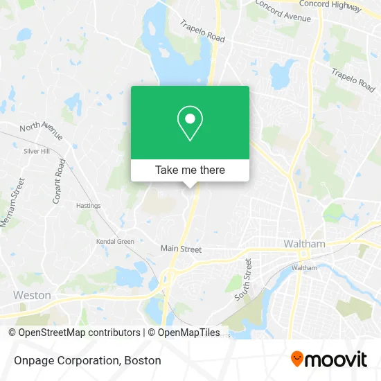
See Onpage Corporation, Waltham, on the map
Public Transit to Onpage Corporation in Waltham
Wondering how to get to Onpage Corporation in Waltham? Moovit helps you find the best way to get to Onpage Corporation with step-by-step directions from the nearest public transit station.
Moovit provides free maps and live directions to help you navigate through your city. View schedules, routes, timetables, and find out how long does it take to get to Onpage Corporation in real time.
Looking for the nearest stop or station to Onpage Corporation? Check out this list of stops closest to your destination: Kendal Green; 225 Second Ave (Sanofi); Main Shopping Center @ Market Basket.
Bus: 70, W1.Train: FITCHBURG.
Want to see if there’s another route that gets you there at an earlier time? Moovit helps you find alternative routes or times. Get directions from and directions to Onpage Corporation easily from the Moovit App or Website.
We make riding to Onpage Corporation easy, which is why over 1.7 million users, including users in Waltham, trust Moovit as the best app for public transit. You don’t need to download an individual bus app or train app, Moovit is your all-in-one transit app that helps you find the best bus time or train time available.
For information on prices of bus, subway and train, costs and ride fares to Onpage Corporation, please check the Moovit app.
Use the app to navigate to popular places including to the airport, hospital, stadium, grocery store, mall, coffee shop, school, college, and university.
Onpage Corporation Address: 60 Hickory Dr Ste 6000 street in Waltham
- Afp Massachusetts Chapter,
- Gunndesign,
- Home Builders & Remodelers Association Of Massachusetts,
- Omicron Electronics Corporation Usa,
- Big Bruin's Garage Door Repair,
- Circle Lending,
- Mosaic Technologies,
- Mccann Systems,
- Repair & Adjust Garage Door Garage Door,
- Vfp Pharmacy Group,
- Exosome Diagnostics, Inc A Bio-Techne Brand,
- Astrazeneca Pharmaceuticals,
- MSPCA Angell Animal Hospital West,
- Naveris,
- Angell West Dermatology,
- Route 20, Weston, MA,
- Thermo Fisher Scientific,
- Onco360 Oncology Pharmacy,
- Navdx,
- Standard Electric
Places Near Onpage Corporation (Waltham)
- Museum Of Science, Boston,
- Boston Medical Center, Boston,
- Boston Common, Boston,
- Leader Bank Pavilion (Leader Bank Pavillion), Boston,
- Massachusetts General Hospital, Boston,
- Faneuil Hall, Boston,
- Boston Convention & Exhibition Center, Boston,
- North End, Boston,
- Boston Children's Hospital, Boston,
- Isabella Stewart Gardner Museum, Boston,
- Seaport District, Boston,
- Wilbur Theatre, Boston,
- Mgm Music Hall, Boston,
- Td Garden, Boston,
- Wang Theater, Boston,
- Prudential Center, Boston,
- Castle Island, Boston,
- House Of Blues, Boston,
- Quincy Market, Boston,
- Cheers, Boston
How to get to popular places in Boston with public transit
Get around Waltham by public transit!
Traveling around Waltham has never been so easy. See step by step directions as you travel to any attraction, street or major public transit station. View bus and train schedules, arrival times, service alerts and detailed routes on a map, so you know exactly how to get to anywhere in Waltham.
When traveling to any destination around Waltham use Moovit's Live Directions with Get Off Notifications to know exactly where and how far to walk, how long to wait for your line, and how many stops are left. Moovit will alert you when it's time to get off — no need to constantly re-check whether yours is the next stop.
Wondering how to use public transit in Waltham or how to pay for public transit in Waltham? Moovit public transit app can help you navigate your way with public transit easily, and at minimum cost. It includes public transit fees, ticket prices, and costs. Looking for a map of Waltham public transit lines? Moovit public transit app shows all public transit maps in Waltham with all Bus, Train, Subway and Ferry routes and stops on an interactive map.
Boston has 4 transit type(s), including: Bus, Train, Subway and Ferry, operated by several transit agencies, including MBTA, Southeastern Regional Transit Authority, MetroWest Regional Transit Authority, Rhode Island Public Transit Authority, WRTA, Lowell Regional Transit Authority, Merrimack Valley Transit, Montachusett Regional Transit Authority, Cape Cod Regional Transit Authority, Brockton Area Transit Authority, Martha's Vineyard Transit Authority, the WAVE - Nantucket Regional Transit Authority, GATRA, Cape Ann Transportation Authority and Massport