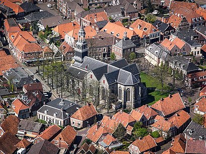
See Ootmarsum, Dinkelland, on the map
Directions to Ootmarsum (Dinkelland) with public transportation
The following transit lines have routes that pass near Ootmarsum
 Bus:
Bus:
How to get to Ootmarsum by bus?
Click on the bus route to see step by step directions with maps, line arrival times and updated time schedules.
Bus stations near Ootmarsum in Dinkelland
- Ootmarsum, Molenstraat,3 min walk,
- Ootmarsum, Stobbenkamp,5 min walk,
Bus lines to Ootmarsum in Dinkelland
- 596,Denekamp,
- 599,Weerselo,
- 64,Oldenzaal,
What are the closest stations to Ootmarsum?
The closest stations to Ootmarsum are:
- Ootmarsum, Molenstraat is 219 meters away, 3 min walk.
- Ootmarsum, Stobbenkamp is 349 meters away, 5 min walk.
Which bus lines stop near Ootmarsum?
These bus lines stop near Ootmarsum: 596, 599, 64.
What’s the nearest bus stop to Ootmarsum in Dinkelland?
The nearest bus stop to Ootmarsum in Dinkelland is Ootmarsum, Molenstraat. It’s a 3 min walk away.
What time is the first bus to Ootmarsum in Dinkelland?
The 596 is the first bus that goes to Ootmarsum in Dinkelland. It stops nearby at 6:35 AM.
What time is the last bus to Ootmarsum in Dinkelland?
The 64 is the last bus that goes to Ootmarsum in Dinkelland. It stops nearby at 9:48 PM.
See Ootmarsum, Dinkelland, on the map
Public Transit to Ootmarsum in Dinkelland
Wondering how to get to Ootmarsum in Dinkelland, Netherlands? Moovit helps you find the best way to get to Ootmarsum with step-by-step directions from the nearest public transit station.
Moovit provides free maps and live directions to help you navigate through your city. View schedules, routes, timetables, and find out how long does it take to get to Ootmarsum in real time.
Looking for the nearest stop or station to Ootmarsum? Check out this list of stops closest to your destination: Ootmarsum; Ootmarsum.
Bus:
Want to see if there’s another route that gets you there at an earlier time? Moovit helps you find alternative routes or times. Get directions from and directions to Ootmarsum easily from the Moovit App or Website.
We make riding to Ootmarsum easy, which is why over 1.5 million users, including users in Dinkelland, trust Moovit as the best app for public transit. You don’t need to download an individual bus app or train app, Moovit is your all-in-one transit app that helps you find the best bus time or train time available.
For information on prices of bus and train, costs and ride fares to Ootmarsum, please check the Moovit app.
Use the app to navigate to popular places including to the airport, hospital, stadium, grocery store, mall, coffee shop, school, college, and university.
Ootmarsum Address: Kerkplein street in Dinkelland
Attractions near Ootmarsum
Aux Fleurs,Ootmarsum,'T Pläske,Koale Kermis Ootmarsum,Rien Schulten le Bon Maitre,Overijssel,Museum Ootmarsum, Marius van Dokkum,Ayka Pierik Art,Stroot Modes Blue Willi's,Bame Beheer B.V.,Polman Bloemist,Canvasso,Oatmossche Joa,Kapsalon Wim Spaltman,Hoorpartners VOF,Larrosoir,Chez Moi Ton Schulten,Tgw B.V.,Bon Bien Chocolaterie,Pop-Up Store HHow to get to popular attractions in Dinkelland with public transit
IKEA, Heerlen,Station Amersfoort Schothorst, Amersfoort,Station Meppel, Meppel,Saxion Hogeschool (Ko Wierenga), Enschede,Universiteit Twente, Enschede,Busstation Arnhem, Arnhem,Duinrell, Wassenaar,Apeldoorn, Apeldoorn,Zwolle, Zwolle,Veerdienst Schoonhoven - Gelkenes, Schoonhoven,IKEA, Utrecht,Gouwe-aquaduct, Waddinxveen,Winkelcentrum In de Bogaard, Rijswijk,azM/Maastricht UMC+, Maastricht,Diergaarde Blijdorp, Rotterdam,SnowWorld, Landgraaf,Stadion Feijenoord, Rotterdam,Brouwerij 't IJ, Amsterdam,IKEA, Breda,Boulevard Scheveningen, 'S-GravenhageGet around Dinkelland by public transit!
Traveling around Dinkelland has never been so easy. See step by step directions as you travel to any attraction, street or major public transit station. View bus and train schedules, arrival times, service alerts and detailed routes on a map, so you know exactly how to get to anywhere in Dinkelland.
When traveling to any destination around Dinkelland use Moovit's Live Directions with Get Off Notifications to know exactly where and how far to walk, how long to wait for your line, and how many stops are left. Moovit will alert you when it's time to get off — no need to constantly re-check whether yours is the next stop.
Wondering how to use public transit in Dinkelland or how to pay for public transit in Dinkelland? Moovit public transit app can help you navigate your way with public transit easily, and at minimum cost. It includes public transit fees, ticket prices, and costs. Looking for a map of Dinkelland public transit lines? Moovit public transit app shows all public transit maps in Dinkelland with all bus or train routes and stops on an interactive map.
Dinkelland has 2 transit type(s), including: bus or train, operated by several transit agencies, including NS, NS International, GVB, GVB, GVB, GVB, U-OV, U-OV, Overal, HTM, R-net, RET, RET, De Lijn and Connexxion