How to get to Opala by bus?
Click on the bus route to see step by step directions with maps, line arrival times and updated time schedules.
From San Juan De Lurigancho, San Juan D
73 minFrom Avenida Universitaria, Lima
45 minFrom Av. Peru, San Martin
44 minFrom Policlinico Hna. María Donrose Sutmoller, Ventanilla
73 minFrom AV LOS PROCERES DE LA INDEPENDENCIA CON AV LURIGANCHO, San Juan D
88 minFrom Universidad Nacional de Ingeniería (UNI), Rimac
48 minFrom ZOOLOGICO DE HUACHIPA, San Juan D
89 minFrom Avenida Carlos Izaguirre, Los Olivos
29 minFrom Av wiesse paradero 15, San Juan D
89 minFrom Av. Las Flores - San Juan de Lurigancho, San Juan D
69 min
Bus stops near Opala in Los Olivos
Bus lines to Opala in Los Olivos
- 1286, Mariategui (S.J. Lurigancho) - San Diego (S.M. Porres),VIEW
- 1173, La Marina (San Miguel) - Pacasmayo (San Martin de Porres),VIEW
- 1197, Chuquitanta (San Martin De Porres) - Ovalo Higuereta (Santiago De Surco) - Chuquitanta (San Martin De Porres),VIEW
- 1248, S.M.P. - Pachacamac,VIEW
- 1436, Collique (Comas) - Mi Peru (Ventanilla),VIEW
- 1469, San Diego (San Martín De Porres) - Los Sauces (San Juan De Lurigancho),VIEW
- 1476, Ate - Los Olivos,VIEW
- 2203, Tomás Valle - Las Torres,VIEW
- 2208, Tantamayo - Japón,VIEW
- CR27, S.M.P. - Comas,VIEW
- IO09, Los Olivos - San Miguel,VIEW
- IO38, San Miguel - Los Olivos,VIEW
- 1104, Puente Piedra - Comas,VIEW
- AN13, Terminal Naranjal (Independencia) - Ensenada (Puente Piedra),VIEW
What are the closest stations to Opala?
The closest stations to Opala are:
- Avenida Rómulo Betancourt is 346 meters away, 5 min walk.
- Rómulo Betancourt is 544 meters away, 7 min walk.
- Avenida Proceres De Huandoy, 7495 is 556 meters away, 8 min walk.
- 2 De Octubre is 669 meters away, 9 min walk.
Which bus lines stop near Opala?
These bus lines stop near Opala: 1173, 1248, 1286, 1469.
What’s the nearest bus station to Opala in Los Olivos?
The nearest bus station to Opala in Los Olivos is Avenida Rómulo Betancourt. It’s a 5 min walk away.
What time is the first bus to Opala in Los Olivos?
The 1286 is the first bus that goes to Opala in Los Olivos. It stops nearby at 3:54 AM.
What time is the last bus to Opala in Los Olivos?
The 2203 is the last bus that goes to Opala in Los Olivos. It stops nearby at 12:40 AM.
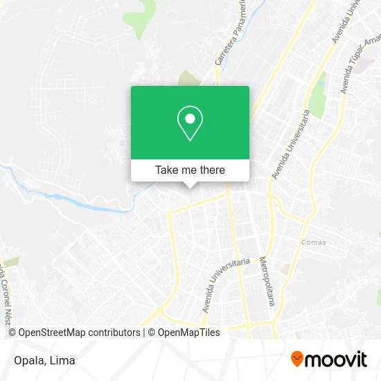
See Opala, Los Olivos, on the map
Public Transit to Opala in Los Olivos
Wondering how to get to Opala in Los Olivos? Moovit helps you find the best way to get to Opala with step-by-step directions from the nearest public transit station.
Moovit provides free maps and live directions to help you navigate through your city. View schedules, routes, timetables, and find out how long does it take to get to Opala in real time.
Looking for the nearest stop or station to Opala? Check out this list of stops closest to your destination: Avenida Rómulo Betancourt; Rómulo Betancourt; Avenida Proceres De Huandoy; 2 De Octubre.
Bus: 1173, 1248, 1286, 1469, 1197, 1436, 1104, AN13.
Want to see if there’s another route that gets you there at an earlier time? Moovit helps you find alternative routes or times. Get directions from and directions to Opala easily from the Moovit App or Website.
We make riding to Opala easy, which is why over 1.5 million users, including users in Los Olivos, trust Moovit as the best app for public transit. You don’t need to download an individual bus app or train app, Moovit is your all-in-one transit app that helps you find the best bus time or train time available.
For information on prices of bus, costs and ride fares to Opala, please check the Moovit app.
Use the app to navigate to popular places including to the airport, hospital, stadium, grocery store, mall, coffee shop, school, college, and university.
Opala Address: Opala, Los Olivos 15307, Perú street in Los Olivos
- Hidalgo Zegarra Jose Manuel,
- Colegio Inca Garcilaso de la Vega - Pro-lima,
- Jardines Viru,
- MZ XX2 LOTE 09 URB PUERTA DE PRO,
- MZ XX2 LOTE 09 URB PRO REFERENCIA URB PUERTA DE PRO ,
- MZ TT2 LOTE 4 URBANIZACIÓN DE PRO SUB PARCELA 10 l,
- Capilla Hacienda Pro,
- residencial las laderas de pro,
- Urb Pro Sector 10 (Las Laderas de Pro) Mz XX2 Lt2,
- Av Los Próceres 7475 Urb Pro Sub Parcela 10 I Primera etapa,
- Parque de los Novios Los Olivos de Pro,
- Las Vinas,
- Romulo Betancourt,
- Av Proceres cdra 74 Urb Pro,
- AV PROCERES DE HUANDOY 7487,
- Cerro Pro,
- Avenida Zaragoza,
- Grupo Ramírez Elevator & Scaletor Servicios Generales S.A.C.,
- Import Agar S.A.C - Pernos, tuercas, arandelas, ubolts y Abrazaderas,
- Parque Señor de los Milagros
Places Near Opala (Los Olivos)
- Pontificia Universidad Católica del Perú - PUCP, San Miguel,
- Real Plaza Puruchuco, Ate,
- Plaza San Miguel, San Miguel,
- Parque Kennedy, Miraflores,
- Hospital Edgardo Rebagliati Martins, Jesus Mari,
- Circuito Mágico Del Agua, Lima,
- Centro Comercial Plaza Norte, Independen,
- Aeropuerto Internacional Jorge Chávez, Ventanilla,
- Miraflores, Miraflores,
- Larcomar, Miraflores,
- Av. La Marina, San Miguel,
- Av. Abancay, Lima,
- Av. Salaverry, Jesus Mari,
- av arequipa, Lima,
- Jockey Plaza, Santiago D,
- Mall Del Sur,
- Barranco, Barranco,
- Gamarra,
- Paradero Av.Brasil,
- Parque de las Leyendas, San Miguel
How to get to popular places in Lima with public transit
Get around Los Olivos by public transit!
Traveling around Los Olivos has never been so easy. See step by step directions as you travel to any attraction, street or major public transit station. View bus and train schedules, arrival times, service alerts and detailed routes on a map, so you know exactly how to get to anywhere in Los Olivos.
When traveling to any destination around Los Olivos use Moovit's Live Directions with Get Off Notifications to know exactly where and how far to walk, how long to wait for your line, and how many stops are left. Moovit will alert you when it's time to get off — no need to constantly re-check whether yours is the next stop.
Wondering how to use public transit in Los Olivos or how to pay for public transit in Los Olivos? Moovit public transit app can help you navigate your way with public transit easily, and at minimum cost. It includes public transit fees, ticket prices, and costs. Looking for a map of Los Olivos public transit lines? Moovit public transit app shows all public transit maps in Los Olivos with all Bus, Metro and Ferry routes and stops on an interactive map.
Lima has 3 transit type(s), including: Bus, Metro and Ferry, operated by several transit agencies, including Metro de Lima Línea 2 , Metro de Lima, Corredor Rojo, Metropolitano, Metropolitano - Alimentadores, Corredor Morado, Corredor Azul, Rutas Tradicionales, Transportes y Servicios La Esperanza S.A., Las Flores S.A., Virgen de la Asunción S.A., Consorcio HAM, Transportes y Service Canadá S.A., ETUL4SA and ETUCHISA