Directions to Open Sky Community Services (Worcester) with public transportation
The following transit lines have routes that pass near Open Sky Community Services
 Bus: 2, 6, 825, GREYHOUND US0230, 7.
How to get to Open Sky Community Services by bus?
Click on the bus route to see step by step directions with maps, line arrival times and updated time schedules.
Bus stops near Open Sky Community Services in Worcester
Bus lines to Open Sky Community Services in Worcester
What are the closest stations to Open Sky Community Services?
The closest stations to Open Sky Community Services are:
- Chandler St at Dewey is 43 yards away, 1 min walk.
- Chandler St at June is 73 yards away, 2 min walk.
- Park Ave + Chandler St is 133 yards away, 2 min walk.
Which bus lines stop near Open Sky Community Services?
These bus lines stop near Open Sky Community Services: 2, 6, 825, GREYHOUND US0230.
What’s the nearest bus station to Open Sky Community Services in Worcester?
The nearest bus station to Open Sky Community Services in Worcester is Chandler St at Dewey. It’s a 1 min walk away.
What time is the first bus to Open Sky Community Services in Worcester?
The 6 is the first bus that goes to Open Sky Community Services in Worcester. It stops nearby at 5:41 AM.
What time is the last bus to Open Sky Community Services in Worcester?
The 6 is the last bus that goes to Open Sky Community Services in Worcester. It stops nearby at 10:19 PM.
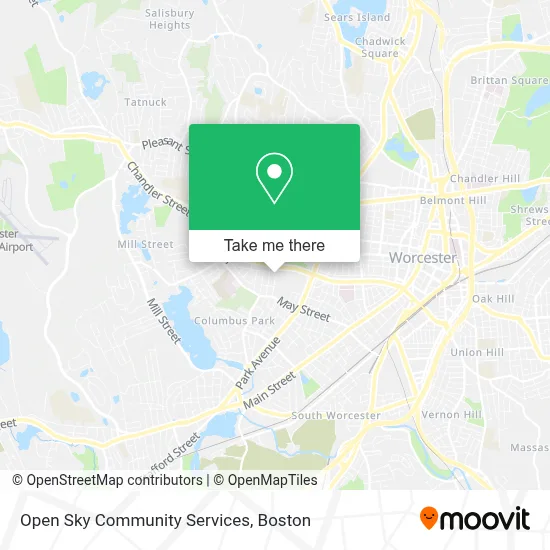
See Open Sky Community Services, Worcester, on the map
Public Transit to Open Sky Community Services in Worcester
Wondering how to get to Open Sky Community Services in Worcester? Moovit helps you find the best way to get to Open Sky Community Services with step-by-step directions from the nearest public transit station.
Moovit provides free maps and live directions to help you navigate through your city. View schedules, routes, timetables, and find out how long does it take to get to Open Sky Community Services in real time.
Looking for the nearest stop or station to Open Sky Community Services? Check out this list of stops closest to your destination: Chandler St at Dewey; Chandler St at June; Park Ave + Chandler St.
Bus: 2, 6, 825, GREYHOUND US0230, 7.
Want to see if there’s another route that gets you there at an earlier time? Moovit helps you find alternative routes or times. Get directions from and directions to Open Sky Community Services easily from the Moovit App or Website.
We make riding to Open Sky Community Services easy, which is why over 1.7 million users, including users in Worcester, trust Moovit as the best app for public transit. You don’t need to download an individual bus app or train app, Moovit is your all-in-one transit app that helps you find the best bus time or train time available.
For information on prices of bus and train, costs and ride fares to Open Sky Community Services, please check the Moovit app.
Use the app to navigate to popular places including to the airport, hospital, stadium, grocery store, mall, coffee shop, school, college, and university.
Open Sky Community Services Address: 4 Mann St street in Worcester
- Jean Eve Brickman, LSW, Ladc-I,
- The Bridge Training Institute,
- The Strike Zone,
- Open Sky,
- BOSCH Car Service,
- JC the Realtor,
- Markopoulos Roofing,
- Century 21 Tangney Association Worcester,
- Kaleidoscope Aba Therapy Services,
- Sullivan Trash Removal,
- ATM,
- Eramo-Webster Susan,
- Levine Jeffrey D Phys,
- General Contracting Design Build Construction Management,
- Coinstar - Bitcoin ATM,
- Foley Stadium,
- Adaptive Exercise,
- Sharkside Community Skatepark,
- Qodesh Family Church - Worcester,
- Quality Chair and van Services
Places Near Open Sky Community Services (Worcester)
- Leader Bank Pavilion (Leader Bank Pavillion), Boston,
- House Of Blues, Boston,
- Quincy Market, Boston,
- Wang Theater, Boston,
- Boston Medical Center, Boston,
- Massachusetts General Hospital, Boston,
- Museum Of Science, Boston,
- Td Garden, Boston,
- Cheers, Boston,
- Boston Convention & Exhibition Center, Boston,
- Boston Common, Boston,
- Wilbur Theatre, Boston,
- Castle Island, Boston,
- Boston Children's Hospital, Boston,
- North End, Boston,
- Isabella Stewart Gardner Museum, Boston,
- Faneuil Hall, Boston,
- Seaport District, Boston,
- Prudential Center, Boston,
- Mgm Music Hall, Boston
How to get to popular places in Boston with public transit
Get around Worcester by public transit!
Traveling around Worcester has never been so easy. See step by step directions as you travel to any attraction, street or major public transit station. View bus and train schedules, arrival times, service alerts and detailed routes on a map, so you know exactly how to get to anywhere in Worcester.
When traveling to any destination around Worcester use Moovit's Live Directions with Get Off Notifications to know exactly where and how far to walk, how long to wait for your line, and how many stops are left. Moovit will alert you when it's time to get off — no need to constantly re-check whether yours is the next stop.
Wondering how to use public transit in Worcester or how to pay for public transit in Worcester? Moovit public transit app can help you navigate your way with public transit easily, and at minimum cost. It includes public transit fees, ticket prices, and costs. Looking for a map of Worcester public transit lines? Moovit public transit app shows all public transit maps in Worcester with all Bus, Train, Subway and Ferry routes and stops on an interactive map.
Boston has 4 transit type(s), including: Bus, Train, Subway and Ferry, operated by several transit agencies, including MBTA, Southeastern Regional Transit Authority, MetroWest Regional Transit Authority, Rhode Island Public Transit Authority, WRTA, Lowell Regional Transit Authority, Merrimack Valley Transit, Montachusett Regional Transit Authority, Cape Cod Regional Transit Authority, Brockton Area Transit Authority, Martha's Vineyard Transit Authority, the WAVE - Nantucket Regional Transit Authority, GATRA, Cape Ann Transportation Authority and Massport