Directions to Optiear Medical, Inc (Cambridge) with public transportation
The following transit lines have routes that pass near Optiear Medical, Inc
 Bus: 77, 83, 87, 62, 67.
- Train: FITCHBURG.
- Subway: RED LINE, GREEN LINE B, GREEN LINE C, GREEN LINE E.
How to get to Optiear Medical, Inc by bus?
Click on the bus route to see step by step directions with maps, line arrival times and updated time schedules.
From City Winery Boston, Boston
68 minFrom Boston Dynamics, Waltham
111 minFrom 75 / 101 Federal Street, Boston
67 minFrom Edic Pier, Boston
74 minFrom South Boston, Boston
79 minFrom Bentley University, Waltham
106 minFrom Home2 Suites-Boston South Bay, Boston
79 minFrom Franklin Park, Boston
92 minFrom Rental Car Center - Logan Airport, Boston
91 minFrom Tufts University, Boston
62 min
How to get to Optiear Medical, Inc by train?
Click on the train route to see step by step directions with maps, line arrival times and updated time schedules.
How to get to Optiear Medical, Inc by subway?
Click on the subway route to see step by step directions with maps, line arrival times and updated time schedules.
From City Winery Boston, Boston
41 minFrom 75 / 101 Federal Street, Boston
35 minFrom Edic Pier, Boston
58 minFrom South Boston, Boston
43 minFrom Home2 Suites-Boston South Bay, Boston
47 minFrom Franklin Park, Boston
63 minFrom Rental Car Center - Logan Airport, Boston
49 minFrom Tufts University, Boston
39 min
Bus stops near Optiear Medical, Inc in Cambridge
Subway stations near Optiear Medical, Inc in Cambridge
Train station near Optiear Medical, Inc in Cambridge
- Porter, 22 min walk,VIEW
Bus lines to Optiear Medical, Inc in Cambridge
- 77, Harvard,VIEW
- 83, Central Square,VIEW
- 62, Alewife - Bedford VA,VIEW
- 67, Alewife via Arlington Center - Turkey Hill via Arlington Center,VIEW
- 76, Alewife - Lincoln Lab via Hanscom Airport,VIEW
- 350, Alewife via Mall Rd - North Burlington via Mall Rd,VIEW
- FITCHBURG LINE SHUTTLE, Littleton/Route 495 - Alewife (Local),VIEW
- FITCHBURG LINE SHUTTLE, Littleton/Route 495 - Alewife (Express),VIEW
- RED LINE SHUTTLE, Alewife - Park Street,VIEW
- RED LINE SHUTTLE, Alewife - Kendall/MIT via Porter (Express),VIEW
- RED LINE SHUTTLE, Alewife - Harvard via Brattle Street,VIEW
- RED LINE SHUTTLE, Alewife - Davis,VIEW
- RED LINE SHUTTLE, Alewife - Kendall/MIT,VIEW
- RED LINE SHUTTLE, Alewife - Harvard via Holyoke Street,VIEW
- R1, Rev Bus - R1,VIEW
- R2, Rev Bus - R2,VIEW
What are the closest stations to Optiear Medical, Inc?
The closest stations to Optiear Medical, Inc are:
- Massachusetts Ave @ Cottage Park Ave is 36 yards away, 1 min walk.
- Rindge Ave @ Middlesex St is 404 yards away, 5 min walk.
- Alewife is 666 yards away, 9 min walk.
- Alewife Station (Depart) is 755 yards away, 10 min walk.
- Davis Sq. is 1095 yards away, 13 min walk.
- Porter is 1818 yards away, 22 min walk.
- Medford/Tufts Station is 2210 yards away, 26 min walk.
Which bus lines stop near Optiear Medical, Inc?
These bus lines stop near Optiear Medical, Inc: 77, 83, 87.
Which train line stops near Optiear Medical, Inc?
FITCHBURG (#409 | Wachusett)
Which subway line stops near Optiear Medical, Inc?
RED LINE (Alewife)
What’s the nearest subway station to Optiear Medical, Inc in Cambridge?
The nearest subway station to Optiear Medical, Inc in Cambridge is Davis Sq.. It’s a 13 min walk away.
What’s the nearest train station to Optiear Medical, Inc in Cambridge?
The nearest train station to Optiear Medical, Inc in Cambridge is Porter. It’s a 22 min walk away.
What’s the nearest bus station to Optiear Medical, Inc in Cambridge?
The nearest bus station to Optiear Medical, Inc in Cambridge is Massachusetts Ave @ Cottage Park Ave. It’s a 1 min walk away.
What time is the first subway to Optiear Medical, Inc in Cambridge?
The GREEN LINE E is the first subway that goes to Optiear Medical, Inc in Cambridge. It stops nearby at 4:55 AM.
What time is the last subway to Optiear Medical, Inc in Cambridge?
The GREEN LINE E is the last subway that goes to Optiear Medical, Inc in Cambridge. It stops nearby at 2:41 AM.
What time is the first train to Optiear Medical, Inc in Cambridge?
The FITCHBURG is the first train that goes to Optiear Medical, Inc in Cambridge. It stops nearby at 5:47 AM.
What time is the last train to Optiear Medical, Inc in Cambridge?
The FITCHBURG is the last train that goes to Optiear Medical, Inc in Cambridge. It stops nearby at 12:17 AM.
What time is the first bus to Optiear Medical, Inc in Cambridge?
The 77 is the first bus that goes to Optiear Medical, Inc in Cambridge. It stops nearby at 4:59 AM.
What time is the last bus to Optiear Medical, Inc in Cambridge?
The 83 is the last bus that goes to Optiear Medical, Inc in Cambridge. It stops nearby at 1:28 AM.
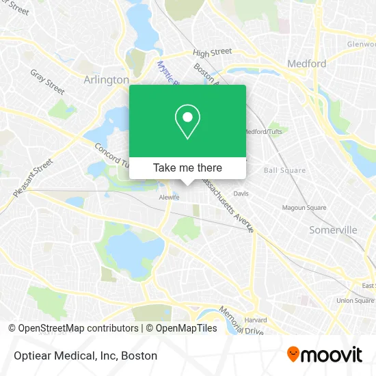
See Optiear Medical, Inc, Cambridge, on the map
Public Transit to Optiear Medical, Inc in Cambridge
Wondering how to get to Optiear Medical, Inc in Cambridge? Moovit helps you find the best way to get to Optiear Medical, Inc with step-by-step directions from the nearest public transit station.
Moovit provides free maps and live directions to help you navigate through your city. View schedules, routes, timetables, and find out how long does it take to get to Optiear Medical, Inc in real time.
Looking for the nearest stop or station to Optiear Medical, Inc? Check out this list of stops closest to your destination: Massachusetts Ave @ Cottage Park Ave; Rindge Ave @ Middlesex St; Alewife; Alewife Station (Depart); Davis Sq.; Porter; Medford/Tufts Station.
Bus: 77, 83, 87, 62, 67, 76, 350, FITCHBURG LINE SHUTTLE.Train: FITCHBURG.Subway: RED LINE, GREEN LINE B, GREEN LINE C, GREEN LINE E.
Want to see if there’s another route that gets you there at an earlier time? Moovit helps you find alternative routes or times. Get directions from and directions to Optiear Medical, Inc easily from the Moovit App or Website.
We make riding to Optiear Medical, Inc easy, which is why over 1.7 million users, including users in Cambridge, trust Moovit as the best app for public transit. You don’t need to download an individual bus app or train app, Moovit is your all-in-one transit app that helps you find the best bus time or train time available.
For information on prices of bus, subway and train, costs and ride fares to Optiear Medical, Inc, please check the Moovit app.
Use the app to navigate to popular places including to the airport, hospital, stadium, grocery store, mall, coffee shop, school, college, and university.
Optiear Medical, Inc Address: # 1 Porter Square Mall street in Cambridge
- Benoit Real Estate Group,
- Outdoor Church of Cambridge,
- Samp Field,
- Russell Field,
- Francis J McCrehan Memorial Swimming and Wading Pool,
- Moriarty J P Millwork,
- 30 Clay St Parking,
- Lindel Group,
- Comeau Field,
- Blue Bikes - Alewife Station at Russell Field,
- USPS COLLECTION BOX - BLUE BOX,
- Cambridge Plumbing,
- Alewife Linear Park,
- Relotek,
- Gas Leak Detection Plumbers,
- Foodtown,
- Russell Field Athletic Complex,
- The Lifeworks Center,
- Ming Hui Academy Boston,
- Psychology
Places Near Optiear Medical, Inc (Cambridge)
- House Of Blues, Boston,
- Boston Convention & Exhibition Center, Boston,
- Prudential Center, Boston,
- Museum Of Science, Boston,
- Boston Common, Boston,
- Quincy Market, Boston,
- Wilbur Theatre, Boston,
- Isabella Stewart Gardner Museum, Boston,
- Massachusetts General Hospital, Boston,
- Leader Bank Pavilion (Leader Bank Pavillion), Boston,
- Seaport District, Boston,
- Td Garden, Boston,
- Mgm Music Hall, Boston,
- Castle Island, Boston,
- Boston Children's Hospital, Boston,
- Boston Medical Center, Boston,
- Faneuil Hall, Boston,
- North End, Boston,
- Cheers, Boston,
- Wang Theater, Boston
How to get to popular places in Boston with public transit
Get around Cambridge by public transit!
Traveling around Cambridge has never been so easy. See step by step directions as you travel to any attraction, street or major public transit station. View bus and train schedules, arrival times, service alerts and detailed routes on a map, so you know exactly how to get to anywhere in Cambridge.
When traveling to any destination around Cambridge use Moovit's Live Directions with Get Off Notifications to know exactly where and how far to walk, how long to wait for your line, and how many stops are left. Moovit will alert you when it's time to get off — no need to constantly re-check whether yours is the next stop.
Wondering how to use public transit in Cambridge or how to pay for public transit in Cambridge? Moovit public transit app can help you navigate your way with public transit easily, and at minimum cost. It includes public transit fees, ticket prices, and costs. Looking for a map of Cambridge public transit lines? Moovit public transit app shows all public transit maps in Cambridge with all Bus, Train, Subway and Ferry routes and stops on an interactive map.
Boston has 4 transit type(s), including: Bus, Train, Subway and Ferry, operated by several transit agencies, including MBTA, Southeastern Regional Transit Authority, MetroWest Regional Transit Authority, Rhode Island Public Transit Authority, WRTA, Lowell Regional Transit Authority, Merrimack Valley Transit, Montachusett Regional Transit Authority, Cape Cod Regional Transit Authority, Brockton Area Transit Authority, Martha's Vineyard Transit Authority, the WAVE - Nantucket Regional Transit Authority, GATRA, Cape Ann Transportation Authority and Massport