How to get to Optimal Body by bus?
Click on the bus route to see step by step directions with maps, line arrival times and updated time schedules.
From Residence Inn-Washington (Residence Inn by Marriott Washington, DC Downtown), Washington
82 minFrom Georgetown Cupcake, Washington
57 minFrom Hotel Zena, Washington
81 minFrom Comfort Inn Downtown DC/Convention Center, Washington
81 minFrom Holy Cross Hospital, Montgomery County
43 minFrom International Monetary Fund (IMF) Headquarters 1 (HQ1), Washington
72 minFrom The World Bank, Washington
71 minFrom Childrens Hospital, Washington
81 minFrom Georgetown Waterfront, Washington
61 minFrom Albert Einstein High School, Montgomery County
43 min
How to get to Optimal Body by metro?
Click on the metro route to see step by step directions with maps, line arrival times and updated time schedules.
From Residence Inn-Washington (Residence Inn by Marriott Washington, DC Downtown), Washington
40 minFrom Georgetown Cupcake, Washington
61 minFrom Hotel Zena, Washington
42 minFrom Comfort Inn Downtown DC/Convention Center, Washington
45 minFrom Holy Cross Hospital, Montgomery County
63 minFrom International Monetary Fund (IMF) Headquarters 1 (HQ1), Washington
42 minFrom The World Bank, Washington
39 minFrom Childrens Hospital, Washington
68 minFrom Georgetown Waterfront, Washington
56 min
Bus stops near Optimal Body in Montgomery County
Metro station near Optimal Body in Montgomery County
- Tenleytown Metro Station, 57 min walk,VIEW
Bus lines to Optimal Body in Montgomery County
What are the closest stations to Optimal Body?
The closest stations to Optimal Body are:
- Montgomery Ln @ East Ln is 139 yards away, 2 min walk.
- Arlington Rd & Bradley Blvd is 151 yards away, 2 min walk.
- Wisconsin Av+Miller Av is 642 yards away, 8 min walk.
- Tenleytown Metro Station is 4824 yards away, 57 min walk.
Which bus lines stop near Optimal Body?
These bus lines stop near Optimal Body: 36, D96, M22, M70.
Which metro line stops near Optimal Body?
RED (Shady Grove)
What’s the nearest bus station to Optimal Body in Montgomery County?
The nearest bus stations to Optimal Body in Montgomery County are Montgomery Ln @ East Ln and Arlington Rd & Bradley Blvd. The closest one is a 2 min walk away.
What time is the first metro to Optimal Body in Montgomery County?
The RED is the first metro that goes to Optimal Body in Montgomery County. It stops nearby at 5:21 AM.
What time is the last metro to Optimal Body in Montgomery County?
The RED is the last metro that goes to Optimal Body in Montgomery County. It stops nearby at 12:19 AM.
What time is the first bus to Optimal Body in Montgomery County?
The D96 is the first bus that goes to Optimal Body in Montgomery County. It stops nearby at 5:32 AM.
What time is the last bus to Optimal Body in Montgomery County?
The D96 is the last bus that goes to Optimal Body in Montgomery County. It stops nearby at 1:08 AM.
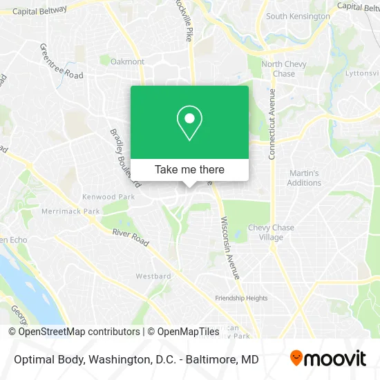
See Optimal Body, Montgomery County, on the map
Public Transit to Optimal Body in Montgomery County
Wondering how to get to Optimal Body in Montgomery County? Moovit helps you find the best way to get to Optimal Body with step-by-step directions from the nearest public transit station.
Moovit provides free maps and live directions to help you navigate through your city. View schedules, routes, timetables, and find out how long does it take to get to Optimal Body in real time.
Looking for the nearest stop or station to Optimal Body? Check out this list of stops closest to your destination: Montgomery Ln @ East Ln; Arlington Rd & Bradley Blvd; Wisconsin Av+Miller Av; Tenleytown Metro Station.
Bus: 36, D96, M22, M70, 798.Metro: RED.
Want to see if there’s another route that gets you there at an earlier time? Moovit helps you find alternative routes or times. Get directions from and directions to Optimal Body easily from the Moovit App or Website.
We make riding to Optimal Body easy, which is why over 1.5 million users, including users in Montgomery County, trust Moovit as the best app for public transit. You don’t need to download an individual bus app or train app, Moovit is your all-in-one transit app that helps you find the best bus time or train time available.
For information on prices of bus and metro, costs and ride fares to Optimal Body, please check the Moovit app.
Use the app to navigate to popular places including to the airport, hospital, stadium, grocery store, mall, coffee shop, school, college, and university.
Optimal Body Address: 6931 Arlington Rd Chevy Chase, MD 20814 street in Montgomery County
- When.In Bethesda HQ,
- Eating Recovery Center,
- Sectilis,
- Sagepoint Financial,
- C F Service,
- Gaylord's Lamps & Shades,
- Bethesda Mac Locksmith Inc,
- Harris Gardens,
- Robyn Pashby, PH.D.,
- Bradley Arlington Offices,
- Synergy Financial Services,
- Little Bellies Spa,
- Barpet,
- Ourisman Motors of Bethesda VO,
- Walgreens Pharmacy,
- SLR Holdings,
- GOODYEAR,
- Shell Recharge,
- Capital Crescent Trail - Bethesda,
- Ourisman Honda in Bethesda
Places Near Optimal Body (Montgomery County)
- Sibley Memorial Hospital, Washington,
- PG Mall, Prince George's County,
- Camden Yards, Baltimore,
- National Museum of African American History and Culture, Washington,
- Rock Creek Tennis Center, Washington,
- M&T Bank Stadium, Baltimore,
- The Anthem, Washington,
- Westfield Montgomery Mall, Montgomery County,
- Pennsylvania Ave NW (3rd st and pennsylvania), Washington,
- National Mall, Washington,
- Georgetown, Washington,
- Museum Of The Bible, Washington,
- National Zoo, Washington,
- Amazon Hq2, Arlington County,
- Washington National Cathedral, Washington,
- Capital One Arena, Washington,
- Warner Theatre, Washington,
- Marriott Marquis Washington, DC, Washington,
- Washington DC VA Medical Center, Washington,
- Basilica of the National Shrine, Washington
How to get to popular places in Washington, D.C. - Baltimore, MD with public transit
Get around Montgomery County by public transit!
Traveling around Montgomery County has never been so easy. See step by step directions as you travel to any attraction, street or major public transit station. View bus and train schedules, arrival times, service alerts and detailed routes on a map, so you know exactly how to get to anywhere in Montgomery County.
When traveling to any destination around Montgomery County use Moovit's Live Directions with Get Off Notifications to know exactly where and how far to walk, how long to wait for your line, and how many stops are left. Moovit will alert you when it's time to get off — no need to constantly re-check whether yours is the next stop.
Wondering how to use public transit in Montgomery County or how to pay for public transit in Montgomery County? Moovit public transit app can help you navigate your way with public transit easily, and at minimum cost. It includes public transit fees, ticket prices, and costs. Looking for a map of Montgomery County public transit lines? Moovit public transit app shows all public transit maps in Montgomery County with all Bus, Train, Metro, Light Rail and Ferry routes and stops on an interactive map.
Washington, D.C. - Baltimore, MD has 5 transit type(s), including: Bus, Train, Metro, Light Rail and Ferry, operated by several transit agencies, including WMATA, Montgomery County Ride On, Fairfax Connector, TheBus, PRTC, DASH - Alexandria, Arlington Transit (ART), RTA of Central Maryland, MDOT MTA, MDOT MTA Light RailLink, MDOT MTA Commuter Bus, MDOT MTA Local Bus, FXBGO!, Virginia Railway Express (VRE) and MARC