How to get to Shell Recharge by bus?
Click on the bus route to see step by step directions with maps, line arrival times and updated time schedules.
From ICE Headquarters, Washington
77 minFrom Washington National Cathedral (Atlantic Services Location, Washington
36 minFrom Trinity Washington University, Washington
80 minFrom Hyatt Place Washington DC/White House, Washington
77 minFrom US Marine Corps War Memorial (Iwo Jima), Arlington County
78 minFrom Consulado General del Peru en Washington, DC, Washington
61 minFrom Embassy of The Federal Republic of Germany, Washington
66 minFrom Comfort Inn Downtown DC/Convention Center, Washington
83 minFrom French Embassy, Washington
66 minFrom Rock Creek Tennis Center, Washington
66 min
How to get to Shell Recharge by metro?
Click on the metro route to see step by step directions with maps, line arrival times and updated time schedules.
From ICE Headquarters, Washington
38 minFrom Washington National Cathedral (Atlantic Services Location, Washington
54 minFrom Trinity Washington University, Washington
64 minFrom Hyatt Place Washington DC/White House, Washington
38 minFrom US Marine Corps War Memorial (Iwo Jima), Arlington County
59 minFrom Consulado General del Peru en Washington, DC, Washington
35 minFrom Embassy of The Federal Republic of Germany, Washington
47 minFrom Comfort Inn Downtown DC/Convention Center, Washington
48 min
Bus stop near Shell Recharge in Montgomery County
- Arlington Rd & Bradley Blvd, 2 min walk,VIEW
Metro station near Shell Recharge in Montgomery County
- Tenleytown Metro Station, 54 min walk,VIEW
Bus lines to Shell Recharge in Montgomery County
- 36, Bethesda Loop,VIEW
What are the closest stations to Shell Recharge?
The closest stations to Shell Recharge are:
- Arlington Rd & Bradley Blvd is 112 yards away, 2 min walk.
- Tenleytown Metro Station is 4579 yards away, 54 min walk.
Which bus lines stop near Shell Recharge?
These bus lines stop near Shell Recharge: 36, D96.
Which metro line stops near Shell Recharge?
RED (Shady Grove)
What’s the nearest bus station to Shell Recharge in Montgomery County?
The nearest bus station to Shell Recharge in Montgomery County is Arlington Rd & Bradley Blvd. It’s a 2 min walk away.
What time is the first metro to Shell Recharge in Montgomery County?
The RED is the first metro that goes to Shell Recharge in Montgomery County. It stops nearby at 5:21 AM.
What time is the last metro to Shell Recharge in Montgomery County?
The RED is the last metro that goes to Shell Recharge in Montgomery County. It stops nearby at 12:19 AM.
What time is the first bus to Shell Recharge in Montgomery County?
The 36 is the first bus that goes to Shell Recharge in Montgomery County. It stops nearby at 5:41 AM.
What time is the last bus to Shell Recharge in Montgomery County?
The 36 is the last bus that goes to Shell Recharge in Montgomery County. It stops nearby at 8:59 PM.
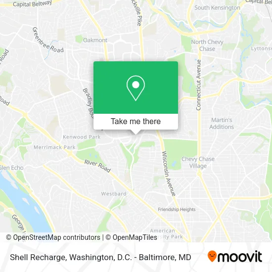
See Shell Recharge, Montgomery County, on the map
Public Transit to Shell Recharge in Montgomery County
Wondering how to get to Shell Recharge in Montgomery County? Moovit helps you find the best way to get to Shell Recharge with step-by-step directions from the nearest public transit station.
Moovit provides free maps and live directions to help you navigate through your city. View schedules, routes, timetables, and find out how long does it take to get to Shell Recharge in real time.
Looking for the nearest stop or station to Shell Recharge? Check out this list of stops closest to your destination: Arlington Rd & Bradley Blvd; Tenleytown Metro Station.
Bus: 36, D96.Metro: RED.
Want to see if there’s another route that gets you there at an earlier time? Moovit helps you find alternative routes or times. Get directions from and directions to Shell Recharge easily from the Moovit App or Website.
We make riding to Shell Recharge easy, which is why over 1.5 million users, including users in Montgomery County, trust Moovit as the best app for public transit. You don’t need to download an individual bus app or train app, Moovit is your all-in-one transit app that helps you find the best bus time or train time available.
For information on prices of bus and metro, costs and ride fares to Shell Recharge, please check the Moovit app.
Use the app to navigate to popular places including to the airport, hospital, stadium, grocery store, mall, coffee shop, school, college, and university.
Shell Recharge Address: 5000 Bradley Blvd Chevy Chase, MD 20815 street in Montgomery County
- Amazon Locker-Gardenia,
- Bento Sushi,
- Coinstar - Bitcoin ATM,
- Walgreens Pharmacy,
- Synergy Financial Services,
- Little Bellies Spa,
- Robyn Pashby, PH.D.,
- Barpet,
- Bradley Arlington Offices,
- Harris Gardens,
- KENWOOD Forest Playground,
- Bethesda Mac Locksmith Inc,
- SLR Holdings,
- Gaylord's Lamps & Shades,
- Sagepoint Financial,
- C F Service,
- Eating Recovery Center,
- Optimal Body,
- Sectilis,
- When.In Bethesda HQ
Places Near Shell Recharge (Montgomery County)
- Museum Of The Bible, Washington,
- Georgetown, Washington,
- Pennsylvania Ave NW (3rd st and pennsylvania), Washington,
- Washington DC VA Medical Center, Washington,
- National Museum of African American History and Culture, Washington,
- National Zoo, Washington,
- Camden Yards, Baltimore,
- Washington National Cathedral, Washington,
- Rock Creek Tennis Center, Washington,
- PG Mall, Prince George's County,
- Marriott Marquis Washington, DC, Washington,
- Sibley Memorial Hospital, Washington,
- Warner Theatre, Washington,
- National Mall, Washington,
- Westfield Montgomery Mall, Montgomery County,
- Basilica of the National Shrine, Washington,
- Amazon Hq2, Arlington County,
- Capital One Arena, Washington,
- The Anthem, Washington,
- M&T Bank Stadium, Baltimore
How to get to popular places in Washington, D.C. - Baltimore, MD with public transit
Get around Montgomery County by public transit!
Traveling around Montgomery County has never been so easy. See step by step directions as you travel to any attraction, street or major public transit station. View bus and train schedules, arrival times, service alerts and detailed routes on a map, so you know exactly how to get to anywhere in Montgomery County.
When traveling to any destination around Montgomery County use Moovit's Live Directions with Get Off Notifications to know exactly where and how far to walk, how long to wait for your line, and how many stops are left. Moovit will alert you when it's time to get off — no need to constantly re-check whether yours is the next stop.
Wondering how to use public transit in Montgomery County or how to pay for public transit in Montgomery County? Moovit public transit app can help you navigate your way with public transit easily, and at minimum cost. It includes public transit fees, ticket prices, and costs. Looking for a map of Montgomery County public transit lines? Moovit public transit app shows all public transit maps in Montgomery County with all Bus, Train, Metro, Light Rail and Ferry routes and stops on an interactive map.
Washington, D.C. - Baltimore, MD has 5 transit type(s), including: Bus, Train, Metro, Light Rail and Ferry, operated by several transit agencies, including WMATA, Montgomery County Ride On, Fairfax Connector, TheBus, PRTC, DASH - Alexandria, Arlington Transit (ART), RTA of Central Maryland, MDOT MTA, MDOT MTA Light RailLink, MDOT MTA Commuter Bus, MDOT MTA Local Bus, FXBGO!, Virginia Railway Express (VRE) and MARC