Directions to Opus Insurance (Malden) with public transportation
The following transit lines have routes that pass near Opus Insurance
 Bus: 106, 108, 137, 411, 430.
- Train: HAVERHILL, ORANGE LINE.
- Subway: ORANGE LINE.
How to get to Opus Insurance by bus?
Click on the bus route to see step by step directions with maps, line arrival times and updated time schedules.
From Boston Harbor Hotel, Boston
59 minFrom Revere Hotel Boston Common, Boston
67 minFrom Courtyard Marriott Lobby, Boston
66 minFrom Park Plaza Hotel Boston, Boston
68 minFrom General Consulate of Colombia, Boston
69 minFrom North Shore Community College Lynn, Lynn
49 minFrom Wakefield, MA, Wakefield
53 minFrom Boston Park Plaza, Boston
69 minFrom Charles/MGH T Stop, Boston
62 minFrom Somerville, MA, Somerville
57 min
How to get to Opus Insurance by train?
Click on the train route to see step by step directions with maps, line arrival times and updated time schedules.
How to get to Opus Insurance by subway?
Click on the subway route to see step by step directions with maps, line arrival times and updated time schedules.
From Boston Harbor Hotel, Boston
57 minFrom Revere Hotel Boston Common, Boston
57 minFrom Courtyard Marriott Lobby, Boston
53 minFrom Park Plaza Hotel Boston, Boston
61 minFrom General Consulate of Colombia, Boston
61 minFrom Boston Park Plaza, Boston
61 minFrom Charles/MGH T Stop, Boston
55 minFrom Somerville, MA, Somerville
69 min
Bus stops near Opus Insurance in Malden
Train station near Opus Insurance in Malden
- Oak Grove, 17 min walk,VIEW
Bus lines to Opus Insurance in Malden
What are the closest stations to Opus Insurance?
The closest stations to Opus Insurance are:
- Lebanon St @ Marshall Ave is 17 yards away, 1 min walk.
- Salem St @ Maplewood St is 161 yards away, 2 min walk.
- Oak Grove is 1399 yards away, 17 min walk.
Which bus lines stop near Opus Insurance?
These bus lines stop near Opus Insurance: 106, 108, 137, 411.
Which train line stops near Opus Insurance?
HAVERHILL (#229 | Haverhill)
Which subway line stops near Opus Insurance?
ORANGE LINE (Oak Grove)
What’s the nearest train station to Opus Insurance in Malden?
The nearest train station to Opus Insurance in Malden is Oak Grove. It’s a 17 min walk away.
What’s the nearest bus station to Opus Insurance in Malden?
The nearest bus station to Opus Insurance in Malden is Lebanon St @ Marshall Ave. It’s a 1 min walk away.
What time is the first subway to Opus Insurance in Malden?
The ORANGE LINE is the first subway that goes to Opus Insurance in Malden. It stops nearby at 5:15 AM.
What time is the last subway to Opus Insurance in Malden?
The ORANGE LINE is the last subway that goes to Opus Insurance in Malden. It stops nearby at 1:59 AM.
What time is the first train to Opus Insurance in Malden?
The HAVERHILL is the first train that goes to Opus Insurance in Malden. It stops nearby at 5:35 AM.
What time is the last train to Opus Insurance in Malden?
The HAVERHILL is the last train that goes to Opus Insurance in Malden. It stops nearby at 11:53 PM.
What time is the first bus to Opus Insurance in Malden?
The 106 is the first bus that goes to Opus Insurance in Malden. It stops nearby at 5:02 AM.
What time is the last bus to Opus Insurance in Malden?
The 108 is the last bus that goes to Opus Insurance in Malden. It stops nearby at 1:41 AM.
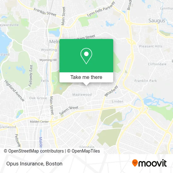
See Opus Insurance, Malden, on the map
Public Transit to Opus Insurance in Malden
Wondering how to get to Opus Insurance in Malden? Moovit helps you find the best way to get to Opus Insurance with step-by-step directions from the nearest public transit station.
Moovit provides free maps and live directions to help you navigate through your city. View schedules, routes, timetables, and find out how long does it take to get to Opus Insurance in real time.
Looking for the nearest stop or station to Opus Insurance? Check out this list of stops closest to your destination: Lebanon St @ Marshall Ave; Salem St @ Maplewood St; Oak Grove.
Bus: 106, 108, 137, 411, 430.Train: HAVERHILL, ORANGE LINE.Subway: ORANGE LINE.
Want to see if there’s another route that gets you there at an earlier time? Moovit helps you find alternative routes or times. Get directions from and directions to Opus Insurance easily from the Moovit App or Website.
We make riding to Opus Insurance easy, which is why over 1.7 million users, including users in Malden, trust Moovit as the best app for public transit. You don’t need to download an individual bus app or train app, Moovit is your all-in-one transit app that helps you find the best bus time or train time available.
For information on prices of bus, subway and train, costs and ride fares to Opus Insurance, please check the Moovit app.
Use the app to navigate to popular places including to the airport, hospital, stadium, grocery store, mall, coffee shop, school, college, and university.
Opus Insurance Address: 221 Sylvan St street in Malden
- Grace Church of God,
- CRG Business Services,
- American Locksmith,
- Dadsss,
- Crixpixels,
- Forestdale Park,
- Sunnyhurst Farms,
- High Rock Memorial Park,
- Quality Carpet Care,
- Brustus Property Management LL,
- Young Kim Ok,
- Joel Gaete Contractor,
- Nicholas Seal Coating,
- Ward,
- Howard Construction,
- Boston Greeter Services,
- L Footwear,
- Fajita's Mexican Grill,
- Rm Money Transfer,
- Maplewood Square
Places Near Opus Insurance (Malden)
- Quincy Market, Boston,
- Td Garden, Boston,
- Castle Island, Boston,
- Wilbur Theatre, Boston,
- Boston Children's Hospital, Boston,
- Isabella Stewart Gardner Museum, Boston,
- Wang Theater, Boston,
- North End, Boston,
- Boston Convention & Exhibition Center, Boston,
- Prudential Center, Boston,
- Boston Medical Center, Boston,
- Faneuil Hall, Boston,
- Boston Common, Boston,
- Seaport District, Boston,
- Massachusetts General Hospital, Boston,
- Leader Bank Pavilion (Leader Bank Pavillion), Boston,
- House Of Blues, Boston,
- Mgm Music Hall, Boston,
- Cheers, Boston,
- Museum Of Science, Boston
How to get to popular places in Boston with public transit
Get around Malden by public transit!
Traveling around Malden has never been so easy. See step by step directions as you travel to any attraction, street or major public transit station. View bus and train schedules, arrival times, service alerts and detailed routes on a map, so you know exactly how to get to anywhere in Malden.
When traveling to any destination around Malden use Moovit's Live Directions with Get Off Notifications to know exactly where and how far to walk, how long to wait for your line, and how many stops are left. Moovit will alert you when it's time to get off — no need to constantly re-check whether yours is the next stop.
Wondering how to use public transit in Malden or how to pay for public transit in Malden? Moovit public transit app can help you navigate your way with public transit easily, and at minimum cost. It includes public transit fees, ticket prices, and costs. Looking for a map of Malden public transit lines? Moovit public transit app shows all public transit maps in Malden with all Bus, Train, Subway and Ferry routes and stops on an interactive map.
Boston has 4 transit type(s), including: Bus, Train, Subway and Ferry, operated by several transit agencies, including MBTA, Southeastern Regional Transit Authority, MetroWest Regional Transit Authority, Rhode Island Public Transit Authority, WRTA, Lowell Regional Transit Authority, Merrimack Valley Transit, Montachusett Regional Transit Authority, Cape Cod Regional Transit Authority, Brockton Area Transit Authority, Martha's Vineyard Transit Authority, the WAVE - Nantucket Regional Transit Authority, GATRA, Cape Ann Transportation Authority and Massport