How to get to Orientaction by bus?
Click on the bus route to see step by step directions with maps, line arrival times and updated time schedules.
From Intermarché Super, Marguerittes
43 minFrom La Demeure d'Hélice, Langlade
72 minFrom St-Gervasy, Saint-Gervasy
51 minFrom Langlade, Langlade
75 minFrom Auchan Supermarché Redessan, Redessan
52 minFrom Aéroport de Nîmes Garons (FNI), Saint-Gilles
55 minFrom Groupe Occitanie Ugecam Centre Médical l'Egrégore, Caveirac
50 minFrom Niaoulis, Langlade
70 minFrom 503 Regiment De Train, Nîmes
36 min
Bus stops near Orientaction in Nimes
Bus lines to Orientaction in Nimes
What are the closest stations to Orientaction?
The closest stations to Orientaction are:
- Georges Besse 2 is 167 meters away, 3 min walk.
- Forez is 298 meters away, 4 min walk.
- Pierre Gamel is 432 meters away, 6 min walk.
- Georges Besse is 663 meters away, 9 min walk.
Which bus lines stop near Orientaction?
These bus lines stop near Orientaction: 41, 42, 6, 7, 8.
What’s the nearest bus station to Orientaction in Nimes?
The nearest bus station to Orientaction in Nimes is Georges Besse 2. It’s a 3 min walk away.
What time is the first bus to Orientaction in Nimes?
The 6 is the first bus that goes to Orientaction in Nimes. It stops nearby at 6:05 AM.
What time is the last bus to Orientaction in Nimes?
The 6 is the last bus that goes to Orientaction in Nimes. It stops nearby at 8:49 PM.
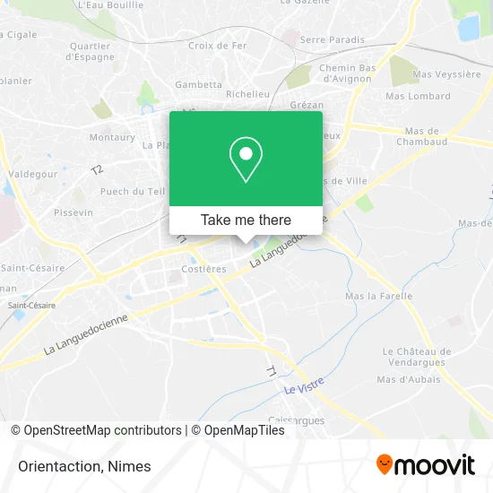
See Orientaction, Nimes, on the map
Public Transit to Orientaction in Nimes
Wondering how to get to Orientaction in Nimes? Moovit helps you find the best way to get to Orientaction with step-by-step directions from the nearest public transit station.
Moovit provides free maps and live directions to help you navigate through your city. View schedules, routes, timetables, and find out how long does it take to get to Orientaction in real time.
Looking for the nearest stop or station to Orientaction? Check out this list of stops closest to your destination: Georges Besse 2; Forez; Pierre Gamel; Georges Besse.
Bus: 41, 42, 6, 7, 8, 76, 218, 219.
Want to see if there’s another route that gets you there at an earlier time? Moovit helps you find alternative routes or times. Get directions from and directions to Orientaction easily from the Moovit App or Website.
We make riding to Orientaction easy, which is why over 1.5 million users, including users in Nimes, trust Moovit as the best app for public transit. You don’t need to download an individual bus app or train app, Moovit is your all-in-one transit app that helps you find the best bus time or train time available.
For information on prices of bus, costs and ride fares to Orientaction, please check the Moovit app.
Use the app to navigate to popular places including to the airport, hospital, stadium, grocery store, mall, coffee shop, school, college, and university.
Orientaction Address: 442 Rue Georges Besse 30900 Nîmes street in Nimes
- Bodysens,
- Parc Georges Besse,
- Rue Georges Besse 417,
- Cantine Site EERIE,
- Achille et Colette,
- Ecole des Mines d'Alès,
- Parc Scientifique Georges Besse,
- Le Georges B,
- Chemin Bas du Mas de Boudan 859,
- Mas de Boudan,
- Centre de Ressources Gardois,
- Rue Georges Besse 100,
- Comité d'Hygiène Bucco-Dentaire du Gard,
- Balthazard Muriel,
- Conseil Général du Gard,
- Audit Action Conseil,
- Le Bois Des Noyers,
- L'Arche Botti,
- Allée Norbert Wiener 116,
- Maison Des Professions Libérales Et De Santé
Places Near Orientaction (Nimes)
- Les 7 Collines,
- Saint-Césaire,
- Hôpital Privé Les Franciscaines,
- Jardins de la Fontaine,
- Kinepolis,
- Polyclinique Du Grand Sud,
- Clinique Franciscaine,
- Centre hospitalier Caremeau,
- E.Leclerc,
- Aire De Covoiturage Nîmes Ouest,
- Carrefour Nîmes Sud,
- La Galerie - Cap Costières,
- Rond-Point Kilomètre Delta, Nîmes,
- Parc Kennedy,
- VILLE ACTIVE, Nîmes,
- Geant Casino,
- École Nationale De Police,
- Rue Gilles Roberval 285,
- Le Parnasse, Nîmes,
- CHU de Nîmes - Hôpital universitaire Carémeau
How to get to popular places in Nimes with public transit
Get around Nimes by public transit!
Traveling around Nimes has never been so easy. See step by step directions as you travel to any attraction, street or major public transit station. View bus and train schedules, arrival times, service alerts and detailed routes on a map, so you know exactly how to get to anywhere in Nimes.
When traveling to any destination around Nimes use Moovit's Live Directions with Get Off Notifications to know exactly where and how far to walk, how long to wait for your line, and how many stops are left. Moovit will alert you when it's time to get off — no need to constantly re-check whether yours is the next stop.
Wondering how to use public transit in Nimes or how to pay for public transit in Nimes? Moovit public transit app can help you navigate your way with public transit easily, and at minimum cost. It includes public transit fees, ticket prices, and costs. Looking for a map of Nimes public transit lines? Moovit public transit app shows all public transit maps in Nimes with all bus routes and stops on an interactive map.
Nimes has 1 transit type(s), including: bus, operated by several transit agencies, including TANGO