How to get to Oso Canyon Chili by bus?
Click on the bus route to see step by step directions with maps, line arrival times and updated time schedules.
From Charlton Memorial Hospital, Fall River
137 minFrom Amazon Fulfillment Bos7, Fall River
123 minFrom Lizzy Borden House, Fall River
66 minFrom Barahona Express, Providence
50 minFrom Bristol Community College, Fall River
73 minFrom Walmart Fall River Supercenter, Fall River
131 minFrom B.M.C. Durfee High School, Fall River
117 min
Bus stops near Oso Canyon Chili in Boston
What are the closest stations to Oso Canyon Chili?
The closest stations to Oso Canyon Chili are:
- Park & Ride (Franklin St - Warren) is 299 yards away, 4 min walk.
- Main Opposite Franklin is 317 yards away, 4 min walk.
Which bus line stops near Oso Canyon Chili?
60 (Providence Via E Main Rd)
What’s the nearest bus station to Oso Canyon Chili in Boston?
The nearest bus stations to Oso Canyon Chili in Boston are Park & Ride (Franklin St - Warren) and Main Opposite Franklin. The closest one is a 4 min walk away.
What time is the first bus to Oso Canyon Chili in Boston?
The 60 is the first bus that goes to Oso Canyon Chili in Boston. It stops nearby at 5:19 AM.
What time is the last bus to Oso Canyon Chili in Boston?
The 60 is the last bus that goes to Oso Canyon Chili in Boston. It stops nearby at 12:42 AM.
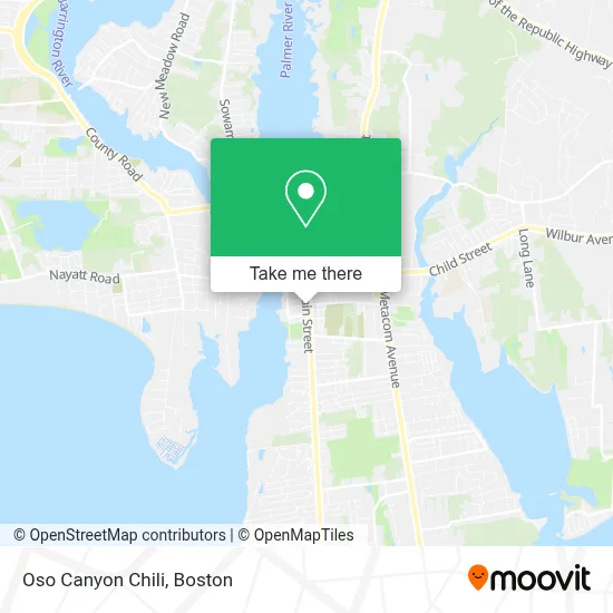
See Oso Canyon Chili, Boston, on the map
Public Transit to Oso Canyon Chili in Boston
Wondering how to get to Oso Canyon Chili in Boston? Moovit helps you find the best way to get to Oso Canyon Chili with step-by-step directions from the nearest public transit station.
Moovit provides free maps and live directions to help you navigate through your city. View schedules, routes, timetables, and find out how long does it take to get to Oso Canyon Chili in real time.
Looking for the nearest stop or station to Oso Canyon Chili? Check out this list of stops closest to your destination: Park & Ride (Franklin St - Warren); Main Opposite Franklin.
Bus: 60, 61X.
Want to see if there’s another route that gets you there at an earlier time? Moovit helps you find alternative routes or times. Get directions from and directions to Oso Canyon Chili easily from the Moovit App or Website.
We make riding to Oso Canyon Chili easy, which is why over 1.7 million users, including users in Boston, trust Moovit as the best app for public transit. You don’t need to download an individual bus app or train app, Moovit is your all-in-one transit app that helps you find the best bus time or train time available.
For information on prices of bus, costs and ride fares to Oso Canyon Chili, please check the Moovit app.
Use the app to navigate to popular places including to the airport, hospital, stadium, grocery store, mall, coffee shop, school, college, and university.
Oso Canyon Chili Address: 691 Main St street in Boston
- Kassumay LLC,
- Good4uri,
- Aunt Tatty,
- Rhode Island Shellfish,
- McDaffa's Donut Cakes,
- Hollister Tamales,
- Brown Family Seafood,
- Caribe & Co.,
- Flaky Crust Pies,
- American Pecan Co.,
- Pickily,
- Morabeza,
- Ocean State Ice Cream Company,
- The Road Runner Food Truck,
- St. Mary Of the Bay Food Pantry,
- The Warren Catholic,
- Drug Rehab Of Warren,
- East Side Clinical Laboratory,
- 18 Franklin St Parking,
- Locksmith & A 24 Hour Emerg
Places Near Oso Canyon Chili (Boston)
- House Of Blues, Boston,
- Wilbur Theatre, Boston,
- Prudential Center, Boston,
- Museum Of Science, Boston,
- Castle Island, Boston,
- North End, Boston,
- Boston Children's Hospital, Boston,
- Faneuil Hall, Boston,
- Boston Medical Center, Boston,
- Cheers, Boston,
- Leader Bank Pavilion (Leader Bank Pavillion), Boston,
- Massachusetts General Hospital, Boston,
- Mgm Music Hall, Boston,
- Seaport District, Boston,
- Boston Common, Boston,
- Td Garden, Boston,
- Wang Theater, Boston,
- Boston Convention & Exhibition Center, Boston,
- Quincy Market, Boston,
- Isabella Stewart Gardner Museum, Boston
How to get to popular places in Boston with public transit
Get around Boston by public transit!
Traveling around Boston has never been so easy. See step by step directions as you travel to any attraction, street or major public transit station. View bus and train schedules, arrival times, service alerts and detailed routes on a map, so you know exactly how to get to anywhere in Boston.
When traveling to any destination around Boston use Moovit's Live Directions with Get Off Notifications to know exactly where and how far to walk, how long to wait for your line, and how many stops are left. Moovit will alert you when it's time to get off — no need to constantly re-check whether yours is the next stop.
Wondering how to use public transit in Boston or how to pay for public transit in Boston? Moovit public transit app can help you navigate your way with public transit easily, and at minimum cost. It includes public transit fees, ticket prices, and costs. Looking for a map of Boston public transit lines? Moovit public transit app shows all public transit maps in Boston with all Bus, Train, Subway and Ferry routes and stops on an interactive map.
Boston has 4 transit type(s), including: Bus, Train, Subway and Ferry, operated by several transit agencies, including MBTA, Southeastern Regional Transit Authority, MetroWest Regional Transit Authority, Rhode Island Public Transit Authority, WRTA, Lowell Regional Transit Authority, Merrimack Valley Transit, Montachusett Regional Transit Authority, Cape Cod Regional Transit Authority, Brockton Area Transit Authority, Martha's Vineyard Transit Authority, the WAVE - Nantucket Regional Transit Authority, GATRA, Cape Ann Transportation Authority and Massport