Directions to Ot Training (Boston) with public transportation
The following transit lines have routes that pass near Ot Training
 Bus: HYANNIS - SOUTH SHORE TO LOGAN AIRPORT, RF.
- Train: KINGSTON.
How to get to Ot Training by bus?
Click on the bus route to see step by step directions with maps, line arrival times and updated time schedules.
How to get to Ot Training by train?
Click on the train route to see step by step directions with maps, line arrival times and updated time schedules.
Train station near Ot Training in Boston
- South Weymouth, 9 min walk,VIEW
What are the closest stations to Ot Training?
The closest stations to Ot Training are:
- South Weymouth is 720 yards away, 9 min walk.
Which bus lines stop near Ot Training?
These bus lines stop near Ot Training: HYANNIS - SOUTH SHORE TO LOGAN AIRPORT, RF.
Which train line stops near Ot Training?
KINGSTON (#1009 | Kingston)
What’s the nearest train station to Ot Training in Boston?
The nearest train station to Ot Training in Boston is South Weymouth. It’s a 9 min walk away.
What time is the first train to Ot Training in Boston?
The KINGSTON is the first train that goes to Ot Training in Boston. It stops nearby at 5:27 AM.
What time is the last train to Ot Training in Boston?
The KINGSTON is the last train that goes to Ot Training in Boston. It stops nearby at 12:32 AM.
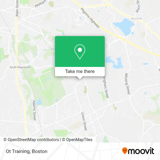
See Ot Training, Boston, on the map
Public Transit to Ot Training in Boston
Wondering how to get to Ot Training in Boston? Moovit helps you find the best way to get to Ot Training with step-by-step directions from the nearest public transit station.
Moovit provides free maps and live directions to help you navigate through your city. View schedules, routes, timetables, and find out how long does it take to get to Ot Training in real time.
Looking for the nearest stop or station to Ot Training? Check out this list of stops closest to your destination: South Weymouth.
Bus: HYANNIS - SOUTH SHORE TO LOGAN AIRPORT, RF.Train: KINGSTON.
Want to see if there’s another route that gets you there at an earlier time? Moovit helps you find alternative routes or times. Get directions from and directions to Ot Training easily from the Moovit App or Website.
We make riding to Ot Training easy, which is why over 1.7 million users, including users in Boston, trust Moovit as the best app for public transit. You don’t need to download an individual bus app or train app, Moovit is your all-in-one transit app that helps you find the best bus time or train time available.
For information on prices of bus, train and subway, costs and ride fares to Ot Training, please check the Moovit app.
Use the app to navigate to popular places including to the airport, hospital, stadium, grocery store, mall, coffee shop, school, college, and university.
Ot Training Address: 180 VFW Dr street in Boston
- R.A.D. Sports,
- Magoo's Ice Cream,
- Magoo's Ice Cream,
- Josch Landscape South Shore-Ma,
- Highway Auto Body, Independent Certified Collision Repair Center Of Bmw Of Rockland,
- Supreme Muffler & Brake,
- Vivi’S Kitchen,
- Mima's Cuban Cafe,
- Jm Home Repair Services,
- Kindercare,
- Iron Way Fitness,
- Igreja Missionaria Betel,
- Commonwealth Building Systems,
- Granby Resort Homes,
- Able Construction Llc.,
- Living Free Home,
- Able Home Performance,
- New England Combustion Products,
- Patriot Spray Foam Insulation,
- Lovell Arena
Places Near Ot Training (Boston)
- Castle Island, Boston,
- Wang Theater, Boston,
- Museum Of Science, Boston,
- Massachusetts General Hospital, Boston,
- Leader Bank Pavilion (Leader Bank Pavillion), Boston,
- Boston Children's Hospital, Boston,
- Cheers, Boston,
- Boston Convention & Exhibition Center, Boston,
- Td Garden, Boston,
- Boston Medical Center, Boston,
- North End, Boston,
- Faneuil Hall, Boston,
- House Of Blues, Boston,
- Boston Common, Boston,
- Mgm Music Hall, Boston,
- Wilbur Theatre, Boston,
- Quincy Market, Boston,
- Seaport District, Boston,
- Isabella Stewart Gardner Museum, Boston,
- Prudential Center, Boston
How to get to popular places in Boston with public transit
Get around Boston by public transit!
Traveling around Boston has never been so easy. See step by step directions as you travel to any attraction, street or major public transit station. View bus and train schedules, arrival times, service alerts and detailed routes on a map, so you know exactly how to get to anywhere in Boston.
When traveling to any destination around Boston use Moovit's Live Directions with Get Off Notifications to know exactly where and how far to walk, how long to wait for your line, and how many stops are left. Moovit will alert you when it's time to get off — no need to constantly re-check whether yours is the next stop.
Wondering how to use public transit in Boston or how to pay for public transit in Boston? Moovit public transit app can help you navigate your way with public transit easily, and at minimum cost. It includes public transit fees, ticket prices, and costs. Looking for a map of Boston public transit lines? Moovit public transit app shows all public transit maps in Boston with all Bus, Train, Subway and Ferry routes and stops on an interactive map.
Boston has 4 transit type(s), including: Bus, Train, Subway and Ferry, operated by several transit agencies, including MBTA, Southeastern Regional Transit Authority, MetroWest Regional Transit Authority, Rhode Island Public Transit Authority, WRTA, Lowell Regional Transit Authority, Merrimack Valley Transit, Montachusett Regional Transit Authority, Cape Cod Regional Transit Authority, Brockton Area Transit Authority, Martha's Vineyard Transit Authority, the WAVE - Nantucket Regional Transit Authority, GATRA, Cape Ann Transportation Authority and Massport