See Otter River State Forest, Boston, on the map
Directions to Otter River State Forest (Boston) with public transportation
The following transit lines have routes that pass near Otter River State Forest
 Bus:
Bus:
Bus stations near Otter River State Forest in Boston
- Route 68 & Route 202, Baldwinville,23 min walk,
Bus lines to Otter River State Forest in Boston
- GLINK: GARDNER TO WINCHENDON,Gardner City Hall (Rear)/Connors Street,
- GLINK: WINCHENDON TO GARDNER,Mt. Wachusett Community College Lot B,
What are the closest stations to Otter River State Forest?
The closest stations to Otter River State Forest are:
- Route 68 & Route 202, Baldwinville is 1974 yards away, 23 min walk.
Which bus line stops near Otter River State Forest?
GLINK: GARDNER TO WINCHENDON
See Otter River State Forest, Boston, on the map
Public Transit to Otter River State Forest in Boston
Wondering how to get to Otter River State Forest in Boston, United States? Moovit helps you find the best way to get to Otter River State Forest with step-by-step directions from the nearest public transit station.
Moovit provides free maps and live directions to help you navigate through your city. View schedules, routes, timetables, and find out how long does it take to get to Otter River State Forest in real time.
Looking for the nearest stop or station to Otter River State Forest? Check out this list of stops closest to your destination: Route 68 & Route 202.
Bus:
Want to see if there’s another route that gets you there at an earlier time? Moovit helps you find alternative routes or times. Get directions from and directions to Otter River State Forest easily from the Moovit App or Website.
We make riding to Otter River State Forest easy, which is why over 1.5 million users, including users in Boston, trust Moovit as the best app for public transit. You don’t need to download an individual bus app or train app, Moovit is your all-in-one transit app that helps you find the best bus time or train time available.
For information on prices of bus, train and subway, costs and ride fares to Otter River State Forest, please check the Moovit app.
Use the app to navigate to popular places including to the airport, hospital, stadium, grocery store, mall, coffee shop, school, college, and university.
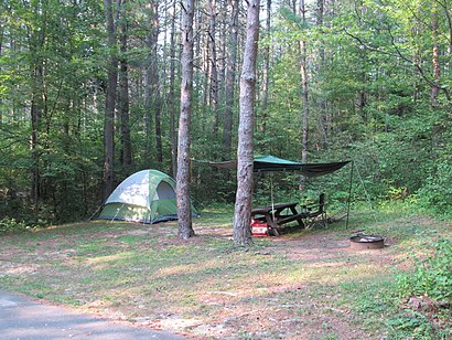
Otter River State Forest Address: Otter River street in Boston
Attractions near Otter River State Forest
Beaman Pond,Bamans Pond Recreation Area,Mike's Auto,Charlie L Stuart Acupuncturist,Beaman Pond,Charles Stuart,Mud Pond,1,Gilman-Waite Field,1,18 Ash St,Gilman Waite Field,35 Claire Ave,New Boston Cemetery,Phil's Drywall Inc,52 Wilson Ct,79 Harris St,Harty's Parking Lot Striping,36 Holman St,Casavant PaintingHow to get to popular attractions in Boston with public transit
Ruggles Station, Boston,Shabu Zen, Boston,South Bay Mall, Boston,Brown University,Portsmouth, RI,Wilmington, MA, Wilmington,Star Market, Waltham,White Horse Tavern, Boston,Raising Cane's Chicken Fingers, Boston,Staples Corporate HQ, Framingham,Joe's American Bar & Grill, Boston,Inman Square, Cambridge,Apple Providence Place,Worcester Polytechnic Institute (WPI), Worcester,FiRE + iCE Boston, Boston,Charlie's Kitchen, Cambridge,Stephanie's On Newbury, Boston,Cityside Restaurant & Bar, Boston,North Shore Mall, Peabody,The Salty Pig, BostonGet around Boston by public transit!
Traveling around Boston has never been so easy. See step by step directions as you travel to any attraction, street or major public transit station. View bus and train schedules, arrival times, service alerts and detailed routes on a map, so you know exactly how to get to anywhere in Boston.
When traveling to any destination around Boston use Moovit's Live Directions with Get Off Notifications to know exactly where and how far to walk, how long to wait for your line, and how many stops are left. Moovit will alert you when it's time to get off — no need to constantly re-check whether yours is the next stop.
Wondering how to use public transit in Boston or how to pay for public transit in Boston? Moovit public transit app can help you navigate your way with public transit easily, and at minimum cost. It includes public transit fees, ticket prices, and costs. Looking for a map of Boston public transit lines? Moovit public transit app shows all public transit maps in Boston with all bus, train or subway routes and stops on an interactive map.
Boston has 3 transit type(s), including: bus, train or subway, operated by several transit agencies, including MBTA, MBTA, MBTA, Southeastern Regional Transit Authority, MetroWest Regional Transit Authority, Rhode Island Public Transit Authority, WRTA, Lowell Regional Transit Authority, Merrimack Valley Transit, Montachusett Regional Transit Authority, Cape Cod Regional Transit Authority, Brockton Area Transit Authority, Cape Cod Regional Transit Authority, Martha's Vineyard Transit Authority and the WAVE - Nantucket Regional Transit Authority