Directions to Our Sisters' School (Boston) with public transportation
The following transit lines have routes that pass near Our Sisters' School
 Bus: 203, 9, PETER PAN, 299, 210.
- Train: FALL RIVER/NEW BEDFORD.
- Ferry: SEASTREAK, SEASTREAK, CUTTYHUNK FERRY.
How to get to Our Sisters' School by bus?
Click on the bus route to see step by step directions with maps, line arrival times and updated time schedules.
From Bedford Industrial Park, New Bedford
105 minFrom Amazon Fulfillment Bos7, Fall River
108 minFrom Charlton Memorial Hospital, Fall River
110 minFrom Walmart Fall River Supercenter, Fall River
104 minFrom Lizzy Borden House, Fall River
66 minFrom B.M.C. Durfee High School, Fall River
90 minFrom RMV New Bedford, New Bedford
103 minFrom Bristol Community College, Fall River
91 minFrom Falmouth MA USA, Falmouth
108 min
Bus stops near Our Sisters' School in Boston
Train station near Our Sisters' School in Boston
- New Bedford, 47 min walk,VIEW
Ferry stations near Our Sisters' School in Boston
Bus lines to Our Sisters' School in Boston
What are the closest stations to Our Sisters' School?
The closest stations to Our Sisters' School are:
- Rockdale Ave And Court St is 24 yards away, 1 min walk.
- Rockdale Ave And Union St is 49 yards away, 1 min walk.
- Kempton St And Jenny Lind St is 389 yards away, 5 min walk.
- New Bedford is 4033 yards away, 47 min walk.
- New Bedford, MA is 4897 yards away, 57 min walk.
- Cuttyhunk Ferry Pier, New Bedford, MA is 5125 yards away, 60 min walk.
Which bus lines stop near Our Sisters' School?
These bus lines stop near Our Sisters' School: 203, 9, PETER PAN.
What’s the nearest bus station to Our Sisters' School in Boston?
The nearest bus stations to Our Sisters' School in Boston are Rockdale Ave And Court St and Rockdale Ave And Union St. The closest one is a 1 min walk away.
What time is the first train to Our Sisters' School in Boston?
The FALL RIVER/NEW BEDFORD is the first train that goes to Our Sisters' School in Boston. It stops nearby at 4:16 AM.
What time is the last train to Our Sisters' School in Boston?
The FALL RIVER/NEW BEDFORD is the last train that goes to Our Sisters' School in Boston. It stops nearby at 1:38 AM.
What time is the first bus to Our Sisters' School in Boston?
The 210 is the first bus that goes to Our Sisters' School in Boston. It stops nearby at 5:52 AM.
What time is the last bus to Our Sisters' School in Boston?
The 9 is the last bus that goes to Our Sisters' School in Boston. It stops nearby at 9:50 PM.
What time is the first ferry to Our Sisters' School in Boston?
The SEASTREAK is the first ferry that goes to Our Sisters' School in Boston. It stops nearby at 8:20 AM.
What time is the last ferry to Our Sisters' School in Boston?
The SEASTREAK is the last ferry that goes to Our Sisters' School in Boston. It stops nearby at 8:40 PM.
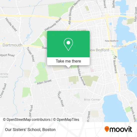
See Our Sisters' School, Boston, on the map
Public Transit to Our Sisters' School in Boston
Wondering how to get to Our Sisters' School in Boston? Moovit helps you find the best way to get to Our Sisters' School with step-by-step directions from the nearest public transit station.
Moovit provides free maps and live directions to help you navigate through your city. View schedules, routes, timetables, and find out how long does it take to get to Our Sisters' School in real time.
Looking for the nearest stop or station to Our Sisters' School? Check out this list of stops closest to your destination: Rockdale Ave And Court St; Rockdale Ave And Union St; Kempton St And Jenny Lind St; New Bedford; New Bedford; Cuttyhunk Ferry Pier.
Bus: 203, 9, PETER PAN, 299, 210.Train: FALL RIVER/NEW BEDFORD.Ferry: SEASTREAK, SEASTREAK, CUTTYHUNK FERRY.
Want to see if there’s another route that gets you there at an earlier time? Moovit helps you find alternative routes or times. Get directions from and directions to Our Sisters' School easily from the Moovit App or Website.
We make riding to Our Sisters' School easy, which is why over 1.7 million users, including users in Boston, trust Moovit as the best app for public transit. You don’t need to download an individual bus app or train app, Moovit is your all-in-one transit app that helps you find the best bus time or train time available.
For information on prices of bus, costs and ride fares to Our Sisters' School, please check the Moovit app.
Use the app to navigate to popular places including to the airport, hospital, stadium, grocery store, mall, coffee shop, school, college, and university.
Our Sisters' School Address: 145 Brownell Ave street in Boston
- Tifereth Israel Congregation,
- Jewish Federation Of Greater New Bedford,
- Salon B,
- Touch Of Grace Florist,
- Buttonwood Park Zoo,
- Dental Surgeons Of Dartmouth,
- Lash And Body Balance,
- Prima Beauty Parlor,
- Hear Better Now Tinnitus & Hearing Center,
- Dlh Consulting & Psychiatric Services,
- Dr. Joseph Mills Dmd,
- Southcoast Health Neurosurgery,
- Arielle M Spadea,
- Mark White,
- Praneetha Arge,
- Amy E Bruno,
- Southcoast Health Neurology,
- Prentiss Persians,
- Southcoast Brain & Spine Center,
- Southcoast Rehabilitation Services
Places Near Our Sisters' School (Boston)
- Massachusetts General Hospital, Boston,
- Wang Theater, Boston,
- House Of Blues, Boston,
- Boston Common, Boston,
- Boston Convention & Exhibition Center, Boston,
- Castle Island, Boston,
- Isabella Stewart Gardner Museum, Boston,
- Faneuil Hall, Boston,
- Mgm Music Hall, Boston,
- Boston Medical Center, Boston,
- Boston Children's Hospital, Boston,
- Quincy Market, Boston,
- Cheers, Boston,
- North End, Boston,
- Seaport District, Boston,
- Wilbur Theatre, Boston,
- Prudential Center, Boston,
- Leader Bank Pavilion (Leader Bank Pavillion), Boston,
- Museum Of Science, Boston,
- Td Garden, Boston
How to get to popular places in Boston with public transit
Get around Boston by public transit!
Traveling around Boston has never been so easy. See step by step directions as you travel to any attraction, street or major public transit station. View bus and train schedules, arrival times, service alerts and detailed routes on a map, so you know exactly how to get to anywhere in Boston.
When traveling to any destination around Boston use Moovit's Live Directions with Get Off Notifications to know exactly where and how far to walk, how long to wait for your line, and how many stops are left. Moovit will alert you when it's time to get off — no need to constantly re-check whether yours is the next stop.
Wondering how to use public transit in Boston or how to pay for public transit in Boston? Moovit public transit app can help you navigate your way with public transit easily, and at minimum cost. It includes public transit fees, ticket prices, and costs. Looking for a map of Boston public transit lines? Moovit public transit app shows all public transit maps in Boston with all Bus, Train, Subway and Ferry routes and stops on an interactive map.
Boston has 4 transit type(s), including: Bus, Train, Subway and Ferry, operated by several transit agencies, including MBTA, Southeastern Regional Transit Authority, MetroWest Regional Transit Authority, Rhode Island Public Transit Authority, WRTA, Lowell Regional Transit Authority, Merrimack Valley Transit, Montachusett Regional Transit Authority, Cape Cod Regional Transit Authority, Brockton Area Transit Authority, Martha's Vineyard Transit Authority, the WAVE - Nantucket Regional Transit Authority, GATRA, Cape Ann Transportation Authority and Massport