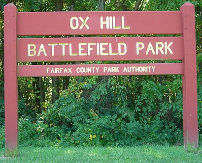
See Ox Hill Battlefield Park, Fair Oaks, on the map
Directions to Ox Hill Battlefield Park (Fair Oaks) with public transportation
The following transit lines have routes that pass near Ox Hill Battlefield Park
Bus:
How to get to Ox Hill Battlefield Park by Bus?
Click on the Bus route to see step by step directions with maps, line arrival times and updated time schedules.
Bus stations near Ox Hill Battlefield Park in Fair Oaks
- West Ox Rd And Polo Dr,4 min walk,
- Monument Dr And West Ox,6 min walk,
- West Ox Rd And Legato Rd,6 min walk,
- Monument Dr + Fair Lakes Pkwy,9 min walk,
- Fair Lakes Promenade,11 min walk,
- Fair Ridge Dr And Apple Orchard Ct,12 min walk,
Bus lines to Ox Hill Battlefield Park in Fair Oaks
- 621,621 Gov'T Ctr,
- 623,623 Gov'T Ctr,
- 624,624 Vienna Metro,
- 699,699 Government Center,
- 605,605 Reston - Town Ctr,
- 1C,FAIR OAKS-DUNN LORING,
- 2B,FAIR OAKS-JERMANTOWN ROAD,
- 630,630 Centreville S - Um Church P&R,
- 622,622 Penderbrook - Fair Ridge - Vienna Metro,
What are the closest stations to Ox Hill Battlefield Park?
The closest stations to Ox Hill Battlefield Park are:
- West Ox Rd And Polo Dr is 322 yards away, 4 min walk.
- Monument Dr And West Ox is 431 yards away, 6 min walk.
- West Ox Rd And Legato Rd is 453 yards away, 6 min walk.
- Monument Dr + Fair Lakes Pkwy is 738 yards away, 9 min walk.
- Fair Lakes Promenade is 871 yards away, 11 min walk.
- Fair Ridge Dr And Apple Orchard Ct is 947 yards away, 12 min walk.
Which Bus lines stop near Ox Hill Battlefield Park?
These Bus lines stop near Ox Hill Battlefield Park: 605, 622, 623
What’s the nearest bus stop to Ox Hill Battlefield Park in Fair Oaks?
The nearest bus stop to Ox Hill Battlefield Park in Fair Oaks is West Ox Rd And Polo Dr. It’s a 4 min walk away.
What time is the first Bus to Ox Hill Battlefield Park in Fair Oaks?
The 623 is the first Bus that goes to Ox Hill Battlefield Park in Fair Oaks. It stops nearby at 4:46 AM.
What time is the last Bus to Ox Hill Battlefield Park in Fair Oaks?
The 1C is the last Bus that goes to Ox Hill Battlefield Park in Fair Oaks. It stops nearby at 11:21 PM.
How much is the Metro fare to Ox Hill Battlefield Park?
The Metro fare to Ox Hill Battlefield Park costs about $2.00 - $6.00.
See Ox Hill Battlefield Park, Fair Oaks, on the map

Public Transit to Ox Hill Battlefield Park in Fair Oaks
Wondering how to get to Ox Hill Battlefield Park in Fair Oaks, United States? Moovit helps you find the best way to get to Ox Hill Battlefield Park with step-by-step directions from the nearest public transit station.
Moovit provides free maps and live directions to help you navigate through your city. View schedules, routes, timetables, and find out how long does it take to get to Ox Hill Battlefield Park in real time.
Looking for the nearest stop or station to Ox Hill Battlefield Park? Check out this list of stops closest to your destination: West Ox Rd And Polo Dr; Monument Dr And West Ox; West Ox Rd And Legato Rd; Monument Dr + Fair Lakes Pkwy; Fair Lakes Promenade; Fair Ridge Dr And Apple Orchard Ct.
Bus:
Want to see if there’s another route that gets you there at an earlier time? Moovit helps you find alternative routes or times. Get directions from and directions to Ox Hill Battlefield Park easily from the Moovit App or Website.
We make riding to Ox Hill Battlefield Park easy, which is why over 1.5 million users, including users in Fair Oaks, trust Moovit as the best app for public transit. You don’t need to download an individual bus app or train app, Moovit is your all-in-one transit app that helps you find the best bus time or train time available.
For information on prices of Bus and Metro, costs and ride fares to Ox Hill Battlefield Park, please check the Moovit app.
Use the app to navigate to popular places including to the airport, hospital, stadium, grocery store, mall, coffee shop, school, college, and university.
Ox Hill Battlefield Park Address: 4134 West Ox Rd street in Fair Oaks

Attractions near Ox Hill Battlefield Park
- Yoked af
- Truist
- Truist Bank
- Respond.Com (Respond Yellow Pages Directory)
- Chalmers Property Company
- Handyman Services
- Young Accountancy Group
- Long Distance Moving at Respond Moving
- Fairfax Towne Center
- WESTERN UNION
- Coinstar - Bitcoin ATM
- Shuster Piano Serv
- Fairfax corner West
- Yolly Molly Cafe
- Leila Shojaei Design
- Energy with Dee
- Regal Cinemas Fairfax Towne Center 10
- The Art Directors Club of Metropolitan Washington
- Regal Fairfax Town Center
- Solution Auto Service
How to get to popular attractions in Fair Oaks with public transit
- G&M Restaurant and Lounge, Anne Arundel County
- Agora, Washington
- Crystal City Sports Pub, Arlington County
- AU – Kerwin Hall, Washington
- I-270, Montgomery County
- Penn Quarter Sports Tavern, Washington
- Toki Underground, Washington
- Looney's Pub, Baltimore
- Buffalo Wild Wings, Anne Arundel County
- Big Bear Cafe, Washington
- Howard Community College, Howard County
- District Taco, Arlington County
- Costco Wholesale, Howard County
- Union Pub, Washington
- Urbana, Washington
- Hamilton's Bar & Grill, Washington
- Dave & Buster's, Anne Arundel County
- Cross Street Market, Baltimore
- Pearl Dive Oyster Palace, Washington
- Hyatt Regency Baltimore Inner Harbor, Baltimore