Directions to Oxeia Biopharma (Boston) with public transportation
The following transit lines have routes that pass near Oxeia Biopharma
 Bus: 1, 57, GREEN LINE B SHUTTLE, GREEN LINE B SHUTTLE, GREEN LINE B SHUTTLE.
- Train: FRAMINGHAM/WORCESTER.
- Subway: GREEN LINE B, GREEN LINE C, GREEN LINE D, GREEN LINE E.
How to get to Oxeia Biopharma by bus?
Click on the bus route to see step by step directions with maps, line arrival times and updated time schedules.
From Milton, MA, Milton
101 minFrom Milton Academy, Milton
100 minFrom MBTA / Alewife #6, Cambridge
61 minFrom Costco Wholesale, Everett
79 minFrom Hilton Garden Inn Boston Logan Airport, Boston
62 minFrom Comfort Inn & Suites Logan International Airport, Revere
70 minFrom Medford Square, Medford
62 minFrom Six Flags New England, Newton
58 minFrom Qea, Quincy
106 minFrom Mount Ida College, Newton
79 min
How to get to Oxeia Biopharma by train?
Click on the train route to see step by step directions with maps, line arrival times and updated time schedules.
How to get to Oxeia Biopharma by subway?
Click on the subway route to see step by step directions with maps, line arrival times and updated time schedules.
From Milton, MA, Milton
79 minFrom Milton Academy, Milton
64 minFrom MBTA / Alewife #6, Cambridge
34 minFrom Costco Wholesale, Everett
51 minFrom Hilton Garden Inn Boston Logan Airport, Boston
39 minFrom Comfort Inn & Suites Logan International Airport, Revere
47 minFrom Medford Square, Medford
60 minFrom Qea, Quincy
40 min
Bus stops near Oxeia Biopharma in Boston
- Hynes - Commonwealth Ave @ Massachusetts Ave, 2 min walk,VIEW
- Hynes Convention Center - Commonwealth Ave @ Massachusetts Ave, 3 min walk,VIEW
- Hynes T Station (To Bumc), 3 min walk,VIEW
- Massachusetts Ave @ Newbury St, 3 min walk,VIEW
- Boylston St @ Massachusetts Ave, 5 min walk,VIEW
- Announcement #3 - Airport To Back Bay, 7 min walk,VIEW
Subway stations near Oxeia Biopharma in Boston
Bus lines to Oxeia Biopharma in Boston
- GREEN LINE B SHUTTLE, Babcock Street - Back Bay,VIEW
- GREEN LINE B SHUTTLE, Babcock Street - Copley,VIEW
- GREEN LINE B SHUTTLE, Boston College - Back Bay (Shuttle),VIEW
- GREEN LINE B SHUTTLE, Babcock Street - Back Bay via Copley (Shuttle),VIEW
- GREEN LINE B SHUTTLE, Kenmore - Back Bay via Copley (Shuttle),VIEW
- GREEN LINE D SHUTTLE, Brookline Hills - Back Bay (Shuttle),VIEW
- GREEN LINE SHUTTLE, Kenmore - Back Bay,VIEW
- GREEN LINE SHUTTLE, Kenmore (Shuttle),VIEW
- 1 BU (CHARLES RIVER-MEDICAL CAMPUS), Comm Ave @ Buick St,VIEW
- 1, Harvard,VIEW
- 57, Watertown Via Kenmore,VIEW
- GREEN LINE B SHUTTLE, Back Bay (Shuttle),VIEW
- GREEN LINE C SHUTTLE, Saint Mary's Street (Shuttle),VIEW
- GREEN LINE SHUTTLE, Park Street (Shuttle),VIEW
- 55, Arlington,VIEW
- BB, Back Bay,VIEW
What are the closest stations to Oxeia Biopharma?
The closest stations to Oxeia Biopharma are:
- Hynes - Commonwealth Ave @ Massachusetts Ave is 137 yards away, 2 min walk.
- Hynes Convention Center - Commonwealth Ave @ Massachusetts Ave is 189 yards away, 3 min walk.
- Hynes T Station (To Bumc) is 222 yards away, 3 min walk.
- Massachusetts Ave @ Newbury St is 231 yards away, 3 min walk.
- Hynes Convention Center is 259 yards away, 4 min walk.
- Boylston St @ Massachusetts Ave is 363 yards away, 5 min walk.
- Announcement #3 - Airport To Back Bay is 550 yards away, 7 min walk.
- Copley is 943 yards away, 12 min walk.
Which bus lines stop near Oxeia Biopharma?
These bus lines stop near Oxeia Biopharma: 1, 57.
Which train line stops near Oxeia Biopharma?
FRAMINGHAM/WORCESTER (#518 | South Station)
Which subway lines stop near Oxeia Biopharma?
These subway lines stop near Oxeia Biopharma: GREEN LINE B, GREEN LINE C, GREEN LINE D.
What’s the nearest subway station to Oxeia Biopharma in Boston?
The nearest subway station to Oxeia Biopharma in Boston is Hynes Convention Center. It’s a 4 min walk away.
What’s the nearest bus station to Oxeia Biopharma in Boston?
The nearest bus station to Oxeia Biopharma in Boston is Hynes - Commonwealth Ave @ Massachusetts Ave. It’s a 2 min walk away.
What time is the first subway to Oxeia Biopharma in Boston?
The GREEN LINE D is the first subway that goes to Oxeia Biopharma in Boston. It stops nearby at 5:00 AM.
What time is the last subway to Oxeia Biopharma in Boston?
The GREEN LINE D is the last subway that goes to Oxeia Biopharma in Boston. It stops nearby at 2:18 AM.
What time is the first bus to Oxeia Biopharma in Boston?
The 1 is the first bus that goes to Oxeia Biopharma in Boston. It stops nearby at 4:50 AM.
What time is the last bus to Oxeia Biopharma in Boston?
The 1 is the last bus that goes to Oxeia Biopharma in Boston. It stops nearby at 2:32 AM.
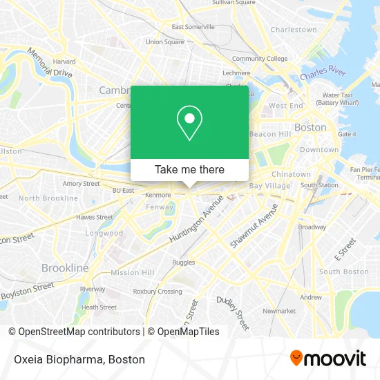
See Oxeia Biopharma, Boston, on the map
Public Transit to Oxeia Biopharma in Boston
Wondering how to get to Oxeia Biopharma in Boston? Moovit helps you find the best way to get to Oxeia Biopharma with step-by-step directions from the nearest public transit station.
Moovit provides free maps and live directions to help you navigate through your city. View schedules, routes, timetables, and find out how long does it take to get to Oxeia Biopharma in real time.
Looking for the nearest stop or station to Oxeia Biopharma? Check out this list of stops closest to your destination: Hynes - Commonwealth Ave @ Massachusetts Ave; Hynes Convention Center - Commonwealth Ave @ Massachusetts Ave; Hynes T Station (To Bumc); Massachusetts Ave @ Newbury St; Hynes Convention Center; Boylston St @ Massachusetts Ave; Announcement #3 - Airport To Back Bay; Copley.
Bus: 1, 57, GREEN LINE B SHUTTLE, GREEN LINE B SHUTTLE, GREEN LINE B SHUTTLE, GREEN LINE B SHUTTLE, GREEN LINE B SHUTTLE, GREEN LINE SHUTTLE, 1 BU (CHARLES RIVER-MEDICAL CAMPUS), GREEN LINE B SHUTTLE, GREEN LINE C SHUTTLE, GREEN LINE SHUTTLE.Train: FRAMINGHAM/WORCESTER.Subway: GREEN LINE B, GREEN LINE C, GREEN LINE D, GREEN LINE E.
Want to see if there’s another route that gets you there at an earlier time? Moovit helps you find alternative routes or times. Get directions from and directions to Oxeia Biopharma easily from the Moovit App or Website.
We make riding to Oxeia Biopharma easy, which is why over 1.7 million users, including users in Boston, trust Moovit as the best app for public transit. You don’t need to download an individual bus app or train app, Moovit is your all-in-one transit app that helps you find the best bus time or train time available.
For information on prices of subway, bus and train, costs and ride fares to Oxeia Biopharma, please check the Moovit app.
Use the app to navigate to popular places including to the airport, hospital, stadium, grocery store, mall, coffee shop, school, college, and university.
Oxeia Biopharma Address: 361 Newbury St street in Boston
- Oxeia Biopharmaceuticals,
- Loc'd on the Vineyard,
- Veterinary CPA Accounting,
- Simon Cpas,
- Calloway Graphix, Printing, Marketing, Inc.,
- Bravesportzwear,
- Sommet Nannies,
- Mass Mobile Phlebotomy Services,
- Ready To Partner,
- Notary Active,
- Copley Square Psychic,
- Kairo Group,
- Stemwave,
- Zelst,
- Sagefrog B2b Marketing Group,
- Rma Executive Search,
- Grace City Church,
- Boston Sports Club,
- KC Abroad Travel,
- Canner Law & Associates
Places Near Oxeia Biopharma (Boston)
- Quincy Market, Boston,
- Museum Of Science, Boston,
- Td Garden, Boston,
- Wang Theater, Boston,
- Boston Children's Hospital, Boston,
- Castle Island, Boston,
- Wilbur Theatre, Boston,
- Massachusetts General Hospital, Boston,
- Cheers, Boston,
- Prudential Center, Boston,
- Faneuil Hall, Boston,
- Boston Common, Boston,
- Boston Convention & Exhibition Center, Boston,
- Mgm Music Hall, Boston,
- Boston Medical Center, Boston,
- House Of Blues, Boston,
- Isabella Stewart Gardner Museum, Boston,
- North End, Boston,
- Seaport District, Boston,
- Leader Bank Pavilion (Leader Bank Pavillion), Boston
How to get to popular places in Boston with public transit
Get around Boston by public transit!
Traveling around Boston has never been so easy. See step by step directions as you travel to any attraction, street or major public transit station. View bus and train schedules, arrival times, service alerts and detailed routes on a map, so you know exactly how to get to anywhere in Boston.
When traveling to any destination around Boston use Moovit's Live Directions with Get Off Notifications to know exactly where and how far to walk, how long to wait for your line, and how many stops are left. Moovit will alert you when it's time to get off — no need to constantly re-check whether yours is the next stop.
Wondering how to use public transit in Boston or how to pay for public transit in Boston? Moovit public transit app can help you navigate your way with public transit easily, and at minimum cost. It includes public transit fees, ticket prices, and costs. Looking for a map of Boston public transit lines? Moovit public transit app shows all public transit maps in Boston with all Bus, Train, Subway and Ferry routes and stops on an interactive map.
Boston has 4 transit type(s), including: Bus, Train, Subway and Ferry, operated by several transit agencies, including MBTA, Southeastern Regional Transit Authority, MetroWest Regional Transit Authority, Rhode Island Public Transit Authority, WRTA, Lowell Regional Transit Authority, Merrimack Valley Transit, Montachusett Regional Transit Authority, Cape Cod Regional Transit Authority, Brockton Area Transit Authority, Martha's Vineyard Transit Authority, the WAVE - Nantucket Regional Transit Authority, GATRA, Cape Ann Transportation Authority and Massport