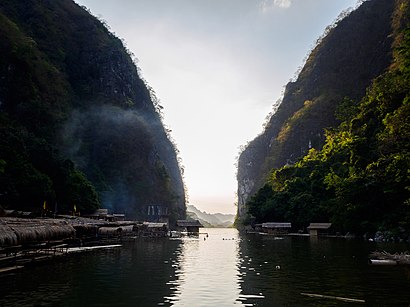
See PAMITINAN PROTECTED LANDSCAPE, Rodriguez, on the map
Directions to PAMITINAN PROTECTED LANDSCAPE (Rodriguez) with public transportation
The following transit lines have routes that pass near PAMITINAN PROTECTED LANDSCAPE
Bus:
How to get to PAMITINAN PROTECTED LANDSCAPE by Bus?
Click on the Bus route to see step by step directions with maps, line arrival times and updated time schedules.
Bus stations near PAMITINAN PROTECTED LANDSCAPE in Rodriguez
- M H Del Pilar Street, Rodriguez,8 min walk,
Bus lines to PAMITINAN PROTECTED LANDSCAPE in Rodriguez
- JEEP,Mh Del Pilar Street, Rodriguez,
What are the closest stations to PAMITINAN PROTECTED LANDSCAPE?
The closest stations to PAMITINAN PROTECTED LANDSCAPE are:
- M H Del Pilar Street, Rodriguez is 560 meters away, 8 min walk.
Which Bus lines stop near PAMITINAN PROTECTED LANDSCAPE?
These Bus lines stop near PAMITINAN PROTECTED LANDSCAPE: JEEP
What’s the nearest bus stop to PAMITINAN PROTECTED LANDSCAPE in Rodriguez?
The nearest bus stop to PAMITINAN PROTECTED LANDSCAPE in Rodriguez is M H Del Pilar Street, Rodriguez. It’s a 8 min walk away.
What time is the first Bus to PAMITINAN PROTECTED LANDSCAPE in Rodriguez?
The JEEP is the first Bus that goes to PAMITINAN PROTECTED LANDSCAPE in Rodriguez. It stops nearby at 6:00 AM.
What time is the last Bus to PAMITINAN PROTECTED LANDSCAPE in Rodriguez?
The JEEP is the last Bus that goes to PAMITINAN PROTECTED LANDSCAPE in Rodriguez. It stops nearby at 12:16 AM.
See PAMITINAN PROTECTED LANDSCAPE, Rodriguez, on the map

Public Transit to PAMITINAN PROTECTED LANDSCAPE in Rodriguez
Wondering how to get to PAMITINAN PROTECTED LANDSCAPE in Rodriguez, Philippines? Moovit helps you find the best way to get to PAMITINAN PROTECTED LANDSCAPE with step-by-step directions from the nearest public transit station.
Moovit provides free maps and live directions to help you navigate through your city. View schedules, routes, timetables, and find out how long does it take to get to PAMITINAN PROTECTED LANDSCAPE in real time.
Looking for the nearest stop or station to PAMITINAN PROTECTED LANDSCAPE? Check out this list of stops closest to your destination: M H Del Pilar Street.
Bus:
Want to see if there’s another route that gets you there at an earlier time? Moovit helps you find alternative routes or times. Get directions from and directions to PAMITINAN PROTECTED LANDSCAPE easily from the Moovit App or Website.
We make riding to PAMITINAN PROTECTED LANDSCAPE easy, which is why over 1.5 million users, including users in Rodriguez, trust Moovit as the best app for public transit. You don’t need to download an individual bus app or train app, Moovit is your all-in-one transit app that helps you find the best bus time or train time available.
For information on prices of Bus, costs and ride fares to PAMITINAN PROTECTED LANDSCAPE, please check the Moovit app.
Use the app to navigate to popular places including to the airport, hospital, stadium, grocery store, mall, coffee shop, school, college, and university.
PAMITINAN PROTECTED LANDSCAPE Address: Mt. Pamitinan Trl street in Rodriguez

Attractions near PAMITINAN PROTECTED LANDSCAPE
- Mt. Pamitinan Cave
- Pamitinan Cave
- Sitio Wawa San Rafael Montalban Rizal
- Wawa Dam
- Brgy. San Rafael Barangay Hall Annex Building
- Wawa Dam
- Sitio Wawa Covered Court
- CCH-Type Rural Health Unit
- Mt. Binacayan Peak (Mt. Binacayan Summit)
- Mt. Binacayan Peak
- Mount Binicayan
- Mt. Binacayan Summit
- Mount Parawagan
- Catmon Elementary School
- Rancho Luisito Resort
- Rancho Luisito
- Hillside San Rafael
- Le Arms Resort (Le Arms Resort, San Rafael, Montalban)
- Wawa Dam
- Jeepney Montalban Cubao
How to get to popular attractions in Rodriguez with public transit
- Camella Homes Bacoor, Bacoor
- San Francisco del Monte, Quezon City
- The Coffee Bean & Tea Leaf
- New Haven Village, Quezon City
- Sauyo, Quezon City, Quezon City
- Adventist Medical Center Manila
- Newport City
- Zapote Flyover, Las Piñas
- DreamPlay by DreamWorks, Parañaque
- Camella Gate Ayala Van Terminal, Bacoor
- St. Michael Homes, Bulacan
- Commerce Avenue, Muntinlupa
- Slimmers World International, Manila
- Philippine Airlines Inflight Center, Parañaque
- Kenny Rogers Roasters
- Baliwag Transit (Grace Park Terminal), Kalookan City
- NLEx Mindanao Ave Toll Plaza, Quezon City
- SM Cinema Southmall, Las Piñas
- J.CO Donuts & Coffee
- J.CO Donuts & Coffee, Imus