How to get to PANDORA by bus?
Click on the bus route to see step by step directions with maps, line arrival times and updated time schedules.
From Miami Dade Waste Disposal Center 2400 Sw 117 Ave, Kendale Lakes-Tamiami
64 minFrom SW 8th St / SW 67th Ave, Miami
57 minFrom Gulliver Preparatory School, Miami
31 minFrom I-95 south, Miami
55 minFrom Coral Gables, FL, Miami
94 minFrom Doctors Hospital, Miami
59 minFrom Biltmore Hotel Miami Coral Gables, Miami
73 minFrom SW 137 Ave. & SW 8 St., Kendale Lakes-Tamiami
71 minFrom G. Holmes Braddock Senior High School, Kendale Lakes-Tamiami
84 minFrom Target (Target Store Dadeland), Miami
22 min
Bus stops near PANDORA in Kendall-Palmetto Bay
Bus lines to PANDORA in Kendall-Palmetto Bay
What are the closest stations to PANDORA?
The closest stations to PANDORA are:
- Sw 107 Av & Sw 88 St is 492 yards away, 7 min walk.
- Sw 107 Av @ Sw 96 St is 494 yards away, 6 min walk.
- Sw 88 St @ Sw 109 Av is 851 yards away, 11 min walk.
- Sw 88 St & 107 Av is 1273 yards away, 15 min walk.
Which bus lines stop near PANDORA?
These bus lines stop near PANDORA: 104, 107, 288, 88.
What’s the nearest bus station to PANDORA in Kendall-Palmetto Bay?
The nearest bus station to PANDORA in Kendall-Palmetto Bay is Sw 107 Av & Sw 88 St. It’s a 7 min walk away.
What time is the first bus to PANDORA in Kendall-Palmetto Bay?
The 88 is the first bus that goes to PANDORA in Kendall-Palmetto Bay. It stops nearby at 5:34 AM.
What time is the last bus to PANDORA in Kendall-Palmetto Bay?
The 88 is the last bus that goes to PANDORA in Kendall-Palmetto Bay. It stops nearby at 1:13 AM.
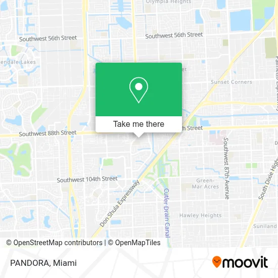
See PANDORA, Kendall-Palmetto Bay, on the map
Public Transit to PANDORA in Kendall-Palmetto Bay
Wondering how to get to PANDORA in Kendall-Palmetto Bay? Moovit helps you find the best way to get to PANDORA with step-by-step directions from the nearest public transit station.
Moovit provides free maps and live directions to help you navigate through your city. View schedules, routes, timetables, and find out how long does it take to get to PANDORA in real time.
Looking for the nearest stop or station to PANDORA? Check out this list of stops closest to your destination: Sw 107 Av & Sw 88 St; Sw 107 Av @ Sw 96 St; Sw 88 St @ Sw 109 Av; Sw 88 St & 107 Av.
Bus: 104, 107, 288, 88.
Want to see if there’s another route that gets you there at an earlier time? Moovit helps you find alternative routes or times. Get directions from and directions to PANDORA easily from the Moovit App or Website.
We make riding to PANDORA easy, which is why over 1.5 million users, including users in Kendall-Palmetto Bay, trust Moovit as the best app for public transit. You don’t need to download an individual bus app or train app, Moovit is your all-in-one transit app that helps you find the best bus time or train time available.
For information on prices of bus and train, costs and ride fares to PANDORA, please check the Moovit app.
Use the app to navigate to popular places including to the airport, hospital, stadium, grocery store, mall, coffee shop, school, college, and university.
PANDORA Address: 9023 SW 107th Ave Miami, FL 33176 street in Kendall-Palmetto Bay
- Citibank,
- Barbershop Unisex (Men's World Barber Shop),
- Key Largo, Florida,
- North Kendall Drive & Southwest 107th Avenue,
- SW 88th St / SW 107th Ave,
- Mahima Institute of Ayurveda & Integrative Medicine (Ayurveda Miami),
- 107 Ave / SW 88 St,
- SW 107 Ave. & SW 84 St.,
- TERRA Environmental Research Institute,
- Miami Dade College Kendall Campus - Bldg R,
- Sunset Kendall Trash & Recycling Center,
- miami dade College Kendall Campus,
- Mdc Kendall Indoor Basketball Court,
- Ministerio de Agricultura Y Desarrollo Rural,
- Killian Pkwy,
- 874- North,
- Glades Middle School,
- Miami Dade College-Kendall,
- Quest Diagnostics,
- T-Mobile
Places Near PANDORA (Kendall-Palmetto Bay)
- Keiser University Flagship Campus, West Palm Beach,
- Marlins Park, Miami,
- Wynwood, Miami,
- Zoo Miami, Miami,
- Aventura Mall, Miami Beach,
- Miami-Dade County Courthouse, Miami,
- Dolphin Mall Bus, Miami,
- Miami Freedom Park, Miami,
- Miami VA Hospital, Miami,
- Brickell City Centre, Miami,
- Little Havana, Miami,
- Richard E. Gerstein Justice Building, Miami,
- Aventura Mall, Miami,
- Bayside Marketplace, Miami,
- Miami Design District, Miami,
- Hard Rock Stadium, Miami Gardens,
- Sawgrass Mall, Miami,
- Dolphin Mall, Miami,
- Port of Miami Cruise Terminal, Miami,
- Sawgrass mall ( FL ), Miami Beach
How to get to popular places in Miami with public transit
Get around Kendall-Palmetto Bay by public transit!
Traveling around Kendall-Palmetto Bay has never been so easy. See step by step directions as you travel to any attraction, street or major public transit station. View bus and train schedules, arrival times, service alerts and detailed routes on a map, so you know exactly how to get to anywhere in Kendall-Palmetto Bay.
When traveling to any destination around Kendall-Palmetto Bay use Moovit's Live Directions with Get Off Notifications to know exactly where and how far to walk, how long to wait for your line, and how many stops are left. Moovit will alert you when it's time to get off — no need to constantly re-check whether yours is the next stop.
Wondering how to use public transit in Kendall-Palmetto Bay or how to pay for public transit in Kendall-Palmetto Bay? Moovit public transit app can help you navigate your way with public transit easily, and at minimum cost. It includes public transit fees, ticket prices, and costs. Looking for a map of Kendall-Palmetto Bay public transit lines? Moovit public transit app shows all public transit maps in Kendall-Palmetto Bay with all Bus, Train, Light Rail and Ferry routes and stops on an interactive map.
Miami has 4 transit type(s), including: Bus, Train, Light Rail and Ferry, operated by several transit agencies, including Broward County Transit, Miami-Dade Transit, Metrorail, Palm Tran, Tri-Rail, Brightline, MARTY, City of Homestead Trolley, Key West Transit, Treasure Coast Connector, GoLine IRT, Amtrak, Greyhound-us, FlixBus-us and Aventura Express Shuttle Bus