Directions to PM Plus (South Duxbury) with public transportation
The following transit lines have routes that pass near PM Plus
 Bus: SAI.
How to get to PM Plus by bus?
Click on the bus route to see step by step directions with maps, line arrival times and updated time schedules.
Bus stop near PM Plus in South Duxbury
- Island Creek, 22 min walk,VIEW
Bus lines to PM Plus in South Duxbury
- SAI, Webster Square,VIEW
What are the closest stations to PM Plus?
The closest stations to PM Plus are:
- Island Creek is 1886 yards away, 22 min walk.
Which bus line stops near PM Plus?
SAI (Kingston Collection→Shop/Kohl's)
What time is the first bus to PM Plus in South Duxbury?
The SAI is the first bus that goes to PM Plus in South Duxbury. It stops nearby at 6:00 AM.
What time is the last bus to PM Plus in South Duxbury?
The SAI is the last bus that goes to PM Plus in South Duxbury. It stops nearby at 6:57 PM.
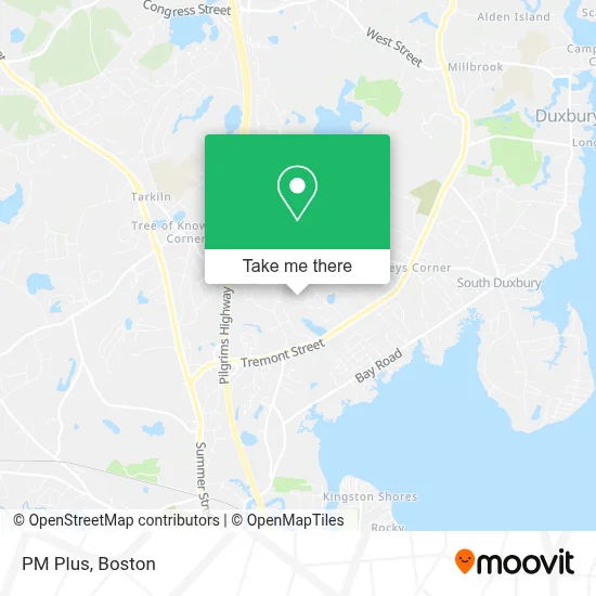
See PM Plus, South Duxbury, on the map
Public Transit to PM Plus in South Duxbury
Wondering how to get to PM Plus in South Duxbury? Moovit helps you find the best way to get to PM Plus with step-by-step directions from the nearest public transit station.
Moovit provides free maps and live directions to help you navigate through your city. View schedules, routes, timetables, and find out how long does it take to get to PM Plus in real time.
Looking for the nearest stop or station to PM Plus? Check out this list of stops closest to your destination: Island Creek.
Bus: SAI.
Want to see if there’s another route that gets you there at an earlier time? Moovit helps you find alternative routes or times. Get directions from and directions to PM Plus easily from the Moovit App or Website.
We make riding to PM Plus easy, which is why over 1.7 million users, including users in South Duxbury, trust Moovit as the best app for public transit. You don’t need to download an individual bus app or train app, Moovit is your all-in-one transit app that helps you find the best bus time or train time available.
For information on prices of bus and train, costs and ride fares to PM Plus, please check the Moovit app.
Use the app to navigate to popular places including to the airport, hospital, stadium, grocery store, mall, coffee shop, school, college, and university.
PM Plus Address: 70 Cushing Dr street in South Duxbury
- South Shore Cabinet,
- Duxfield Mosquito Spray,
- Four Mile Brook Rd,
- Labiaplasty Boston,
- Pivotcare Precision Psychiatry,
- Forty Four Post Rd,
- Myles Standish Monument,
- Costa John,
- Attorney Susan Collins,
- Windsor Group,
- Duxbury - PMG Physician Associates,
- Atrius Health,
- Bridget D. Burgess, M.D.,
- Duxbury Family Dentistry,
- Hulien & Company,
- Kathleen Barber LMHC,
- Occupational Physical Therapy,
- Open Road Garage Door Repairs,
- Learning Sprouts Children's Center and Preschool,
- Joseph B Lanza Design + Building
Places Near PM Plus (South Duxbury)
- Quincy Market, Boston,
- Museum Of Science, Boston,
- Td Garden, Boston,
- Wang Theater, Boston,
- Boston Children's Hospital, Boston,
- Castle Island, Boston,
- Wilbur Theatre, Boston,
- Massachusetts General Hospital, Boston,
- Cheers, Boston,
- Prudential Center, Boston,
- Faneuil Hall, Boston,
- Boston Common, Boston,
- Boston Convention & Exhibition Center, Boston,
- Mgm Music Hall, Boston,
- Boston Medical Center, Boston,
- House Of Blues, Boston,
- Isabella Stewart Gardner Museum, Boston,
- North End, Boston,
- Seaport District, Boston,
- Leader Bank Pavilion (Leader Bank Pavillion), Boston
How to get to popular places in Boston with public transit
Get around South Duxbury by public transit!
Traveling around South Duxbury has never been so easy. See step by step directions as you travel to any attraction, street or major public transit station. View bus and train schedules, arrival times, service alerts and detailed routes on a map, so you know exactly how to get to anywhere in South Duxbury.
When traveling to any destination around South Duxbury use Moovit's Live Directions with Get Off Notifications to know exactly where and how far to walk, how long to wait for your line, and how many stops are left. Moovit will alert you when it's time to get off — no need to constantly re-check whether yours is the next stop.
Wondering how to use public transit in South Duxbury or how to pay for public transit in South Duxbury? Moovit public transit app can help you navigate your way with public transit easily, and at minimum cost. It includes public transit fees, ticket prices, and costs. Looking for a map of South Duxbury public transit lines? Moovit public transit app shows all public transit maps in South Duxbury with all Bus, Train, Subway and Ferry routes and stops on an interactive map.
Boston has 4 transit type(s), including: Bus, Train, Subway and Ferry, operated by several transit agencies, including MBTA, Southeastern Regional Transit Authority, MetroWest Regional Transit Authority, Rhode Island Public Transit Authority, WRTA, Lowell Regional Transit Authority, Merrimack Valley Transit, Montachusett Regional Transit Authority, Cape Cod Regional Transit Authority, Brockton Area Transit Authority, Martha's Vineyard Transit Authority, the WAVE - Nantucket Regional Transit Authority, GATRA, Cape Ann Transportation Authority and Massport