Directions to PNG Customs (Boston) with public transportation
The following transit lines have routes that pass near PNG Customs
 Bus: SANDWICH LINE.
How to get to PNG Customs by bus?
Click on the bus route to see step by step directions with maps, line arrival times and updated time schedules.
Bus stop near PNG Customs in Boston
- Race Lane/Farmersville Road & Great Hill Road, Sandwich, 4 min walk,VIEW
Bus lines to PNG Customs in Boston
- SANDWICH LINE, Hyannis Transportation Center (Htc),VIEW
What are the closest stations to PNG Customs?
The closest stations to PNG Customs are:
- Race Lane/Farmersville Road & Great Hill Road, Sandwich is 276 yards away, 4 min walk.
Which bus line stops near PNG Customs?
SANDWICH LINE (Hyannis Transportation Center (Htc)→Buzzards Bay Train Station)
What’s the nearest bus station to PNG Customs in Boston?
The nearest bus station to PNG Customs in Boston is Race Lane/Farmersville Road & Great Hill Road, Sandwich. It’s a 4 min walk away.
What time is the first bus to PNG Customs in Boston?
The SANDWICH LINE is the first bus that goes to PNG Customs in Boston. It stops nearby at 6:52 AM.
What time is the last bus to PNG Customs in Boston?
The SANDWICH LINE is the last bus that goes to PNG Customs in Boston. It stops nearby at 7:32 PM.
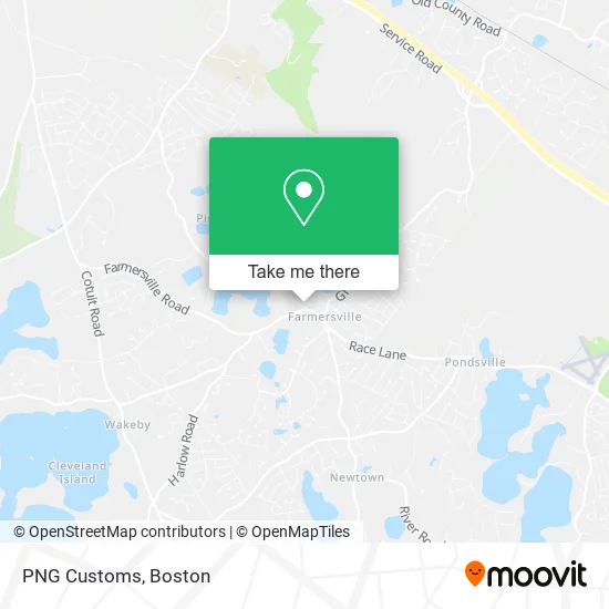
See PNG Customs, Boston, on the map
Public Transit to PNG Customs in Boston
Wondering how to get to PNG Customs in Boston? Moovit helps you find the best way to get to PNG Customs with step-by-step directions from the nearest public transit station.
Moovit provides free maps and live directions to help you navigate through your city. View schedules, routes, timetables, and find out how long does it take to get to PNG Customs in real time.
Looking for the nearest stop or station to PNG Customs? Check out this list of stops closest to your destination: Race Lane/Farmersville Road & Great Hill Road.
Bus: SANDWICH LINE.
Want to see if there’s another route that gets you there at an earlier time? Moovit helps you find alternative routes or times. Get directions from and directions to PNG Customs easily from the Moovit App or Website.
We make riding to PNG Customs easy, which is why over 1.7 million users, including users in Boston, trust Moovit as the best app for public transit. You don’t need to download an individual bus app or train app, Moovit is your all-in-one transit app that helps you find the best bus time or train time available.
For information on prices of bus, costs and ride fares to PNG Customs, please check the Moovit app.
Use the app to navigate to popular places including to the airport, hospital, stadium, grocery store, mall, coffee shop, school, college, and university.
PNG Customs Address: 135 Stowe Rd Sandwich, MA 02563 street in Boston
- Coast Carpentry Home Improvement,
- Curves,
- Southeast Truck Center,
- Paula Tatko,
- Sandwich Police Department,
- Sandwich Council on Aging,
- Coinstar - Bitcoin ATM,
- Oak Crest Cove Court,
- Sandwich Skatepark,
- The Bazaar and Antique Sale,
- Cape Cod Cuticles,
- Salty Nails,
- Penguins Ice Cream Factory,
- Dollar Tree,
- The Sandwich Dog,
- Copp Chiropractic,
- Michael Persico Jazz,
- J & K Wood Finishing,
- Woodworks Plus,
- Service Master Co.
Places Near PNG Customs (Boston)
- Boston Common, Boston,
- Boston Medical Center, Boston,
- Td Garden, Boston,
- Seaport District, Boston,
- Massachusetts General Hospital, Boston,
- Castle Island, Boston,
- Museum Of Science, Boston,
- Boston Children's Hospital, Boston,
- Wilbur Theatre, Boston,
- Quincy Market, Boston,
- Cheers, Boston,
- House Of Blues, Boston,
- Wang Theater, Boston,
- Leader Bank Pavilion (Leader Bank Pavillion), Boston,
- Mgm Music Hall, Boston,
- Prudential Center, Boston,
- Isabella Stewart Gardner Museum, Boston,
- North End, Boston,
- Faneuil Hall, Boston,
- Boston Convention & Exhibition Center, Boston
How to get to popular places in Boston with public transit
Get around Boston by public transit!
Traveling around Boston has never been so easy. See step by step directions as you travel to any attraction, street or major public transit station. View bus and train schedules, arrival times, service alerts and detailed routes on a map, so you know exactly how to get to anywhere in Boston.
When traveling to any destination around Boston use Moovit's Live Directions with Get Off Notifications to know exactly where and how far to walk, how long to wait for your line, and how many stops are left. Moovit will alert you when it's time to get off — no need to constantly re-check whether yours is the next stop.
Wondering how to use public transit in Boston or how to pay for public transit in Boston? Moovit public transit app can help you navigate your way with public transit easily, and at minimum cost. It includes public transit fees, ticket prices, and costs. Looking for a map of Boston public transit lines? Moovit public transit app shows all public transit maps in Boston with all Bus, Train, Subway and Ferry routes and stops on an interactive map.
Boston has 4 transit type(s), including: Bus, Train, Subway and Ferry, operated by several transit agencies, including MBTA, Southeastern Regional Transit Authority, MetroWest Regional Transit Authority, Rhode Island Public Transit Authority, WRTA, Lowell Regional Transit Authority, Merrimack Valley Transit, Montachusett Regional Transit Authority, Cape Cod Regional Transit Authority, Brockton Area Transit Authority, Martha's Vineyard Transit Authority, the WAVE - Nantucket Regional Transit Authority, GATRA, Cape Ann Transportation Authority and Massport