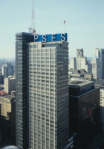
See PSFS Building, Philadelphia, on the map
Directions to PSFS Building (Philadelphia) with public transportation
The following transit lines have routes that pass near PSFS Building
 Bus:
Bus: - Train:
- Subway:
- Light Rail:
How to get to PSFS Building by bus?
Click on the bus route to see step by step directions with maps, line arrival times and updated time schedules.
How to get to PSFS Building by train?
Click on the train route to see step by step directions with maps, line arrival times and updated time schedules.
How to get to PSFS Building by subway?
Click on the subway route to see step by step directions with maps, line arrival times and updated time schedules.
Bus stations near PSFS Building in Philadelphia
- Market St & 12th St - Mbfs,1 min walk,
- Market St & 13th St,1 min walk,
- Market St at 12th St,1 min walk,
- 12th St & Market St ,2 min walk,
- 13th St & Market St - Mbfs,2 min walk,
- Chestnut St & 11th St,3 min walk,
Subway stations near PSFS Building in Philadelphia
- City Hall,3 min walk,
- 11th St Station,9 min walk,
Light Rail stations near PSFS Building in Philadelphia
- 13th St,5 min walk,
Train stations near PSFS Building in Philadelphia
- Jefferson Station,7 min walk,
Bus lines to PSFS Building in Philadelphia
- 38,5th-Market,
- 44,Ardmore Via Narberth,
- 62,Andorra,
- MFO,69th St Transportation Center,
- 17,2nd-Market,
- 33,5th-Market,
- 313,Cape May-Wildwood-Phila,
- 315,Cape May-Wildwood-Phila,
- 316,Cape May-Wildwood-Phila Exp,
- 317,Asbury Park-Fort Dix-Phila,
- 400,Sicklerville - Philadelphia,
- 401,Salem - Philadelphia,
- 402,Pennsville - Philadelphia,
- 404,CherryHillMall-Pennsauken-Ph,
- 406,Berlin-Marlton-Philadelphia,
- 408,Millville - Philadelphia,
- 409,Trenton-Willingboro-Phila,
- 410,Bridgeton - Philadelphia,
- 412,Sewell-Glassboro-Phila,
- 414,Philadelphia - Moorestown,
What are the closest stations to PSFS Building?
The closest stations to PSFS Building are:
- Market St & 12th St - Mbfs is 17 yards away, 1 min walk.
- Market St & 13th St is 36 yards away, 1 min walk.
- Market St at 12th St is 48 yards away, 1 min walk.
- 12th St & Market St is 89 yards away, 2 min walk.
- 13th St & Market St - Mbfs is 121 yards away, 2 min walk.
- Chestnut St & 11th St is 229 yards away, 3 min walk.
- City Hall is 230 yards away, 3 min walk.
- 13th St is 407 yards away, 5 min walk.
- Jefferson Station is 502 yards away, 7 min walk.
- 11th St Station is 705 yards away, 9 min walk.
Which bus lines stop near PSFS Building?
These bus lines stop near PSFS Building: 17, 23, 317, 33, 4, 44, 45.
Which train lines stop near PSFS Building?
These train lines stop near PSFS Building: AIRPORT, PAOLI/THORNDALE, WARMINSTER.
Which subway lines stop near PSFS Building?
These subway lines stop near PSFS Building: BSL, MFL, PATCO.
Which light rail line stops near PSFS Building?
36
What’s the nearest light rail station to PSFS Building in Philadelphia?
The nearest light rail station to PSFS Building in Philadelphia is 13th St. It’s a 5 min walk away.
What’s the nearest subway station to PSFS Building in Philadelphia?
The nearest subway station to PSFS Building in Philadelphia is City Hall. It’s a 3 min walk away.
What’s the nearest train station to PSFS Building in Philadelphia?
The nearest train station to PSFS Building in Philadelphia is Jefferson Station. It’s a 7 min walk away.
What’s the nearest bus stop to PSFS Building in Philadelphia?
The nearest bus stops to PSFS Building in Philadelphia are Market St & 12th St - Mbfs, Market St & 13th St and Market St at 12th St. The closest one is a 1 min walk away.
What time is the first light rail to PSFS Building in Philadelphia?
The 13 is the first light rail that goes to PSFS Building in Philadelphia. It stops nearby at 3:03 AM.
What time is the last light rail to PSFS Building in Philadelphia?
The 10 is the last light rail that goes to PSFS Building in Philadelphia. It stops nearby at 3:08 AM.
What time is the first subway to PSFS Building in Philadelphia?
The BSL is the first subway that goes to PSFS Building in Philadelphia. It stops nearby at 5:00 AM.
What time is the last subway to PSFS Building in Philadelphia?
The MFL is the last subway that goes to PSFS Building in Philadelphia. It stops nearby at 12:32 AM.
What time is the first train to PSFS Building in Philadelphia?
The TRENTON is the first train that goes to PSFS Building in Philadelphia. It stops nearby at 3:55 AM.
What time is the last train to PSFS Building in Philadelphia?
The TRENTON is the last train that goes to PSFS Building in Philadelphia. It stops nearby at 1:00 AM.
What time is the first bus to PSFS Building in Philadelphia?
The 17 is the first bus that goes to PSFS Building in Philadelphia. It stops nearby at 3:00 AM.
What time is the last bus to PSFS Building in Philadelphia?
The 551 is the last bus that goes to PSFS Building in Philadelphia. It stops nearby at 3:36 AM.
How much is the bus fare to PSFS Building?
The bus fare to PSFS Building costs about $2.00.
How much is the subway fare to PSFS Building?
The subway fare to PSFS Building costs about $1.40 - $3.00.
How much is the train fare to PSFS Building?
The train fare to PSFS Building costs about $3.75 - $9.25.
How much is the light rail fare to PSFS Building?
The light rail fare to PSFS Building costs about $2.00.
See PSFS Building, Philadelphia, on the map
Public Transit to PSFS Building in Philadelphia
Wondering how to get to PSFS Building in Philadelphia, United States? Moovit helps you find the best way to get to PSFS Building with step-by-step directions from the nearest public transit station.
Moovit provides free maps and live directions to help you navigate through your city. View schedules, routes, timetables, and find out how long does it take to get to PSFS Building in real time.
Looking for the nearest stop or station to PSFS Building? Check out this list of stops closest to your destination: Market St & 12th St - Mbfs; Market St & 13th St; Market St at 12th St; 12th St & Market St ; 13th St & Market St - Mbfs; Chestnut St & 11th St; City Hall; 13th St; Jefferson Station; 11th St Station.
Bus:Train:Subway:Light Rail:
Want to see if there’s another route that gets you there at an earlier time? Moovit helps you find alternative routes or times. Get directions from and directions to PSFS Building easily from the Moovit App or Website.
We make riding to PSFS Building easy, which is why over 1.5 million users, including users in Philadelphia, trust Moovit as the best app for public transit. You don’t need to download an individual bus app or train app, Moovit is your all-in-one transit app that helps you find the best bus time or train time available.
For information on prices of bus, subway, train and light rail, costs and ride fares to PSFS Building, please check the Moovit app.
Use the app to navigate to popular places including to the airport, hospital, stadium, grocery store, mall, coffee shop, school, college, and university.
Location: Philadelphia
Attractions near PSFS Building
Loews Hotel (Loews Lobby Bar),Loews Hotel-Philadelphia (Lowes Philadelphia),Salvation Demolition and Clean Out,Rothman Institute,SEPTA Headquarters,1200 Market Street,St. John the Evangelist Church Parish Center And Offices,Bobina's TMO store,Key Medium,Loews Philadelphia Hotel,Marriott Philadelphia,Marriott-Philadelphia Downtown ,Madden Law Firm PC (Madden Law Firm, P.C.),Premier Tours (Premier Travel Services),Wawa,N 12th St / Market St,Canopy by Hilton Philadelphia Center City,Wanamaker Organ,Sleepy's (Mattress Firm Philadelphia Downtown),OpportunitiesHow to get to popular attractions in Philadelphia with public transit
Fado Irish Pub, Philadelphia,Three Monkeys Café, Philadelphia,Spring Valley YMCA, Limerick,Barrington, NJ, Barrington,Vedge, Philadelphia,Our Lady of Lourdes Hospital, Camden,Philadelphia Premium Outlets, Limerick,Manayunk Brewery & Restaurant, Philadelphia,Hard Rock Cafe Philadelphia, Philadelphia,The Cheesecake Factory, Golden Triangle,Dalessandro’s Steaks and Hoagies, Philadelphia,Blackwood, NJ, Blackwood,Lansdowne, PA, Lansdowne,West Chester, PA, West Chester,Burlington Coat Factory Corporate Office,McCarter Theatre, Princeton,Maggiano's Little Italy, King Of Prussia,The Cheesecake Factory, Willow Grove,NJT - Hamilton Station (NEC),Continental Restaurant & Martini Bar, PhiladelphiaGet around Philadelphia by public transit!
Traveling around Philadelphia has never been so easy. See step by step directions as you travel to any attraction, street or major public transit station. View bus and train schedules, arrival times, service alerts and detailed routes on a map, so you know exactly how to get to anywhere in Philadelphia.
When traveling to any destination around Philadelphia use Moovit's Live Directions with Get Off Notifications to know exactly where and how far to walk, how long to wait for your line, and how many stops are left. Moovit will alert you when it's time to get off — no need to constantly re-check whether yours is the next stop.
Wondering how to use public transit in Philadelphia or how to pay for public transit in Philadelphia? Moovit public transit app can help you navigate your way with public transit easily, and at minimum cost. It includes public transit fees, ticket prices, and costs. Looking for a map of Philadelphia public transit lines? Moovit public transit app shows all public transit maps in Philadelphia with all bus, subway, train or light rail routes and stops on an interactive map.
Philadelphia has 4 transit type(s), including: bus, subway, train or light rail, operated by several transit agencies, including SEPTA Subway, SEPTA Trolley, SEPTA Rail, SEPTA, SEPTA, NJ TRANSIT RAIL-Rail, NJ TRANSIT RAIL-Tram, NJ TRANSIT BUS, Port Authority Transit Corporation, Navy Yard, Penn Transit, Drexel University, Pottstown Area Rapid Transit (PART), Fullington Tours and Chescobus