Directions to P. J. Kennedy And Sons (Boston) with public transportation
The following transit lines have routes that pass near P. J. Kennedy And Sons
 Bus: 15, 19, 201, 202, 210.
- Train: FAIRMOUNT, FRANKLIN/FOXBORO, FAIRMOUNT LINE SHUTTLE, PROVIDENCE/STOUGHTON.
- Subway: RED LINE.
How to get to P. J. Kennedy And Sons by bus?
Click on the bus route to see step by step directions with maps, line arrival times and updated time schedules.
From Residence Inn by Marriott Boston Back Bay/Fenway, Boston
52 minFrom Wachusett mountain, Boston
88 minFrom The Mall At Chestnut Hill, Newton
90 minFrom The Barking Crab, Boston
72 minFrom Eataly, Boston
57 minFrom Alumni Stadium, Newton
95 minFrom Cambria Hotel Boston Somerville, Somerville
87 minFrom Harvard Museum Of Natural History, Cambridge
75 minFrom Four Seasons Hotel One Dalton, Boston
54 minFrom Charles W. Eliot Bridge, Boston
89 min
How to get to P. J. Kennedy And Sons by train?
Click on the train route to see step by step directions with maps, line arrival times and updated time schedules.
How to get to P. J. Kennedy And Sons by subway?
Click on the subway route to see step by step directions with maps, line arrival times and updated time schedules.
From Residence Inn by Marriott Boston Back Bay/Fenway, Boston
55 minFrom Wachusett mountain, Boston
52 minFrom The Mall At Chestnut Hill, Newton
84 minFrom The Barking Crab, Boston
34 minFrom Eataly, Boston
39 minFrom Alumni Stadium, Newton
85 minFrom Cambria Hotel Boston Somerville, Somerville
57 minFrom Harvard Museum Of Natural History, Cambridge
46 minFrom Four Seasons Hotel One Dalton, Boston
49 minFrom Charles W. Eliot Bridge, Boston
58 min
Bus stops near P. J. Kennedy And Sons in Boston
Subway station near P. J. Kennedy And Sons in Boston
- Shawmut, 9 min walk,VIEW
Train stations near P. J. Kennedy And Sons in Boston
- Talbot Avenue, 16 min walk,VIEW
Bus lines to P. J. Kennedy And Sons in Boston
What are the closest stations to P. J. Kennedy And Sons?
The closest stations to P. J. Kennedy And Sons are:
- Gibson St @ Adams St is 10 yards away, 1 min walk.
- Dorchester Ave @ Melville Ave is 179 yards away, 3 min walk.
- Shawmut is 768 yards away, 9 min walk.
- Dorchester Ave @ Lincoln St - Fields Corner Sta is 950 yards away, 12 min walk.
- Talbot Avenue is 1330 yards away, 16 min walk.
Which bus lines stop near P. J. Kennedy And Sons?
These bus lines stop near P. J. Kennedy And Sons: 15, 19, 201.
Which train line stops near P. J. Kennedy And Sons?
FAIRMOUNT (#1619 | Fairmount)
Which subway line stops near P. J. Kennedy And Sons?
RED LINE (Ashmont/Braintree)
What’s the nearest subway station to P. J. Kennedy And Sons in Boston?
The nearest subway station to P. J. Kennedy And Sons in Boston is Shawmut. It’s a 9 min walk away.
What’s the nearest train station to P. J. Kennedy And Sons in Boston?
The nearest train station to P. J. Kennedy And Sons in Boston is Talbot Avenue. It’s a 16 min walk away.
What’s the nearest bus station to P. J. Kennedy And Sons in Boston?
The nearest bus station to P. J. Kennedy And Sons in Boston is Gibson St @ Adams St. It’s a 1 min walk away.
What time is the first subway to P. J. Kennedy And Sons in Boston?
The RED LINE is the first subway that goes to P. J. Kennedy And Sons in Boston. It stops nearby at 5:16 AM.
What time is the last subway to P. J. Kennedy And Sons in Boston?
The RED LINE is the last subway that goes to P. J. Kennedy And Sons in Boston. It stops nearby at 2:03 AM.
What time is the first train to P. J. Kennedy And Sons in Boston?
The FAIRMOUNT is the first train that goes to P. J. Kennedy And Sons in Boston. It stops nearby at 4:41 AM.
What time is the last train to P. J. Kennedy And Sons in Boston?
The FAIRMOUNT is the last train that goes to P. J. Kennedy And Sons in Boston. It stops nearby at 12:03 AM.
What time is the first bus to P. J. Kennedy And Sons in Boston?
The 15 is the first bus that goes to P. J. Kennedy And Sons in Boston. It stops nearby at 3:28 AM.
What time is the last bus to P. J. Kennedy And Sons in Boston?
The 210 is the last bus that goes to P. J. Kennedy And Sons in Boston. It stops nearby at 1:03 AM.
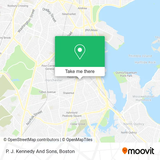
See P. J. Kennedy And Sons, Boston, on the map
Public Transit to P. J. Kennedy And Sons in Boston
Wondering how to get to P. J. Kennedy And Sons in Boston? Moovit helps you find the best way to get to P. J. Kennedy And Sons with step-by-step directions from the nearest public transit station.
Moovit provides free maps and live directions to help you navigate through your city. View schedules, routes, timetables, and find out how long does it take to get to P. J. Kennedy And Sons in real time.
Looking for the nearest stop or station to P. J. Kennedy And Sons? Check out this list of stops closest to your destination: Gibson St @ Adams St; Dorchester Ave @ Melville Ave; Shawmut; Dorchester Ave @ Lincoln St - Fields Corner Sta; Talbot Avenue.
Bus: 15, 19, 201, 202, 210, 18, RED LINE SHUTTLE.Train: FAIRMOUNT, FRANKLIN/FOXBORO, FAIRMOUNT LINE SHUTTLE, PROVIDENCE/STOUGHTON.Subway: RED LINE.
Want to see if there’s another route that gets you there at an earlier time? Moovit helps you find alternative routes or times. Get directions from and directions to P. J. Kennedy And Sons easily from the Moovit App or Website.
We make riding to P. J. Kennedy And Sons easy, which is why over 1.7 million users, including users in Boston, trust Moovit as the best app for public transit. You don’t need to download an individual bus app or train app, Moovit is your all-in-one transit app that helps you find the best bus time or train time available.
For information on prices of bus, subway and train, costs and ride fares to P. J. Kennedy And Sons, please check the Moovit app.
Use the app to navigate to popular places including to the airport, hospital, stadium, grocery store, mall, coffee shop, school, college, and university.
P. J. Kennedy And Sons Address: 39 Gibson St street in Boston
- Boston Police Station Area C-11,
- Joel,
- WESTERN UNION,
- DUNKIN',
- Cottonseed Locksmith,
- 1576 Dorchester Ave Parking,
- J7 Tattoo,
- Fasoli,
- Eblens - 46,
- Save Another Youth Taekwondo Inc.,
- Protech Secure Systems,
- Bevo Security Solutions,
- KC Painting and Landscaping Maintenance,
- Chua Luc Hoa Buddhist Center,
- Remodeling Enterprises,
- Boston Flooring,
- Strickland Brothers 10 Minute Oil Change,
- Upali Convenience,
- Barry Noone Electrician,
- CDS Electrical
Places Near P. J. Kennedy And Sons (Boston)
- Wilbur Theatre, Boston,
- Seaport District, Boston,
- Boston Common, Boston,
- Leader Bank Pavilion (Leader Bank Pavillion), Boston,
- House Of Blues, Boston,
- Mgm Music Hall, Boston,
- Boston Medical Center, Boston,
- Boston Children's Hospital, Boston,
- Quincy Market, Boston,
- Massachusetts General Hospital, Boston,
- Td Garden, Boston,
- Isabella Stewart Gardner Museum, Boston,
- Cheers, Boston,
- North End, Boston,
- Museum Of Science, Boston,
- Prudential Center, Boston,
- Castle Island, Boston,
- Wang Theater, Boston,
- Faneuil Hall, Boston,
- Boston Convention & Exhibition Center, Boston
How to get to popular places in Boston with public transit
Get around Boston by public transit!
Traveling around Boston has never been so easy. See step by step directions as you travel to any attraction, street or major public transit station. View bus and train schedules, arrival times, service alerts and detailed routes on a map, so you know exactly how to get to anywhere in Boston.
When traveling to any destination around Boston use Moovit's Live Directions with Get Off Notifications to know exactly where and how far to walk, how long to wait for your line, and how many stops are left. Moovit will alert you when it's time to get off — no need to constantly re-check whether yours is the next stop.
Wondering how to use public transit in Boston or how to pay for public transit in Boston? Moovit public transit app can help you navigate your way with public transit easily, and at minimum cost. It includes public transit fees, ticket prices, and costs. Looking for a map of Boston public transit lines? Moovit public transit app shows all public transit maps in Boston with all Bus, Train, Subway and Ferry routes and stops on an interactive map.
Boston has 4 transit type(s), including: Bus, Train, Subway and Ferry, operated by several transit agencies, including MBTA, Southeastern Regional Transit Authority, MetroWest Regional Transit Authority, Rhode Island Public Transit Authority, WRTA, Lowell Regional Transit Authority, Merrimack Valley Transit, Montachusett Regional Transit Authority, Cape Cod Regional Transit Authority, Brockton Area Transit Authority, Martha's Vineyard Transit Authority, the WAVE - Nantucket Regional Transit Authority, GATRA, Cape Ann Transportation Authority and Massport