How to get to P & M Custom Closets by bus?
Click on the bus route to see step by step directions with maps, line arrival times and updated time schedules.
From Dcu Center, Worcester
135 minFrom Worcester, MA, Worcester
133 minFrom Foxwoods, Worcester
162 minFrom Registry Of Motor Vehicles (Rmv) Branch Office, Worcester
137 minFrom South High Community School, Worcester
229 minFrom Walmart Supercenter, Worcester
191 minFrom Polar Park, Worcester
134 minFrom Palladium, Worcester
138 min
Bus stops near P & M Custom Closets in Boston
Bus lines to P & M Custom Closets in Boston
What are the closest stations to P & M Custom Closets?
The closest stations to P & M Custom Closets are:
- East / Hubbard is 176 yards away, 3 min walk.
- State / Hampden (Opposite) is 364 yards away, 5 min walk.
Which bus line stops near P & M Custom Closets?
B6 (Ludlow Big Y Via Bay/Berkshire/Pasco)
What’s the nearest bus station to P & M Custom Closets in Boston?
The nearest bus station to P & M Custom Closets in Boston is East / Hubbard. It’s a 3 min walk away.
What time is the first bus to P & M Custom Closets in Boston?
The B6 is the first bus that goes to P & M Custom Closets in Boston. It stops nearby at 5:38 AM.
What time is the last bus to P & M Custom Closets in Boston?
The B6 is the last bus that goes to P & M Custom Closets in Boston. It stops nearby at 10:11 PM.
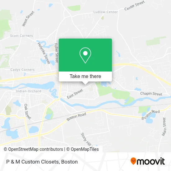
See P & M Custom Closets, Boston, on the map
Public Transit to P & M Custom Closets in Boston
Wondering how to get to P & M Custom Closets in Boston? Moovit helps you find the best way to get to P & M Custom Closets with step-by-step directions from the nearest public transit station.
Moovit provides free maps and live directions to help you navigate through your city. View schedules, routes, timetables, and find out how long does it take to get to P & M Custom Closets in real time.
Looking for the nearest stop or station to P & M Custom Closets? Check out this list of stops closest to your destination: East / Hubbard; State / Hampden (Opposite).
Bus: B6, X94.
Want to see if there’s another route that gets you there at an earlier time? Moovit helps you find alternative routes or times. Get directions from and directions to P & M Custom Closets easily from the Moovit App or Website.
We make riding to P & M Custom Closets easy, which is why over 1.7 million users, including users in Boston, trust Moovit as the best app for public transit. You don’t need to download an individual bus app or train app, Moovit is your all-in-one transit app that helps you find the best bus time or train time available.
For information on prices of bus, costs and ride fares to P & M Custom Closets, please check the Moovit app.
Use the app to navigate to popular places including to the airport, hospital, stadium, grocery store, mall, coffee shop, school, college, and university.
P & M Custom Closets Address: 26 Kirkland Ave street in Boston
- Polish American Citizen's Club,
- East Street Elementary School,
- Lusitano Club,
- M.A. Cafe,
- Our Lady Of Fatima Parish Center,
- Our Lady Of Fatima Church,
- Cumberland Farms,
- Lusitano Stadium,
- Luso Federal Credit Union,
- Saint John the Baptist School,
- East Street School,
- St. Elizabeth Parish,
- John J Thompson Memorial Pool,
- Ludlow Locksmith Shop,
- Wood Pond,
- Paradise Limousine Service,
- Whitney St. Park,
- ATM,
- Healthsouth Rehabilitation Hospital Of Western Massachusetts,
- Chemi-Graphic
Places Near P & M Custom Closets (Boston)
- Faneuil Hall, Boston,
- Castle Island, Boston,
- Museum Of Science, Boston,
- Wilbur Theatre, Boston,
- Isabella Stewart Gardner Museum, Boston,
- Massachusetts General Hospital, Boston,
- North End, Boston,
- Seaport District, Boston,
- Leader Bank Pavilion (Leader Bank Pavillion), Boston,
- Boston Convention & Exhibition Center, Boston,
- Boston Common, Boston,
- Quincy Market, Boston,
- Prudential Center, Boston,
- Boston Medical Center, Boston,
- Mgm Music Hall, Boston,
- Cheers, Boston,
- Wang Theater, Boston,
- Td Garden, Boston,
- Boston Children's Hospital, Boston,
- House Of Blues, Boston
How to get to popular places in Boston with public transit
Get around Boston by public transit!
Traveling around Boston has never been so easy. See step by step directions as you travel to any attraction, street or major public transit station. View bus and train schedules, arrival times, service alerts and detailed routes on a map, so you know exactly how to get to anywhere in Boston.
When traveling to any destination around Boston use Moovit's Live Directions with Get Off Notifications to know exactly where and how far to walk, how long to wait for your line, and how many stops are left. Moovit will alert you when it's time to get off — no need to constantly re-check whether yours is the next stop.
Wondering how to use public transit in Boston or how to pay for public transit in Boston? Moovit public transit app can help you navigate your way with public transit easily, and at minimum cost. It includes public transit fees, ticket prices, and costs. Looking for a map of Boston public transit lines? Moovit public transit app shows all public transit maps in Boston with all Bus, Train, Subway and Ferry routes and stops on an interactive map.
Boston has 4 transit type(s), including: Bus, Train, Subway and Ferry, operated by several transit agencies, including MBTA, Southeastern Regional Transit Authority, MetroWest Regional Transit Authority, Rhode Island Public Transit Authority, WRTA, Lowell Regional Transit Authority, Merrimack Valley Transit, Montachusett Regional Transit Authority, Cape Cod Regional Transit Authority, Brockton Area Transit Authority, Martha's Vineyard Transit Authority, the WAVE - Nantucket Regional Transit Authority, GATRA, Cape Ann Transportation Authority and Massport