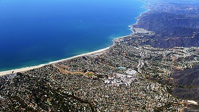
See Pacific Palisades, La on the map
Directions to Pacific Palisades, La with public transportation
The following transit lines have routes that pass near Pacific Palisades, La
Bus:
How to get to Pacific Palisades, La by Bus?
Click on the Bus route to see step by step directions with maps, line arrival times and updated time schedules.
Bus stations near Pacific Palisades, La
- Paul Revere Junior High,2 min walk,
- 26th SB & LA Mesa Ns,8 min walk,
Light Rail stations near Pacific Palisades, La
- 17th St / SMC,24 min walk,
Bus lines to Pacific Palisades, La
- 602,Westwood / UCLA,
- 14,Westchester/Veterans Station,
What are the closest stations to Pacific Palisades, La?
The closest stations to Pacific Palisades, La are:
- Paul Revere Junior High is 75 yards away, 2 min walk.
- 26th SB & LA Mesa Ns is 671 yards away, 8 min walk.
- 17th St / SMC is 2020 yards away, 24 min walk.
Which Bus lines stop near Pacific Palisades, La?
These Bus lines stop near Pacific Palisades, La: 20, 4, 602, 720
What’s the nearest light rail station to Pacific Palisades, La?
The nearest light rail station to Pacific Palisades, La is 17th St / SMC. It’s a 24 min walk away.
What’s the nearest bus stop to Pacific Palisades, La?
The nearest bus stop to Pacific Palisades, La is Paul Revere Junior High. It’s a 2 min walk away.
What time is the first Light Rail to Pacific Palisades, La?
The E LINE is the first Light Rail that goes to Pacific Palisades, La. It stops nearby at 4:37 AM.
What time is the last Light Rail to Pacific Palisades, La?
The E LINE is the last Light Rail that goes to Pacific Palisades, La. It stops nearby at 1:24 AM.
What time is the first Bus to Pacific Palisades, La?
The 602 is the first Bus that goes to Pacific Palisades, La. It stops nearby at 5:44 AM.
What time is the last Bus to Pacific Palisades, La?
The 602 is the last Bus that goes to Pacific Palisades, La. It stops nearby at 11:40 PM.
How much is the Bus fare to Pacific Palisades, La?
The Bus fare to Pacific Palisades, La costs about $1.75.
See Pacific Palisades, La on the map

Public Transportation to Pacific Palisades, La
Wondering how to get to Pacific Palisades, La, United States? Moovit helps you find the best way to get to Pacific Palisades, La with step-by-step directions from the nearest public transit station.
Moovit provides free maps and live directions to help you navigate through your city. View schedules, routes, timetables, and find out how long does it take to get to Pacific Palisades, La in real time.
Looking for the nearest stop or station to Pacific Palisades, La? Check out this list of stops closest to your destination: Paul Revere Junior High; 26th SB & LA Mesa Ns; 17th St / SMC.
Bus:
Want to see if there’s another route that gets you there at an earlier time? Moovit helps you find alternative routes or times. Get directions from and directions to Pacific Palisades, La easily from the Moovit App or Website.
We make riding to Pacific Palisades, La easy, which is why over 1.5 million users, including users in Los Angeles, trust Moovit as the best app for public transit. You don’t need to download an individual bus app or train app, Moovit is your all-in-one transit app that helps you find the best bus time or train time available.
For information on prices of Bus, costs and ride fares to Pacific Palisades, La, please check the Moovit app.
Use the app to navigate to popular places including to the airport, hospital, stadium, grocery store, mall, coffee shop, school, college, and university.
Location: Los Angeles

Popular routes to Pacific Palisades, La
From Pacific Palisades, LaFrom Avocado HeightsFrom Pacific Palisades, LaFrom Pacific Palisades, LaFrom Pacific Palisades, LaFrom Pacific Palisades, LaFrom Pacific Palisades, LaFrom Pacific Palisades, LaFrom Pacific Palisades, LaFrom Pacific Palisades, LaPopular routes from Pacific Palisades, La
To Pacific Palisades, LaTo Pacific Palisades, LaTo Pacific Palisades, LaTo ActonTo MontecitoTo Pacific Palisades, LaTo Pacific Palisades, LaTo Agua DulceTo Pacific Palisades, LaTo Pacific Palisades, LaAttractions near Pacific Palisades, La
- Paul Revere Middle School (Paul Revere Jr High School)
- Paul Revere Charter Middle School
- Vreeland Law Firm, Inc.
- Midnight Monkii
- Paul Revere Middle School Park
- Balmoral Farm
- Amalfi Estates
- Capri Dr / W Sunset Blvd
- Fresh Prince of Bel Air House
- Luxury Estates Division
- Cookies Brentwood
- Casa de Perrin
- Nino Deangelis Hair Stylist
- F45
- Kiitsu
- La Salsa and Bachata Dance Academy
- Dance with Alexis
- Herbal Medicine Pain Management
- Brandy Melville
- Brentwood Town Center parking
How to get to popular attractions in Los Angeles with public transit
- Radiator Springs Racers, Anaheim
- Interstate 5 (Golden State Freeway), Pacoima, La
- Los Olivos Apartment Village, Irvine
- Matterhorn Bobsleds, Anaheim
- Torrance, CA, Torrance
- Roscoe's House of Chicken and Waffles - Long Beach, Long Beach
- City of Murrieta, Murrieta
- City of San Bernardino, San Bernardino
- Mickey & Friends Parking Structure, Anaheim
- Pomona, CA, Pomona
- Apple South Coast Plaza, Costa Mesa
- Barney's Beanery, West Hollywood
- Whole Foods Market, Tustin
- Citadel Outlets, Commerce
- Redlands, CA, Redlands
- Golden Road Brewing, Atwater Village, La
- Montclair Place, Montclair
- World of Disney, Anaheim
- Tito's Tacos, Culver City
- Disneyland Monorail, Anaheim