How to get to Pailin Jewelry by bus?
Click on the bus route to see step by step directions with maps, line arrival times and updated time schedules.
How to get to Pailin Jewelry by train?
Click on the train route to see step by step directions with maps, line arrival times and updated time schedules.
Bus stops near Pailin Jewelry in Lowell
Bus lines to Pailin Jewelry in Lowell
What are the closest stations to Pailin Jewelry?
The closest stations to Pailin Jewelry are:
- School St & Lawson St is 152 yards away, 2 min walk.
- Chelmsford St & Cambridge St is 279 yards away, 4 min walk.
- Chelmsford St And Westford St is 515 yards away, 7 min walk.
- Middlesex St & Lord Overpass Circle is 628 yards away, 8 min walk.
- Boys & Girls Club is 972 yards away, 12 min walk.
Which bus lines stop near Pailin Jewelry?
These bus lines stop near Pailin Jewelry: 12, 14, 24.
Which train line stops near Pailin Jewelry?
LOWELL (#331 | Lowell)
What’s the nearest bus station to Pailin Jewelry in Lowell?
The nearest bus station to Pailin Jewelry in Lowell is School St & Lawson St. It’s a 2 min walk away.
What time is the first bus to Pailin Jewelry in Lowell?
The 5 is the first bus that goes to Pailin Jewelry in Lowell. It stops nearby at 6:08 AM.
What time is the last bus to Pailin Jewelry in Lowell?
The 14 is the last bus that goes to Pailin Jewelry in Lowell. It stops nearby at 8:04 PM.
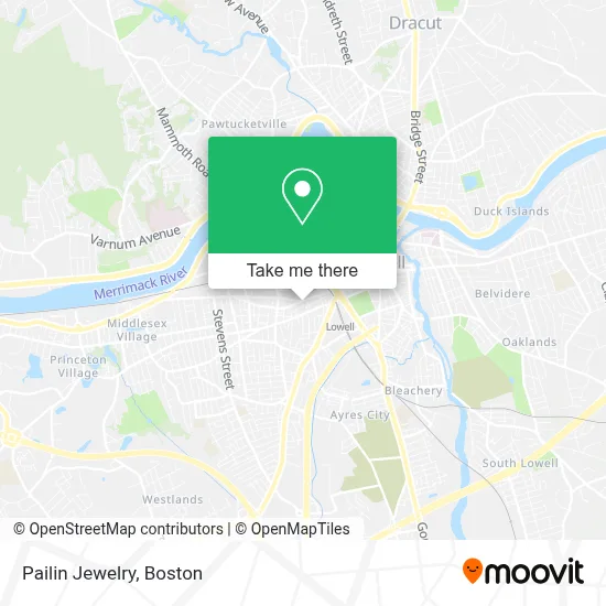
See Pailin Jewelry, Lowell, on the map
Public Transit to Pailin Jewelry in Lowell
Wondering how to get to Pailin Jewelry in Lowell? Moovit helps you find the best way to get to Pailin Jewelry with step-by-step directions from the nearest public transit station.
Moovit provides free maps and live directions to help you navigate through your city. View schedules, routes, timetables, and find out how long does it take to get to Pailin Jewelry in real time.
Looking for the nearest stop or station to Pailin Jewelry? Check out this list of stops closest to your destination: School St & Lawson St; Chelmsford St & Cambridge St; Chelmsford St And Westford St; Middlesex St & Lord Overpass Circle; Boys & Girls Club.
Bus: 12, 14, 24, 4, 5, 18, 17.Train: LOWELL.
Want to see if there’s another route that gets you there at an earlier time? Moovit helps you find alternative routes or times. Get directions from and directions to Pailin Jewelry easily from the Moovit App or Website.
We make riding to Pailin Jewelry easy, which is why over 1.7 million users, including users in Lowell, trust Moovit as the best app for public transit. You don’t need to download an individual bus app or train app, Moovit is your all-in-one transit app that helps you find the best bus time or train time available.
For information on prices of bus and train, costs and ride fares to Pailin Jewelry, please check the Moovit app.
Use the app to navigate to popular places including to the airport, hospital, stadium, grocery store, mall, coffee shop, school, college, and university.
Pailin Jewelry Address: 716 Middlesex St street in Lowell
- Phnom Leap,
- Pailin Asian Market,
- Vann Hair,
- Sian Blessing Sushi and Drinks,
- Pailin Express,
- CBC Dental Clinic,
- Mayura,
- Seng Hong Video,
- Lowell Licensed & Insured Locksmiths,
- Freindship Auto Repair,
- Matilde Sanchez,
- Dessert Shop & Bakery,
- Lifesign Ministry School,
- Bopha Lowell Bridal Boutique សំអាងការបុប្ផាឡូវែល,
- Qualified Movers - Lowell Moving Company,
- Libertyx Bitcoin Atm,
- Gdharley Associates, Inc & Architects,
- Gopuff,
- B. Felt,
- Roneld Lores & Ang
Places Near Pailin Jewelry (Lowell)
- Isabella Stewart Gardner Museum, Boston,
- Boston Medical Center, Boston,
- North End, Boston,
- Wang Theater, Boston,
- Cheers, Boston,
- Massachusetts General Hospital, Boston,
- Prudential Center, Boston,
- Boston Convention & Exhibition Center, Boston,
- Td Garden, Boston,
- House Of Blues, Boston,
- Castle Island, Boston,
- Quincy Market, Boston,
- Seaport District, Boston,
- Faneuil Hall, Boston,
- Museum Of Science, Boston,
- Mgm Music Hall, Boston,
- Leader Bank Pavilion (Leader Bank Pavillion), Boston,
- Boston Children's Hospital, Boston,
- Wilbur Theatre, Boston,
- Boston Common, Boston
How to get to popular places in Boston with public transit
Get around Lowell by public transit!
Traveling around Lowell has never been so easy. See step by step directions as you travel to any attraction, street or major public transit station. View bus and train schedules, arrival times, service alerts and detailed routes on a map, so you know exactly how to get to anywhere in Lowell.
When traveling to any destination around Lowell use Moovit's Live Directions with Get Off Notifications to know exactly where and how far to walk, how long to wait for your line, and how many stops are left. Moovit will alert you when it's time to get off — no need to constantly re-check whether yours is the next stop.
Wondering how to use public transit in Lowell or how to pay for public transit in Lowell? Moovit public transit app can help you navigate your way with public transit easily, and at minimum cost. It includes public transit fees, ticket prices, and costs. Looking for a map of Lowell public transit lines? Moovit public transit app shows all public transit maps in Lowell with all Bus, Train, Subway and Ferry routes and stops on an interactive map.
Boston has 4 transit type(s), including: Bus, Train, Subway and Ferry, operated by several transit agencies, including MBTA, Southeastern Regional Transit Authority, MetroWest Regional Transit Authority, Rhode Island Public Transit Authority, WRTA, Lowell Regional Transit Authority, Merrimack Valley Transit, Montachusett Regional Transit Authority, Cape Cod Regional Transit Authority, Brockton Area Transit Authority, Martha's Vineyard Transit Authority, the WAVE - Nantucket Regional Transit Authority, GATRA, Cape Ann Transportation Authority and Massport