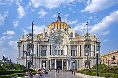
Directions to Palacio De Bellas Artes (Azcapotzalco) with public transportation
The following transit lines have routes that pass near Palacio De Bellas Artes
How to get to Palacio De Bellas Artes by bus?
Click on the bus route to see step by step directions with maps, line arrival times and updated time schedules.
How to get to Palacio De Bellas Artes by metro?
Click on the metro route to see step by step directions with maps, line arrival times and updated time schedules.
Bus stations near Palacio De Bellas Artes in Azcapotzalco
- Metrobús: Glorieta Violeta,2 min walk,
- Mina - Valerio Trujano,3 min walk,
- Mina, 80,3 min walk,
- Calle de Galeana, 49,3 min walk,
- Zaragoza - Mina,4 min walk,
- Valerio Trujano - Pensador Mexicano,4 min walk,
- Magnolia, 61,4 min walk,
- Calle Violeta, 28,4 min walk,
- Valerio Trujano, 67,4 min walk,
- Lerdo - Fonda Big-Ben,5 min walk,
- Paseo de La Reforma Norte 4469,5 min walk,
Metro stations near Palacio De Bellas Artes in Azcapotzalco
- Hidalgo,5 min walk,
- Bellas Artes,7 min walk,
- Garibaldi / Lagunilla,7 min walk,
Bus lines to Palacio De Bellas Artes in Azcapotzalco
- L5,La Diana,
- 2,Glorieta Cuitláhuac Sur - Alameda Tacubaya,
- 7,Hospital Infantil - La Diana,
- RUTA 22,Valeriano Trujano - Alameda Oriente,
- RUTA 22,Metro Zaragoza - Valerio Trujano,
- RUTA 22,Valeriano Trujano - Cárcel Mujeres,
- RUTA 22,Valeriano Trujano - Metro Guelatao,
- 20,Km-13,
- RUTA 1,Metro Oceania,
- 27-A,Estado de México,
- 1,Ticomán,
- 2,Metro Normal,
- 110,Parque Ceylan,
- MICROBÚS,Santo Tomás,
- 108,C.U.,
- 178,Manchuria,
What are the closest stations to Palacio De Bellas Artes?
The closest stations to Palacio De Bellas Artes are:
- Metrobús: Glorieta Violeta is 128 meters away, 2 min walk.
- Mina - Valerio Trujano is 188 meters away, 3 min walk.
- Mina, 80 is 195 meters away, 3 min walk.
- Calle de Galeana, 49 is 214 meters away, 3 min walk.
- Zaragoza - Mina is 228 meters away, 4 min walk.
- Valerio Trujano - Pensador Mexicano is 255 meters away, 4 min walk.
- Magnolia, 61 is 274 meters away, 4 min walk.
- Calle Violeta, 28 is 290 meters away, 4 min walk.
- Valerio Trujano, 67 is 291 meters away, 4 min walk.
- Lerdo - Fonda Big-Ben is 307 meters away, 5 min walk.
- Hidalgo is 326 meters away, 5 min walk.
- Paseo de La Reforma Norte 4469 is 333 meters away, 5 min walk.
- Bellas Artes is 517 meters away, 7 min walk.
- Garibaldi / Lagunilla is 537 meters away, 7 min walk.
Which bus lines stop near Palacio De Bellas Artes?
These bus lines stop near Palacio De Bellas Artes: 11A, 2, 7, L5.
Which metro lines stop near Palacio De Bellas Artes?
These metro lines stop near Palacio De Bellas Artes: 2, 3.
What’s the nearest metro station to Palacio De Bellas Artes in Azcapotzalco?
The nearest metro station to Palacio De Bellas Artes in Azcapotzalco is Hidalgo. It’s a 5 min walk away.
What’s the nearest bus stop to Palacio De Bellas Artes in Azcapotzalco?
The nearest bus stop to Palacio De Bellas Artes in Azcapotzalco is Metrobús: Glorieta Violeta. It’s a 2 min walk away.
What time is the first metro to Palacio De Bellas Artes in Azcapotzalco?
The 8 is the first metro that goes to Palacio De Bellas Artes in Azcapotzalco. It stops nearby at 5:00 AM.
What time is the last metro to Palacio De Bellas Artes in Azcapotzalco?
The B is the last metro that goes to Palacio De Bellas Artes in Azcapotzalco. It stops nearby at 12:47 AM.
What time is the first bus to Palacio De Bellas Artes in Azcapotzalco?
The 7 is the first bus that goes to Palacio De Bellas Artes in Azcapotzalco. It stops nearby at 4:10 AM.
What time is the last bus to Palacio De Bellas Artes in Azcapotzalco?
The 7 is the last bus that goes to Palacio De Bellas Artes in Azcapotzalco. It stops nearby at 1:18 AM.
See Palacio De Bellas Artes, Azcapotzalco, on the map
Public Transit to Palacio De Bellas Artes in Azcapotzalco
Wondering how to get to Palacio De Bellas Artes in Azcapotzalco, México? Moovit helps you find the best way to get to Palacio De Bellas Artes with step-by-step directions from the nearest public transit station.
Moovit provides free maps and live directions to help you navigate through your city. View schedules, routes, timetables, and find out how long does it take to get to Palacio De Bellas Artes in real time.
Looking for the nearest stop or station to Palacio De Bellas Artes? Check out this list of stops closest to your destination: Metrobús: Glorieta Violeta; Mina - Valerio Trujano; Mina; Calle de Galeana; Zaragoza - Mina; Valerio Trujano - Pensador Mexicano; Magnolia; Calle Violeta; Valerio Trujano; Lerdo - Fonda Big-Ben; Hidalgo; Paseo de La Reforma Norte 4469; Bellas Artes; Garibaldi / Lagunilla.
Bus:11A27L520RUTA 22RUTA 22RUTA 22RUTA 22Metro:238B
Want to see if there’s another route that gets you there at an earlier time? Moovit helps you find alternative routes or times. Get directions from and directions to Palacio De Bellas Artes easily from the Moovit App or Website.
We make riding to Palacio De Bellas Artes easy, which is why over 1.5 million users, including users in Azcapotzalco, trust Moovit as the best app for public transit. You don’t need to download an individual bus app or train app, Moovit is your all-in-one transit app that helps you find the best bus time or train time available.
For information on prices of bus and metro, costs and ride fares to Palacio De Bellas Artes, please check the Moovit app.
Use the app to navigate to popular places including to the airport, hospital, stadium, grocery store, mall, coffee shop, school, college, and university.
Location: Azcapotzalco, Ciudad de Mexico
Attractions near Palacio De Bellas Artes
Monumento A Simón Bolívar,SEIDO Procuraduría General de la República,Violeta - Glorieta Simón Bolivar,Reforma y Calle Pedro Moreno,Paseo de la Reforma Calle Valerio Trujano,PERALVILLO 147 ESQUINA CON REFORMA,Valerio Trujano - Glorieta Simón Bolivar,Glorieta Simón Bolivar - Paseo De La Reforma,SAT Hidalgo / FoPAI,SEIDO PGR,violeta 33 col guerrero mexico df esquina paseo de la reforma,SAT Hidalgo Modulo VII FoPAI,Violeta 33 y paseo de la reforma,Banjercito,Casa MX Alameda,Avenida Universidad 1778,Metrobus Glorieta Violeta L7,Reforma Calle Francisco Javier Mina,Estacionamiento Complejo Hidalgo,Reforma Norte 122How to get to popular attractions in Azcapotzalco with public transit
Corporativo HP, Naucalpan De Juárez,Ecatepec, Ecatepec De Morelos,Los Bisquets Bisquets Obregón, Cuautitlán Izcalli,Corporativo Polanco, Naucalpan De Juárez,Caseta La Venta, Huixquilucan,SAP México, Naucalpan De Juárez,Vips, Atizapán De Zaragoza,Starbucks, Cuautitlán Izcalli,Fraccionamiento Lomas De Guadalupe, Huixquilucan,Sports World, Huixquilucan,El Charco de las Ranas, Cuajimalpa De Morelos,Starbucks, Huixquilucan,Zona Fitness Arboledas, Cuautitlán Izcalli,Perros y Burros, Cuautitlán Izcalli,Centro de Distribucion Comex Crisol, Tepotzotlán,Starbucks, Atizapán De Zaragoza,Tulyehualco, Tláhuac,Puentes de Santa Fe, Huixquilucan,ISSSTE Direccion De Administracion, Alvaro Obregón,Smart Fit, Naucalpan De JuárezGet around Azcapotzalco by public transit!
Traveling around Azcapotzalco has never been so easy. See step by step directions as you travel to any attraction, street or major public transit station. View bus and train schedules, arrival times, service alerts and detailed routes on a map, so you know exactly how to get to anywhere in Azcapotzalco.
When traveling to any destination around Azcapotzalco use Moovit's Live Directions with Get Off Notifications to know exactly where and how far to walk, how long to wait for your line, and how many stops are left. Moovit will alert you when it's time to get off — no need to constantly re-check whether yours is the next stop.
Wondering how to use public transit in Azcapotzalco or how to pay for public transit in Azcapotzalco? Moovit public transit app can help you navigate your way with public transit easily, and at minimum cost. It includes public transit fees, ticket prices, and costs. Looking for a map of Azcapotzalco public transit lines? Moovit public transit app shows all public transit maps in Azcapotzalco with all bus or metro routes and stops on an interactive map.
Azcapotzalco has 2 transit type(s), including: bus or metro, operated by several transit agencies, including STC (Metro CDMX), Metrobús, RTP, Trolebús elevado, Trolebús, Tren Ligero, Corredores Concesionados, Ferrocarriles Suburbanos, Mexibus, Mexicable, Cablebús, Puma Bus, Peseros and Autobuses / Combis