Palmdale Metrolink Station station - Saturday schedule
| Line | Direction | Time |
|---|---|---|
| 91-PERRIS VALLEY LINE | L.A Union Station | 6:20 AM |
| 91-PERRIS VALLEY LINE | L.A Union Station | 8:20 AM |
| 91-PERRIS VALLEY LINE | Perry - South | 9:40 AM |
| 91-PERRIS VALLEY LINE | L.A Union Station | 10:20 AM |
| 91-PERRIS VALLEY LINE | L.A Union Station | 12:20 PM |
| 91-PERRIS VALLEY LINE | Perry - South | 1:40 PM |
| 91-PERRIS VALLEY LINE | L.A Union Station | 2:20 PM |
| 91-PERRIS VALLEY LINE | Perry - South | 3:40 PM |
| 91-PERRIS VALLEY LINE | Perry - South | 5:40 PM |
| 91-PERRIS VALLEY LINE | L.A Union Station | 6:20 PM |
| 91-PERRIS VALLEY LINE | Perry - South | 7:40 PM |
| 91-PERRIS VALLEY LINE | Perry - South | 9:40 PM |
Directions to Palmdale Metrolink Station with public transportation
The following transit lines have routes that pass near Palmdale Metrolink Station
How to get to Palmdale Metrolink Station by bus?
Click on the bus route to see step by step directions with maps, line arrival times and updated time schedules.
How to get to Palmdale Metrolink Station by train?
Click on the train route to see step by step directions with maps, line arrival times and updated time schedules.
Bus stops near Palmdale Metrolink Station
- Palmdale Transportation Center, 2 min walk,
Bus lines to Palmdale Metrolink Station
- 1, Lancaster / Palmdale,
- 3, East/West Palmdale via Avenue S,
- 7, Rancho Vista/Lancaster,
- 8, Antelope Valley College,
- 51, Lake LA/Palmdale,
- 97, Special - Highland High School,
- 98, Special - Pete Knight High School,
- 785, Downtown Los Angeles,
- 786, Century City/West Los Angeles,
- 787, West San Fernando Valley,
- 790, Commuter,
What are the closest stations to Palmdale Metrolink Station?
The closest stations to Palmdale Metrolink Station are:
- Palmdale Transportation Center is 147 yards away, 2 min walk.
Which bus lines stop near Palmdale Metrolink Station?
These bus lines stop near Palmdale Metrolink Station: 785, 787, 790.
Which train line stops near Palmdale Metrolink Station?
ANTELOPE VALLEY LINE
What’s the nearest bus stop to Palmdale Metrolink Station?
The nearest bus stop to Palmdale Metrolink Station is Palmdale Transportation Center. It’s a 2 min walk away.
What time is the first bus to Palmdale Metrolink Station?
The 785 is the first bus that goes to Palmdale Metrolink Station. It stops nearby at 4:05 AM.
What time is the last bus to Palmdale Metrolink Station?
The 1 is the last bus that goes to Palmdale Metrolink Station. It stops nearby at 11:49 PM.
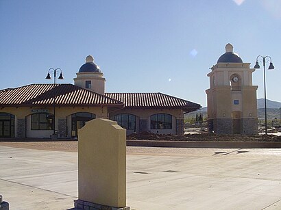
Palmdale Metrolink Station station
 Taken by ERIC R.
See Palmdale Metrolink Station on the map
Public transit to Palmdale Metrolink Station station
Looking for directions to Palmdale Metrolink Station in Palmdale, United States?
Download the Moovit App to find the current schedule and step-by-step directions for Bus or Train routes that pass through Palmdale Metrolink Station.
Looking for the nearest stops closest to Palmdale Metrolink Station ? Check out this list of closest stops to your destination: Palmdale Transportation Center.
Bus: 785, 787, 790, 1, 3, 7, 8, 51.Train: ANTELOPE VALLEY LINE.
We make riding on public transit to Palmdale Metrolink Station easy, which is why over 1.5 million users, including users in Palmdale trust Moovit as the best app for public transit.
Use the app to navigate to popular places including to the airport, hospital, stadium, grocery store, mall, coffee shop, school, college, and university.
The station has the following entrances: 6th Street East Entrance and Sierra Highway Entrance
The first line to this station is 91-PERRIS VALLEY LINE, at 6:20 AM, and the last line is 91-PERRIS VALLEY LINE at 9:40 PM.
39000 Clock Tower Plaza Dr, Palmdale, CA, USA
This station serves Metrolink Trains’s lines
Bus stop near Palmdale Metrolink Station
Popular public transit stations in Palmdale
Get around Los Angeles by public transit!
Traveling around Los Angeles has never been so easy. See step by step directions as you travel to any attraction, street or major public transit station. View bus and train schedules, arrival times, service alerts and detailed routes on a map, so you know exactly how to get to anywhere in Los Angeles.
When traveling to any destination around Los Angeles use Moovit's Live Directions with Get Off Notifications to know exactly where and how far to walk, how long to wait for your line, and how many stops are left. Moovit will alert you when it's time to get off — no need to constantly re-check whether yours is the next stop.
Wondering how to use public transit in Los Angeles or how to pay for public transit in Los Angeles? Moovit public transit app can help you navigate your way with public transit easily, and at minimum cost. It includes public transit fees, ticket prices, and costs. Looking for a map of Los Angeles public transit lines? Moovit public transit app shows all public transit maps in Los Angeles with all Bus, Train, Subway, Light Rail, Ferry and Funicular routes and stops on an interactive map.
Los Angeles has 6 transit type(s), including: Bus, Train, Subway, Light Rail, Ferry and Funicular, operated by several transit agencies, including Metro - Los Angeles, Metrolink Trains, METRO, Long Beach Transit, LADOT, OCTA, Foothill Transit, Big Blue Bus, Riverside Transit Agency, LAX FlyAway, Airporter Shuttle, Playa Vista Shuttle, Amtrak, OMNITRANS, Pasadena Transit