See Palmer Park Apartments, Detroit, on the map
Directions to Palmer Park Apartments (Detroit) with public transportation
The following transit lines have routes that pass near Palmer Park Apartments
 Bus:
Bus:
How to get to Palmer Park Apartments by bus?
Click on the bus route to see step by step directions with maps, line arrival times and updated time schedules.
Bus stations near Palmer Park Apartments in Detroit
- Mcnichols & Pontchartrain,8 min walk,
- Hamilton & Mcnichols,8 min walk,
- Woodward & Nevada,15 min walk,
Bus lines to Palmer Park Apartments in Detroit
- 32,Mcnichols & Telegraph,
- 23,Rosa Parks Transit Center - Deboarding,
- 4,Woodward & Larned,
What are the closest stations to Palmer Park Apartments?
The closest stations to Palmer Park Apartments are:
- Mcnichols & Pontchartrain is 589 yards away, 8 min walk.
- Hamilton & Mcnichols is 594 yards away, 8 min walk.
- Woodward & Nevada is 1180 yards away, 15 min walk.
Which bus lines stop near Palmer Park Apartments?
These bus lines stop near Palmer Park Apartments: 23, 32.
What’s the nearest bus stop to Palmer Park Apartments in Detroit?
The nearest bus stops to Palmer Park Apartments in Detroit are Mcnichols & Pontchartrain and Hamilton & Mcnichols. The closest one is a 8 min walk away.
What time is the first bus to Palmer Park Apartments in Detroit?
The 4 is the first bus that goes to Palmer Park Apartments in Detroit. It stops nearby at 3:04 AM.
What time is the last bus to Palmer Park Apartments in Detroit?
The 4 is the last bus that goes to Palmer Park Apartments in Detroit. It stops nearby at 3:07 AM.
How much is the bus fare to Palmer Park Apartments?
The bus fare to Palmer Park Apartments costs about $2.00.
See Palmer Park Apartments, Detroit, on the map
Public Transit to Palmer Park Apartments in Detroit
Wondering how to get to Palmer Park Apartments in Detroit, United States? Moovit helps you find the best way to get to Palmer Park Apartments with step-by-step directions from the nearest public transit station.
Moovit provides free maps and live directions to help you navigate through your city. View schedules, routes, timetables, and find out how long does it take to get to Palmer Park Apartments in real time.
Looking for the nearest stop or station to Palmer Park Apartments? Check out this list of stops closest to your destination: Mcnichols & Pontchartrain; Hamilton & Mcnichols; Woodward & Nevada.
Bus:
Want to see if there’s another route that gets you there at an earlier time? Moovit helps you find alternative routes or times. Get directions from and directions to Palmer Park Apartments easily from the Moovit App or Website.
We make riding to Palmer Park Apartments easy, which is why over 1.5 million users, including users in Detroit, trust Moovit as the best app for public transit. You don’t need to download an individual bus app or train app, Moovit is your all-in-one transit app that helps you find the best bus time or train time available.
For information on prices of bus, costs and ride fares to Palmer Park Apartments, please check the Moovit app.
Use the app to navigate to popular places including to the airport, hospital, stadium, grocery store, mall, coffee shop, school, college, and university.
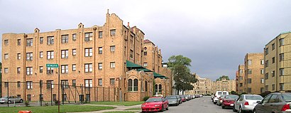
Palmer Park Apartments Address: 17673 Manderson Rd Highland Park, MI 48203 street in Detroit
Attractions near Palmer Park Apartments
Detroit Mounted Police,Angels Trucking,Property Investment Stellar,Best Buy Flooring & Carpet,Ucpalmerpark,Valero,HP Petroleum,Lake Frances,ATM,Shell,Bakers Keyboard Lounge,Adventure Locksmith Co,Takato Infant & Child DVLPT Inst,Unity Institute For Holistic Living,Detroit Golf Club,Acroservicecorporation,Saint John Vianney School,Charlotte Mason Community School of Detroit,The Ark Detroit,Woodward Tire & Auto ServiceHow to get to popular attractions in Detroit with public transit
8 Mile & John R Roads, Hazel Park,DMC Sinai-Grace Professional Building, Detroit,I-96 Schoolcraft & Middlebelt Roads, Livonia,London Chop House, Detroit,Jav's, Detroit,Nemo's Party Bus, Detroit,Buddy's Pizza, Detroit,Aisha Shule / W.E.B. DuBois Preparatory Academy, Detroit,I-94 Exit 222A, Outer Dr Chalmers Ave, Detroit,Operation Get Down, Detroit,Beacon Park, Detroit,Crossroads of Michigan, Detroit,Downtown Detroit, Detroit,I-75 & Clay St, Detroit,St John Professional Building 2, Detroit,southfield & warren, Detroit,City of River Rouge, River Rouge,Family Foods Super Store, Detroit,I-94 Exit 222B, Harper Avenue, Detroit,Detroit Opera House, DetroitGet around Detroit by public transit!
Traveling around Detroit has never been so easy. See step by step directions as you travel to any attraction, street or major public transit station. View bus and train schedules, arrival times, service alerts and detailed routes on a map, so you know exactly how to get to anywhere in Detroit.
When traveling to any destination around Detroit use Moovit's Live Directions with Get Off Notifications to know exactly where and how far to walk, how long to wait for your line, and how many stops are left. Moovit will alert you when it's time to get off — no need to constantly re-check whether yours is the next stop.
Wondering how to use public transit in Detroit or how to pay for public transit in Detroit? Moovit public transit app can help you navigate your way with public transit easily, and at minimum cost. It includes public transit fees, ticket prices, and costs. Looking for a map of Detroit public transit lines? Moovit public transit app shows all public transit maps in Detroit with all bus routes and stops on an interactive map.
Detroit has 1 transit type(s), including: bus, operated by several transit agencies, including SMART, Qline Detroit, DDOT, DETROIT PEOPLE MOVER, The Ride, Michigan Flyer, Detroit Ann Arbor Express, University of Michigan Transportation Services, Amtrak, FlixBus-us and Greyhound-us