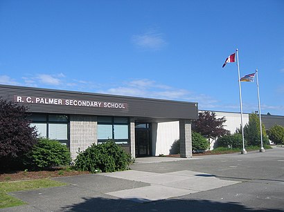
Directions to Palmer Secondary School (Richmond) with public transportation
The following transit lines have routes that pass near Palmer Secondary School
How to get to Palmer Secondary School by bus?
Click on the bus route to see step by step directions with maps, line arrival times and updated time schedules.
How to get to Palmer Secondary School by SkyTrain?
Click on the SkyTrain route to see step by step directions with maps, line arrival times and updated time schedules.
Bus stops near Palmer Secondary School in Richmond
- Southbound Garden City Rd @ Bowcock Rd, 2 min walk,
- Southbound No. 3 Rd @ Blundell Rd, 11 min walk,
- Northbound No. 3 Rd @ Blundell Rd, 11 min walk,
Skytrain stations near Palmer Secondary School in Richmond
- Richmond-Brighouse Station, 32 min walk,
Bus lines to Palmer Secondary School in Richmond
- 408, Brighouse Station,
- 403, Three Road,
- 402, Brighouse Station,
What are the closest stations to Palmer Secondary School?
The closest stations to Palmer Secondary School are:
- Southbound Garden City Rd @ Bowcock Rd is 141 meters away, 2 min walk.
- Southbound No. 3 Rd @ Blundell Rd is 819 meters away, 11 min walk.
- Northbound No. 3 Rd @ Blundell Rd is 845 meters away, 11 min walk.
- Richmond-Brighouse Station is 2449 meters away, 32 min walk.
Which bus lines stop near Palmer Secondary School?
These bus lines stop near Palmer Secondary School: 403, 405, 408, 430, N10.
Which SkyTrain line stops near Palmer Secondary School?
CANADA LINE
What’s the nearest bus stop to Palmer Secondary School in Richmond?
The nearest bus stop to Palmer Secondary School in Richmond is Southbound Garden City Rd @ Bowcock Rd. It’s a 2 min walk away.
What time is the first SkyTrain to Palmer Secondary School in Richmond?
The CANADA LINE is the first SkyTrain that goes to Palmer Secondary School in Richmond. It stops nearby at 5:02 AM.
What time is the last SkyTrain to Palmer Secondary School in Richmond?
The CANADA LINE is the last SkyTrain that goes to Palmer Secondary School in Richmond. It stops nearby at 1:41 AM.
What time is the first bus to Palmer Secondary School in Richmond?
The 403 is the first bus that goes to Palmer Secondary School in Richmond. It stops nearby at 4:45 AM.
What time is the last bus to Palmer Secondary School in Richmond?
The 403 is the last bus that goes to Palmer Secondary School in Richmond. It stops nearby at 1:54 AM.
See Palmer Secondary School, Richmond, on the map
Public Transit to Palmer Secondary School in Richmond
Wondering how to get to Palmer Secondary School in Richmond, Canada? Moovit helps you find the best way to get to Palmer Secondary School with step-by-step directions from the nearest public transit station.
Moovit provides free maps and live directions to help you navigate through your city. View schedules, routes, timetables, and find out how long does it take to get to Palmer Secondary School in real time.
Looking for the nearest stop or station to Palmer Secondary School? Check out this list of stops closest to your destination: Southbound Garden City Rd @ Bowcock Rd; Southbound No. 3 Rd @ Blundell Rd; Northbound No. 3 Rd @ Blundell Rd; Richmond-Brighouse Station.
Bus: 403, 405, 408, 430, N10, 402.SkyTrain: CANADA LINE.
Want to see if there’s another route that gets you there at an earlier time? Moovit helps you find alternative routes or times. Get directions from and directions to Palmer Secondary School easily from the Moovit App or Website.
We make riding to Palmer Secondary School easy, which is why over 1.5 million users, including users in Richmond, trust Moovit as the best app for public transit. You don’t need to download an individual bus app or train app, Moovit is your all-in-one transit app that helps you find the best bus time or train time available.
For information on prices of bus and SkyTrain, costs and ride fares to Palmer Secondary School, please check the Moovit app.
Use the app to navigate to popular places including to the airport, hospital, stadium, grocery store, mall, coffee shop, school, college, and university.
Location: Richmond, Southwest British Columbia
Attractions near Palmer Secondary School
Palmer Baseball Complex,8191 Saint Albans Road,Michael Aghamohseni,Garden City,Myomi Food Service,Canada Research Institute of TCM & Western Medicine Integration,Midtown Medical Clinic,Uncle Sal's Shawarma,旺記中式料理 (Wang Ji Restaurant 旺記中式料理),Brazilian Soccer Schools Canada,Garden City Shopping Centre,Celia Yeung - Diversity and Emotional Wellness Centre,Intech Solutions,Medical Transcription Svc,Belinda's Happy Ending Spa,Leodoctor Computer Services,Harbour Air Seaplanes,The Dream Clean,LS Bodega Pets Foods A,JSK PhysiotherapyHow to get to popular attractions in Richmond with public transit
Atrium Inn, Vancouver,Cultus Lake, Chilliwack,Free Visitor Parking compliments of City of Van, Vancouver,Newton Athletic Park, Surrey,Art Gallery Vancouver, Vancouver,Ismaili Jamatkhana Burnaby Lake, Burnaby,Rupert SkyTrain Station, Vancouver,Hornby Street Ferry Dock, Vancouver,City Square Shopping Centre, Vancouver,Columbia College, Vancouver,Ikea, Coquitlam,Douglas (Peace Arch) Border Crossing Station, Surrey,International Village, Vancouver,The Listel Hotel, Vancouver,Justice Institute of BC, New Westminster,VGH Radiology Department, Vancouver,Capilano Rv Park, Capilano 5,Main Street – Science World SkyTrain Station, Vancouver,BC Women's Hospital, Vancouver,Chinese Visa Application Service Centre, VancouverGet around Southwest British Columbia by public transit!
Traveling around Southwest British Columbia has never been so easy. See step by step directions as you travel to any attraction, street or major public transit station. View bus and train schedules, arrival times, service alerts and detailed routes on a map, so you know exactly how to get to anywhere in Southwest British Columbia.
When traveling to any destination around Southwest British Columbia use Moovit's Live Directions with Get Off Notifications to know exactly where and how far to walk, how long to wait for your line, and how many stops are left. Moovit will alert you when it's time to get off — no need to constantly re-check whether yours is the next stop.
Wondering how to use public transit in Southwest British Columbia or how to pay for public transit in Southwest British Columbia? Moovit public transit app can help you navigate your way with public transit easily, and at minimum cost. It includes public transit fees, ticket prices, and costs. Looking for a map of Southwest British Columbia public transit lines? Moovit public transit app shows all public transit maps in Southwest British Columbia with all Bus, Train, SkyTrain and Ferry routes and stops on an interactive map.
Southwest British Columbia has 4 transit type(s), including: Bus, Train, SkyTrain and Ferry, operated by several transit agencies, including TransLink, False Creek Ferries, BC Ferries, Aquabus, BC Transit - Central Fraser Valley Transit System, BCTransit, BC Transit - Comox Valley Transit System, BC Transit - Aggasiz-Harrison and Hope Transit System, BC Transit - Chilliwack Transit System, BC Transit - Squamish, BC Transit - Whistler Transit System, BC Transit - Cowichan Valley Regional Transit System, BC Transit - Campbell River Transit System, BC Transit - Powell River Regional Transit System, BC Transit - Sunshine Coast Transit System