How to get to Pamela Bartlett by bus?
Click on the bus route to see step by step directions with maps, line arrival times and updated time schedules.
How to get to Pamela Bartlett by train?
Click on the train route to see step by step directions with maps, line arrival times and updated time schedules.
Bus stops near Pamela Bartlett in Boston
- Thornes Market (R44 Only), 4 min walk,VIEW
- Crafts Avenue / Peter Pan, 5 min walk,VIEW
- Northampton Court House, 5 min walk,VIEW
- Peter Pan Bus Terminal Northampton, 5 min walk,VIEW
- Live 155, 6 min walk,VIEW
- Old South / Conz (Mcdonald House), 6 min walk,VIEW
- Northampton (Northampton Market), 7 min walk,VIEW
- State St And Bedford Terrace (S), 14 min walk,VIEW
Train station near Pamela Bartlett in Boston
- Northampton, 27 min walk,VIEW
Bus lines to Pamela Bartlett in Boston
- R44, Williamsburg Via Va Hospital,VIEW
- R42, Northampton,VIEW
- 904, Pittsfield Itc,VIEW
- B43, Northampton,VIEW
- PETER PAN, Boston (South Station),VIEW
- PETER PAN, Springfield,VIEW
- PETER PAN, Northampton,VIEW
- PETER PAN, South Hadley,VIEW
- B48, Holyoke Trans. Ctr. Via Rt. 5,VIEW
- G73E, Northampton Via Holyoke Mall,VIEW
- R41, Northampton Via Easthampton,VIEW
- G47, Northampton Via Westfield,VIEW
- NE, Southampton Big Y,VIEW
- GREYHOUND US0255S, New York Port Authority,VIEW
- 31, Jwo Transit Center,VIEW
What are the closest stations to Pamela Bartlett?
The closest stations to Pamela Bartlett are:
- Thornes Market (R44 Only) is 272 yards away, 4 min walk.
- Crafts Avenue / Peter Pan is 371 yards away, 5 min walk.
- Northampton Court House is 375 yards away, 5 min walk.
- Peter Pan Bus Terminal Northampton is 386 yards away, 5 min walk.
- Live 155 is 458 yards away, 6 min walk.
- Old South / Conz (Mcdonald House) is 463 yards away, 6 min walk.
- Northampton (Northampton Market) is 537 yards away, 7 min walk.
- State St And Bedford Terrace (S) is 1113 yards away, 14 min walk.
- Northampton is 2244 yards away, 27 min walk.
Which bus lines stop near Pamela Bartlett?
These bus lines stop near Pamela Bartlett: 31, B48, G73E.
Which train line stops near Pamela Bartlett?
VERMONTER (St Albans)
What’s the nearest train station to Pamela Bartlett in Boston?
The nearest train station to Pamela Bartlett in Boston is Northampton. It’s a 27 min walk away.
What’s the nearest bus station to Pamela Bartlett in Boston?
The nearest bus station to Pamela Bartlett in Boston is Thornes Market (R44 Only). It’s a 4 min walk away.
What time is the first train to Pamela Bartlett in Boston?
The VALLEY FLYER is the first train that goes to Pamela Bartlett in Boston. It stops nearby at 6:30 AM.
What time is the last train to Pamela Bartlett in Boston?
The VALLEY FLYER is the last train that goes to Pamela Bartlett in Boston. It stops nearby at 10:07 PM.
What time is the first bus to Pamela Bartlett in Boston?
The R44 is the first bus that goes to Pamela Bartlett in Boston. It stops nearby at 5:41 AM.
What time is the last bus to Pamela Bartlett in Boston?
The B43 is the last bus that goes to Pamela Bartlett in Boston. It stops nearby at 11:56 PM.
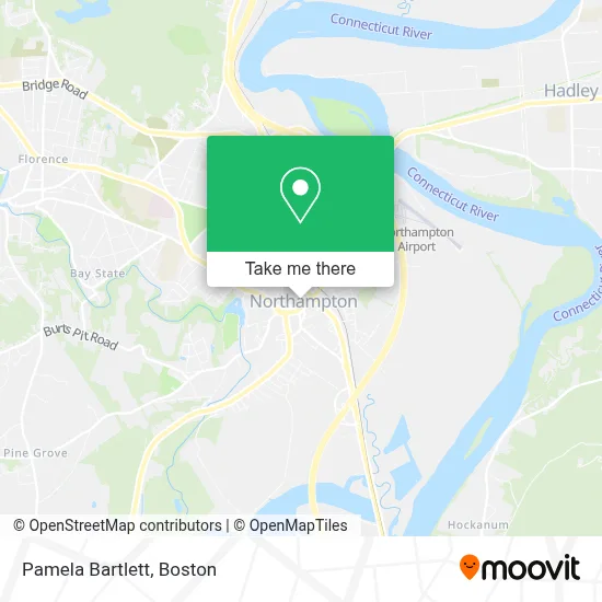
See Pamela Bartlett, Boston, on the map
Public Transit to Pamela Bartlett in Boston
Wondering how to get to Pamela Bartlett in Boston? Moovit helps you find the best way to get to Pamela Bartlett with step-by-step directions from the nearest public transit station.
Moovit provides free maps and live directions to help you navigate through your city. View schedules, routes, timetables, and find out how long does it take to get to Pamela Bartlett in real time.
Looking for the nearest stop or station to Pamela Bartlett? Check out this list of stops closest to your destination: Thornes Market (R44 Only); Crafts Avenue / Peter Pan; Northampton Court House; Peter Pan Bus Terminal Northampton; Live 155; Old South / Conz (Mcdonald House); Northampton (Northampton Market); State St And Bedford Terrace (S); Northampton.
Bus: 31, B48, G73E, R44, R42, 904, B43, PETER PAN, PETER PAN, PETER PAN, PETER PAN, R41.Train: VERMONTER, VALLEY FLYER.
Want to see if there’s another route that gets you there at an earlier time? Moovit helps you find alternative routes or times. Get directions from and directions to Pamela Bartlett easily from the Moovit App or Website.
We make riding to Pamela Bartlett easy, which is why over 1.7 million users, including users in Boston, trust Moovit as the best app for public transit. You don’t need to download an individual bus app or train app, Moovit is your all-in-one transit app that helps you find the best bus time or train time available.
For information on prices of bus and train, costs and ride fares to Pamela Bartlett, please check the Moovit app.
Use the app to navigate to popular places including to the airport, hospital, stadium, grocery store, mall, coffee shop, school, college, and university.
Pamela Bartlett Address: 16 Center St street in Boston
- Central Chambers,
- Iron Horse Ventures,
- Dentist in Northampton Ma,
- Gorgeous Smiles Dental,
- Norris, Margot,
- Leaves of Change Counseling,
- Greenfield Family Dentistry,
- Robyn T Brokos Therapeuticmas,
- Cohen Emily,
- Griswold Special Care,
- Erin Wyllie, Attorney,
- Kierstein Margaret,
- Hostetler Sara,
- Edmund P Delacour Dr,
- Michael Verrilli,
- Brill Jonathan,
- O'Neill Susan F Psychologist,
- Northampton Chiropractic & Wellness Center,
- New Beginnings Pennylane,
- Ucc & ABC & ABC
Places Near Pamela Bartlett (Boston)
- Wang Theater, Boston,
- Massachusetts General Hospital, Boston,
- Cheers, Boston,
- Td Garden, Boston,
- Boston Medical Center, Boston,
- Quincy Market, Boston,
- North End, Boston,
- Seaport District, Boston,
- Faneuil Hall, Boston,
- Isabella Stewart Gardner Museum, Boston,
- Boston Convention & Exhibition Center, Boston,
- Museum Of Science, Boston,
- Boston Common, Boston,
- Leader Bank Pavilion (Leader Bank Pavillion), Boston,
- Wilbur Theatre, Boston,
- Mgm Music Hall, Boston,
- Prudential Center, Boston,
- Castle Island, Boston,
- House Of Blues, Boston,
- Boston Children's Hospital, Boston
How to get to popular places in Boston with public transit
Get around Boston by public transit!
Traveling around Boston has never been so easy. See step by step directions as you travel to any attraction, street or major public transit station. View bus and train schedules, arrival times, service alerts and detailed routes on a map, so you know exactly how to get to anywhere in Boston.
When traveling to any destination around Boston use Moovit's Live Directions with Get Off Notifications to know exactly where and how far to walk, how long to wait for your line, and how many stops are left. Moovit will alert you when it's time to get off — no need to constantly re-check whether yours is the next stop.
Wondering how to use public transit in Boston or how to pay for public transit in Boston? Moovit public transit app can help you navigate your way with public transit easily, and at minimum cost. It includes public transit fees, ticket prices, and costs. Looking for a map of Boston public transit lines? Moovit public transit app shows all public transit maps in Boston with all Bus, Train, Subway and Ferry routes and stops on an interactive map.
Boston has 4 transit type(s), including: Bus, Train, Subway and Ferry, operated by several transit agencies, including MBTA, Southeastern Regional Transit Authority, MetroWest Regional Transit Authority, Rhode Island Public Transit Authority, WRTA, Lowell Regional Transit Authority, Merrimack Valley Transit, Montachusett Regional Transit Authority, Cape Cod Regional Transit Authority, Brockton Area Transit Authority, Martha's Vineyard Transit Authority, the WAVE - Nantucket Regional Transit Authority, GATRA, Cape Ann Transportation Authority and Massport