Directions to Pamela Swallows Dee (Boston) with public transportation
The following transit lines have routes that pass near Pamela Swallows Dee
 Bus: 501, 504, SL4, SL5, 43.
- Train: FRAMINGHAM/WORCESTER, LOWELL, NEEDHAM.
- Subway: GREEN LINE B, GREEN LINE D, ORANGE LINE, RED LINE, GREEN LINE C.
How to get to Pamela Swallows Dee by bus?
Click on the bus route to see step by step directions with maps, line arrival times and updated time schedules.
From Conte Forum, Boston
61 minFrom Regent Theatre, Arlington
81 minFrom Newton, MA, Newton
42 minFrom the mall at rockingham park mall, Boston
50 minFrom West Roxbury, Boston
53 minFrom FOUR POINTS BY SHERATON Boston Newton, Newton
24 minFrom Mount Auburn, Cambridge
51 minFrom Milton Academy, Milton
88 minFrom Wollaston Beach, Quincy
104 minFrom Franklin Park, Boston
41 min
How to get to Pamela Swallows Dee by train?
Click on the train route to see step by step directions with maps, line arrival times and updated time schedules.
How to get to Pamela Swallows Dee by subway?
Click on the subway route to see step by step directions with maps, line arrival times and updated time schedules.
Bus stops near Pamela Swallows Dee in Boston
Subway stations near Pamela Swallows Dee in Boston
Bus lines to Pamela Swallows Dee in Boston
- 43, Park St & Tremont St,VIEW
- 15, Mattapan Via Nubian & Fields Corner,VIEW
- SL4, South Station,VIEW
- SL5, Downtown,VIEW
- 39, Forest Hills,VIEW
- 57, Watertown Via Kenmore,VIEW
- 501, Downtown Via Cambridge St And Copley (Express),VIEW
- 504, Downtown Via Copley (Express),VIEW
- 11, Chauncy & Summer,VIEW
- 9, City Point,VIEW
What are the closest stations to Pamela Swallows Dee?
The closest stations to Pamela Swallows Dee are:
- 285 Tremont St is 116 yards away, 2 min walk.
- Washington St @ Tufts Med Ctr is 178 yards away, 3 min walk.
- Stuart St @ Charles St S is 260 yards away, 4 min walk.
- Washington St @ Essex St is 311 yards away, 4 min walk.
- Downtown Crossing is 372 yards away, 5 min walk.
- Herald St @ Harrison Ave is 504 yards away, 7 min walk.
- Boylston is 526 yards away, 7 min walk.
Which bus lines stop near Pamela Swallows Dee?
These bus lines stop near Pamela Swallows Dee: 501, 504, SL4, SL5.
Which train lines stop near Pamela Swallows Dee?
These train lines stop near Pamela Swallows Dee: FRAMINGHAM/WORCESTER, LOWELL, NEEDHAM.
Which subway lines stop near Pamela Swallows Dee?
These subway lines stop near Pamela Swallows Dee: GREEN LINE B, GREEN LINE D, ORANGE LINE.
What’s the nearest subway station to Pamela Swallows Dee in Boston?
The nearest subway station to Pamela Swallows Dee in Boston is Downtown Crossing. It’s a 5 min walk away.
What’s the nearest bus station to Pamela Swallows Dee in Boston?
The nearest bus station to Pamela Swallows Dee in Boston is 285 Tremont St. It’s a 2 min walk away.
What time is the first subway to Pamela Swallows Dee in Boston?
The GREEN LINE D is the first subway that goes to Pamela Swallows Dee in Boston. It stops nearby at 5:07 AM.
What time is the last subway to Pamela Swallows Dee in Boston?
The GREEN LINE E is the last subway that goes to Pamela Swallows Dee in Boston. It stops nearby at 2:16 AM.
What time is the first bus to Pamela Swallows Dee in Boston?
The 43 is the first bus that goes to Pamela Swallows Dee in Boston. It stops nearby at 5:06 AM.
What time is the last bus to Pamela Swallows Dee in Boston?
The 9 is the last bus that goes to Pamela Swallows Dee in Boston. It stops nearby at 1:16 AM.
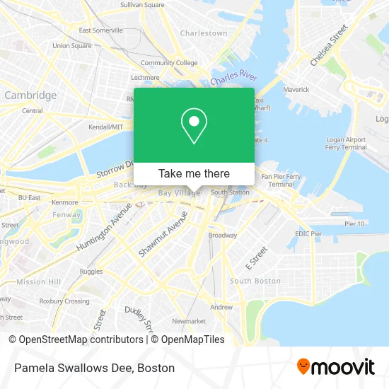
See Pamela Swallows Dee, Boston, on the map
Public Transit to Pamela Swallows Dee in Boston
Wondering how to get to Pamela Swallows Dee in Boston? Moovit helps you find the best way to get to Pamela Swallows Dee with step-by-step directions from the nearest public transit station.
Moovit provides free maps and live directions to help you navigate through your city. View schedules, routes, timetables, and find out how long does it take to get to Pamela Swallows Dee in real time.
Looking for the nearest stop or station to Pamela Swallows Dee? Check out this list of stops closest to your destination: 285 Tremont St; Washington St @ Tufts Med Ctr; Stuart St @ Charles St S; Washington St @ Essex St; Downtown Crossing; Herald St @ Harrison Ave; Boylston.
Bus: 501, 504, SL4, SL5, 43, 15, 39, 57, 11.Train: FRAMINGHAM/WORCESTER, LOWELL, NEEDHAM.Subway: GREEN LINE B, GREEN LINE D, ORANGE LINE, RED LINE, GREEN LINE C, GREEN LINE E.
Want to see if there’s another route that gets you there at an earlier time? Moovit helps you find alternative routes or times. Get directions from and directions to Pamela Swallows Dee easily from the Moovit App or Website.
We make riding to Pamela Swallows Dee easy, which is why over 1.7 million users, including users in Boston, trust Moovit as the best app for public transit. You don’t need to download an individual bus app or train app, Moovit is your all-in-one transit app that helps you find the best bus time or train time available.
For information on prices of bus, subway and train, costs and ride fares to Pamela Swallows Dee, please check the Moovit app.
Use the app to navigate to popular places including to the airport, hospital, stadium, grocery store, mall, coffee shop, school, college, and university.
Pamela Swallows Dee Address: 821 Washington St street in Boston
- Doubletree by Hilton Hotel Boston - Downtown,
- 37 Bennett st-Tufts Medical Center,
- MBTA Silver Line SL4 Dudley Station,
- Jonathon Sillman, MD, Facs,
- The Corner of Tremont & Tremont,
- Wang YMCA of Chinatown,
- Tufts Medical Center Emergency Room,
- MBTA Tufts Medical Center Station,
- BCNC,
- Tufts Children's Hospital Division of Newborn Medicine,
- John N Gaitanis, MD (Rebeca N Alvareza-Altalef),
- Santander,
- Chop'd & Top'd NEMC,
- Diego Illanes, MD, Facog, Facs,
- Dustin Patil, MD,
- Raymond L. Comenzo, MD (Sheryl L Levy),
- Lori B. Olans, MD, MPH,
- Tufts Medical Center / Floating Hospital for Children,
- Navin K Kapur, MD (Navin Krishna Yadlapalli),
- Floating Hospital For Children
Places Near Pamela Swallows Dee (Boston)
- Td Garden, Boston,
- Wang Theater, Boston,
- Museum Of Science, Boston,
- North End, Boston,
- Isabella Stewart Gardner Museum, Boston,
- Faneuil Hall, Boston,
- Boston Medical Center, Boston,
- Wilbur Theatre, Boston,
- Prudential Center, Boston,
- Cheers, Boston,
- Boston Common, Boston,
- Mgm Music Hall, Boston,
- House Of Blues, Boston,
- Massachusetts General Hospital, Boston,
- Quincy Market, Boston,
- Boston Children's Hospital, Boston,
- Boston Convention & Exhibition Center, Boston,
- Seaport District, Boston,
- Leader Bank Pavilion (Leader Bank Pavillion), Boston,
- Castle Island, Boston
How to get to popular places in Boston with public transit
Get around Boston by public transit!
Traveling around Boston has never been so easy. See step by step directions as you travel to any attraction, street or major public transit station. View bus and train schedules, arrival times, service alerts and detailed routes on a map, so you know exactly how to get to anywhere in Boston.
When traveling to any destination around Boston use Moovit's Live Directions with Get Off Notifications to know exactly where and how far to walk, how long to wait for your line, and how many stops are left. Moovit will alert you when it's time to get off — no need to constantly re-check whether yours is the next stop.
Wondering how to use public transit in Boston or how to pay for public transit in Boston? Moovit public transit app can help you navigate your way with public transit easily, and at minimum cost. It includes public transit fees, ticket prices, and costs. Looking for a map of Boston public transit lines? Moovit public transit app shows all public transit maps in Boston with all Bus, Train, Subway and Ferry routes and stops on an interactive map.
Boston has 4 transit type(s), including: Bus, Train, Subway and Ferry, operated by several transit agencies, including MBTA, Southeastern Regional Transit Authority, MetroWest Regional Transit Authority, Rhode Island Public Transit Authority, WRTA, Lowell Regional Transit Authority, Merrimack Valley Transit, Montachusett Regional Transit Authority, Cape Cod Regional Transit Authority, Brockton Area Transit Authority, Martha's Vineyard Transit Authority, the WAVE - Nantucket Regional Transit Authority, GATRA, Cape Ann Transportation Authority and Massport