Directions to Panchsheel Park station (Delhi) with public transit
The following transit lines have routes that pass near Panchsheel Park
How to get to Panchsheel Park station by bus?
Click on the bus route to see step by step directions with maps, line arrival times and updated time schedules.
How to get to Panchsheel Park station by metro?
Click on the metro route to see step by step directions with maps, line arrival times and updated time schedules.
Bus stops near Panchsheel Park in Delhi
- Panchsheel Club, 4 min walk,
- Panchsheel, 4 min walk,
- Sadhna Enclave, 5 min walk,
- Bhavishya Nidhi Enclave, 10 min walk,
Metro stations near Panchsheel Park in Delhi
- Green Park, 8 min walk,
- Panchsheel Park, 22 min walk,
Bus lines to Panchsheel Park station in Delhi
- 764, Nehru Place Terminal,
- 511, Dhaula Kuan,
- 540ACL, South Extension,
- 540CL, Tara Apartments Terminal,
- 774, Badarpur Border (T),
- 465, Madanpur Khadar J.J Colony - Safdarjung (T),
- 465A, Badarpur Border (T) - Safdarjung (T),
- 511A, Dhaula Kuan - Nehru Place (T),
- 511A, Badarpur Border (T) - Dhaula Kuan,
- 511A, Hauz Khas (T) To Nehru Place (T),
- 540, Safdarjung (T) - Tara Apartment,
- 540, Kendriya (T) Church Road - Tara Apartment,
- 764, Nehru Place (T) - Dwarka More Metro Station,
- 764, Jharoda Kalan Border (Satyam Puram) - Nehru Place (T),
- 764, Dhansa Stand Najafgarh - Nehru Place (T),
- 764LS, Nehru Place (T) - Dwarka More Metro Station Ladies Special,
- 764STL, Nehru Place (T) - Sai Baba Mandir Najafgarh Road,
- 511A, ARSD College (Dhaula Kuan),
- 413, Nizamuddin Railway Station,
- 448, Hamdard Nagar / Sangam Vihar,
What are the closest stations to Panchsheel Park?
The closest stations to Panchsheel Park are:
- Panchsheel Club is 216 meters away, 4 min walk.
- Panchsheel is 247 meters away, 4 min walk.
- Sadhna Enclave is 358 meters away, 5 min walk.
- Green Park is 547 meters away, 8 min walk.
- Bhavishya Nidhi Enclave is 706 meters away, 10 min walk.
- Panchsheel Park is 1669 meters away, 22 min walk.
Which bus lines stop near Panchsheel Park?
These bus lines stop near Panchsheel Park: 413, 511A, 540, 764.
Which metro lines stop near Panchsheel Park?
These metro lines stop near Panchsheel Park: 2, 8.
What’s the nearest metro station to Panchsheel Park in Delhi?
The nearest metro station to Panchsheel Park in Delhi is Green Park. It’s a 8 min walk away.
What’s the nearest bus stop to Panchsheel Park in Delhi?
The nearest bus stops to Panchsheel Park in Delhi are Panchsheel Club and Panchsheel. The closest one is a 4 min walk away.
What time is the first metro to Panchsheel Park in Delhi?
The 2 is the first metro that goes to Panchsheel Park in Delhi. It stops nearby at 5:25 AM.
What time is the last metro to Panchsheel Park in Delhi?
The 2 is the last metro that goes to Panchsheel Park in Delhi. It stops nearby at 12:09 AM.
What time is the first bus to Panchsheel Park in Delhi?
The 540CL is the first bus that goes to Panchsheel Park in Delhi. It stops nearby at 4:36 AM.
What time is the last bus to Panchsheel Park in Delhi?
The 764STL is the last bus that goes to Panchsheel Park in Delhi. It stops nearby at 12:45 AM.
See Panchsheel Park, Delhi, on the map
Public Transit to Panchsheel Park in Delhi
Wondering how to get to Panchsheel Park in Delhi, India? Moovit helps you find the best way to get to Panchsheel Park with step-by-step directions from the nearest public transit station.
Moovit provides free maps and live directions to help you navigate through your city. View schedules, routes, timetables, and find out how long does it take to get to Panchsheel Park in real time.
Looking for the nearest stop or station to Panchsheel Park? Check out this list of stops closest to your destination: Panchsheel Club; Panchsheel; Sadhna Enclave; Green Park; Bhavishya Nidhi Enclave; Panchsheel Park.
Bus: 413, 511A, 540, 764, 511, 540ACL, 540CL, 774, 465, 465A.Metro: 2, 8.
Want to see if there’s another route that gets you there at an earlier time? Moovit helps you find alternative routes or times. Get directions from and directions to Panchsheel Park easily from the Moovit App or Website.
We make riding to Panchsheel Park easy, which is why over 1.5 million users, including users in Delhi, trust Moovit as the best app for public transit. You don’t need to download an individual bus app or train app, Moovit is your all-in-one transit app that helps you find the best bus time or train time available.
For information on prices of bus and metro, costs and ride fares to Panchsheel Park, please check the Moovit app.
Use the app to navigate to popular places including to the airport, hospital, stadium, grocery store, mall, coffee shop, school, college, and university.
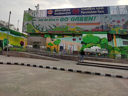
Panchsheel Park Address: Ho Chi Minh Marg street in Delhi
The Panchsheel Park metro station is located on the Magenta Line of the Delhi Metro. It was opened to public on 29 May 2018.Wiki
Places Near Panchsheel Park (Delhi)
Get around Delhi by public transit!
Traveling around Delhi has never been so easy. See step by step directions as you travel to any attraction, street or major public transit station. View bus and train schedules, arrival times, service alerts and detailed routes on a map, so you know exactly how to get to anywhere in Delhi.
When traveling to any destination around Delhi use Moovit's Live Directions with Get Off Notifications to know exactly where and how far to walk, how long to wait for your line, and how many stops are left. Moovit will alert you when it's time to get off — no need to constantly re-check whether yours is the next stop.
Wondering how to use public transit in Delhi or how to pay for public transit in Delhi? Moovit public transit app can help you navigate your way with public transit easily, and at minimum cost. It includes public transit fees, ticket prices, and costs. Looking for a map of Delhi public transit lines? Moovit public transit app shows all public transit maps in Delhi with all Bus, Train and Metro routes and stops on an interactive map.
New Delhi has 3 transit type(s), including: Bus, Train and Metro, operated by several transit agencies, including Delhi Metro Rail Corporation (DMRC), Delhi Transport Corporation (DTC), Northern Railways, Noida Metro Rail corporation, DTC Night Bus, GMCBL (Gurugram Metropolitan City Bus Limited), Delhi Integrated Multi-Modal Transit System Ltd., Delhi Metro Rail Corporation, DTC AC Services, DIMTS AC Buses, DTC Express Buses, DIMTS (Delhi Integrated Multi-Modal Transit System Ltd.), DMRC Feeder AC E-Buses, AC bus lines and Airport AC bus lines