How to get to Panela de Casa by bus?
Click on the bus route to see step by step directions with maps, line arrival times and updated time schedules.
From Avenida Roberto Silveira, Niterói
51 minFrom Niteroi X Caxias, Niterói
30 minFrom Clínica da Família Dr. Zerbini, São Gonçalo
56 minFrom Barreto, Niterói
31 minFrom Rua Mariz e Barros, Niterói
61 minFrom Rua Ataíde Parreiras 266, Niterói
36 minFrom icarai, Niterói
35 minFrom Hospital Niterói D'Or, Niterói
60 minFrom Hospital Estadual Azevedo Lima, Niterói
37 minFrom niterói x itaipuaçu Viação Nossa Senhora Do Amparo, Niterói
29 min
Bus stops near Panela de Casa in São Gonçalo
Bus lines to Panela de Casa in São Gonçalo
- 45, Shopping,VIEW
- 536, Niterói,VIEW
- 14C, Jardim Catarina - Shopping (Via Coroado / Visconde de Seabra),VIEW
- 20, Maria Rita - Alcântara,VIEW
- 35, Shopping - Alcântara (Via Av. Maricá),VIEW
- 42, Pontal - Alcantâra (Via Porto da Pedra),VIEW
- 526M, Antonina - Niterói (Via Porto da Pedra),VIEW
- 443, Boa Vista,VIEW
- 523, Praia Das Pedrinhas,VIEW
- 20A, Praia Das Pedrinhas,VIEW
- 26, Capote,VIEW
What are the closest stations to Panela de Casa?
The closest stations to Panela de Casa are:
- Rua Alfredo Azamor is 168 meters away, 3 min walk.
- Rua Alfredo Azamor, 2631 is 169 meters away, 3 min walk.
- Rua Abílio José De Mattos, 2314 is 476 meters away, 7 min walk.
- Rua Veríssimo De Souza is 552 meters away, 8 min walk.
Which bus lines stop near Panela de Casa?
These bus lines stop near Panela de Casa: 1121Q, 14C, 526, 536, 5400M.
What’s the nearest bus station to Panela de Casa in São Gonçalo?
The nearest bus stations to Panela de Casa in São Gonçalo are Rua Alfredo Azamor and Rua Alfredo Azamor, 2631. The closest one is a 3 min walk away.
What time is the first bus to Panela de Casa in São Gonçalo?
The 536 is the first bus that goes to Panela de Casa in São Gonçalo. It stops nearby at 3:38 AM.
What time is the last bus to Panela de Casa in São Gonçalo?
The 536 is the last bus that goes to Panela de Casa in São Gonçalo. It stops nearby at 2:44 AM.
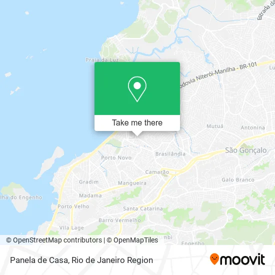
See Panela de Casa, São Gonçalo, on the map
Public Transit to Panela de Casa in São Gonçalo
Wondering how to get to Panela de Casa in São Gonçalo? Moovit helps you find the best way to get to Panela de Casa with step-by-step directions from the nearest public transit station.
Moovit provides free maps and live directions to help you navigate through your city. View schedules, routes, timetables, and find out how long does it take to get to Panela de Casa in real time.
Looking for the nearest stop or station to Panela de Casa? Check out this list of stops closest to your destination: Rua Alfredo Azamor; Rua Alfredo Azamor; Rua Abílio José De Mattos; Rua Veríssimo De Souza.
Bus: 1121Q, 14C, 526, 536, 5400M, 45, 20, 35, 42, 526M, 443, 523, 20A, 26.
Want to see if there’s another route that gets you there at an earlier time? Moovit helps you find alternative routes or times. Get directions from and directions to Panela de Casa easily from the Moovit App or Website.
We make riding to Panela de Casa easy, which is why over 1.5 million users, including users in São Gonçalo, trust Moovit as the best app for public transit. You don’t need to download an individual bus app or train app, Moovit is your all-in-one transit app that helps you find the best bus time or train time available.
For information on prices of bus, costs and ride fares to Panela de Casa, please check the Moovit app.
Use the app to navigate to popular places including to the airport, hospital, stadium, grocery store, mall, coffee shop, school, college, and university.
Panela de Casa Address: Rua Belmiro Braga, 311 Boa Vista São Gonçalo-RJ 24466-010 street in São Gonçalo
- Conjunto Habitacional Boa Vista,
- Rua Mossoró, 1921,
- BR Gnv,
- Avenida Governador Macedo Soares 1828,
- Av. São Gonçalo 100,
- Rua Jurandir Moiano 356,
- Estacionamento Boa Vista Park,
- Vovó Zuzu-Pet Shop,
- Vk7 2000 Locadora,
- Rua Nova Jersey,
- Parada Certa,
- Rio Poupa Tempo,
- C&A,
- Sky Banda Larga,
- Rua Belmiro Braga,
- Usf Jair Arantes da Cruz,
- Rio Poupa Tempo - São Gonçalo Shopping,
- Travessa São Gonçalo 100,
- Linha 42 Pontal X Alcântara,
- Pompeu
Places Near Panela de Casa (São Gonçalo)
- Shopping Rio Sul, Botafogo,
- Avenida Rio Branco, Centro,
- Hospital Municipal Ronaldo Gazolla, Acari,
- Hospital Pedro Ernesto, Vila Isabel,
- Rua Ulysses Guimarães 16, Cidade Nova,
- Rua Licínio Cardoso, São Francisco Xavier,
- Feira Livre da Gloria, Glória,
- Avenida Venezuela 134, Saúde,
- Rio De Janeiro,
- Shopping RioSul, Botafogo,
- Shopping Nova América, Del Castilho,
- Norte Shopping, Cachambi,
- Rodoviária Novo Rio (Rodoviária do Rio de Janeiro), Santo Cristo,
- Shopping Downtown, Barra Da Tijuca,
- Hospital Federal Do Andaraí, Andaraí,
- Niterói, Niterói,
- Museu Do Amanhã, Centro,
- Feirão De Malhas, Duque De Caxias,
- Hospital Federal Cardoso Fontes, Jacarepaguá,
- Praia do Arpoador, Ipanema
How to get to popular places in Rio de Janeiro Region with public transit
Get around São Gonçalo by public transit!
Traveling around São Gonçalo has never been so easy. See step by step directions as you travel to any attraction, street or major public transit station. View bus and train schedules, arrival times, service alerts and detailed routes on a map, so you know exactly how to get to anywhere in São Gonçalo.
When traveling to any destination around São Gonçalo use Moovit's Live Directions with Get Off Notifications to know exactly where and how far to walk, how long to wait for your line, and how many stops are left. Moovit will alert you when it's time to get off — no need to constantly re-check whether yours is the next stop.
Wondering how to use public transit in São Gonçalo or how to pay for public transit in São Gonçalo? Moovit public transit app can help you navigate your way with public transit easily, and at minimum cost. It includes public transit fees, ticket prices, and costs. Looking for a map of São Gonçalo public transit lines? Moovit public transit app shows all public transit maps in São Gonçalo with all Bus, Train, Metro, Light Rail, Ferry, Cable Car, Gondola and Funicular routes and stops on an interactive map.
Rio de Janeiro Region has 8 transit type(s), including: Bus, Train, Metro, Light Rail, Ferry, Cable Car, Gondola and Funicular, operated by several transit agencies, including TrensRJ, Metrô Rio, VLT Carioca, Barcas Rio, BRT MOBI-Rio, Auto Viação Alpha, Auto Viação Tijuca, Gire Transportes, Transurb, Viação Nossa Senhora das Graças, Consórcio INTERSUL, Braso Lisboa (Municipal), Caprichosa Auto Ônibus, Auto Viação Três Amigos and Rodoviária Âncora Matias