Directions to Papelaria Papelonia (Méier) with public transportation
The following transit lines have routes that pass near Papelaria Papelonia
 Bus: 239, 247, 363, 685, 693.
- Train: RAMAL DEODORO, RAMAL JAPERI, RAMAL SANTA CRUZ.
How to get to Papelaria Papelonia by bus?
Click on the bus route to see step by step directions with maps, line arrival times and updated time schedules.
From Estádio de São Januário (Estádio Vasco da Gama), Vasco Da Gama
36 minFrom Cosme Velho, Cosme Velho
54 minFrom Cemitério São Francisco de Paula (Catumbi), Catumbi
43 minFrom Taquara (Jacarepagua), Taquara
25 minFrom Fiocruz - Fundação Oswaldo Cruz, Manguinhos
46 minFrom Jardim Botânico, Jardim Botânico
55 minFrom Instituto Nacional Contra o Câncer - INCA, Centro
42 minFrom Cemitério De Irajá, Irajá
58 minFrom Van Central X Guapimirim, Gamboa
50 minFrom Avenida Paris, Bonsucesso
43 min
How to get to Papelaria Papelonia by train?
Click on the train route to see step by step directions with maps, line arrival times and updated time schedules.
From Estádio de São Januário (Estádio Vasco da Gama), Vasco Da Gama
70 minFrom Cemitério São Francisco de Paula (Catumbi), Catumbi
68 minFrom Fiocruz - Fundação Oswaldo Cruz, Manguinhos
62 minFrom Instituto Nacional Contra o Câncer - INCA, Centro
56 minFrom Van Central X Guapimirim, Gamboa
51 minFrom Avenida Paris, Bonsucesso
62 min
Bus stops near Papelaria Papelonia in Méier
Train station near Papelaria Papelonia in Méier
- Piedade, 3 min walk,VIEW
Bus lines to Papelaria Papelonia in Méier
- 239, Água Santa - Passeio (Brs 4 - Via 24 de Maio),VIEW
- 247, Camarista Méier - Passeio (Brs 4 - Via Uerj / Central),VIEW
- 249, Água Santa - Carioca (Brs 4 - Via Uerj - Circular),VIEW
- 363, Vila Valqueire - Candelária (Brs 5 - Via Dias da Cruz),VIEW
- SN 363, Vila Valqueire - Candelária (Brs 5 - Via Dias da Cruz),VIEW
- 606, Engenho de Dentro - Terminal Gentileza (Brs 6),VIEW
- SV 606, Engenho de Dentro - Terminal Gentileza (Brs 6 - Via Boca do Mato),VIEW
- 607, Cascadura - Rio Comprido (Brs 6 - Via Estácio),VIEW
- 649, LECD126 - Parque Piedade - Meier,VIEW
- 652, Cascadura - Méier (Via Pilares),VIEW
- 653, Deodoro - Méier (Via Marechal Hermes),VIEW
- 685, LECD140 - Terminal Margaridas - Méier (via Rua dos Diamantes),VIEW
- SN 685, Irajá - Méier (Via Rua dos Diamantes),VIEW
- SVA 685, Irajá - Méier (Via Rua Embaú),VIEW
- SVB 685, Terminal Margaridas - Méier (via Rua Ururaí / Madureira Shopping),VIEW
- 691, Méier - Alvorada (via Cidade de Deus),VIEW
- 693, Méier - Alvorada (Expresso),VIEW
- 651, Méier,VIEW
- 232, Castelo,VIEW
- SN 232, Lins,VIEW
What are the closest stations to Papelaria Papelonia?
The closest stations to Papelaria Papelonia are:
- Rua Dias Da Cruz, 582 | Prezunic (Sentido Engenho De Dentro) is 91 meters away, 2 min walk.
- Rua Dias Da Cruz, 579 | Prezunic (Sentido Méier) is 133 meters away, 2 min walk.
- Rua Maranhão, 66 is 200 meters away, 3 min walk.
- Piedade is 203 meters away, 3 min walk.
- Rua Intendente Cunha Menezes, 43 is 233 meters away, 4 min walk.
Which bus lines stop near Papelaria Papelonia?
These bus lines stop near Papelaria Papelonia: 239, 247, 363, 685, 693.
Which train lines stop near Papelaria Papelonia?
These train lines stop near Papelaria Papelonia: RAMAL DEODORO, RAMAL JAPERI, RAMAL SANTA CRUZ.
What’s the nearest train station to Papelaria Papelonia in Méier?
The nearest train station to Papelaria Papelonia in Méier is Piedade. It’s a 3 min walk away.
What’s the nearest bus station to Papelaria Papelonia in Méier?
The nearest bus stations to Papelaria Papelonia in Méier are Rua Dias Da Cruz, 582 | Prezunic (Sentido Engenho De Dentro) and Rua Dias Da Cruz, 579 | Prezunic (Sentido Méier). The closest one is a 2 min walk away.
What time is the first train to Papelaria Papelonia in Méier?
The RAMAL DEODORO is the first train that goes to Papelaria Papelonia in Méier. It stops nearby at 4:21 AM.
What time is the last train to Papelaria Papelonia in Méier?
The RAMAL SANTA CRUZ is the last train that goes to Papelaria Papelonia in Méier. It stops nearby at 11:45 PM.
What time is the first bus to Papelaria Papelonia in Méier?
The SN 232 is the first bus that goes to Papelaria Papelonia in Méier. It stops nearby at 3:00 AM.
What time is the last bus to Papelaria Papelonia in Méier?
The SN 685 is the last bus that goes to Papelaria Papelonia in Méier. It stops nearby at 3:34 AM.
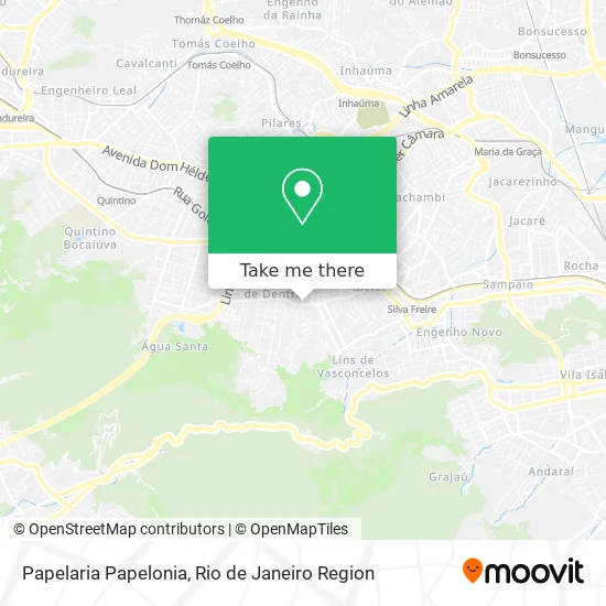
See Papelaria Papelonia, Méier, on the map
Public Transit to Papelaria Papelonia in Méier
Wondering how to get to Papelaria Papelonia in Méier? Moovit helps you find the best way to get to Papelaria Papelonia with step-by-step directions from the nearest public transit station.
Moovit provides free maps and live directions to help you navigate through your city. View schedules, routes, timetables, and find out how long does it take to get to Papelaria Papelonia in real time.
Looking for the nearest stop or station to Papelaria Papelonia? Check out this list of stops closest to your destination: Rua Dias Da Cruz; Rua Dias Da Cruz; Rua Maranhão; Piedade; Rua Intendente Cunha Menezes.
Bus: 239, 247, 363, 685, 693, 249, SN 363, 651, 232, SN 232, 679.Train: RAMAL DEODORO, RAMAL JAPERI, RAMAL SANTA CRUZ.
Want to see if there’s another route that gets you there at an earlier time? Moovit helps you find alternative routes or times. Get directions from and directions to Papelaria Papelonia easily from the Moovit App or Website.
We make riding to Papelaria Papelonia easy, which is why over 1.5 million users, including users in Méier, trust Moovit as the best app for public transit. You don’t need to download an individual bus app or train app, Moovit is your all-in-one transit app that helps you find the best bus time or train time available.
For information on prices of bus and train, costs and ride fares to Papelaria Papelonia, please check the Moovit app.
Use the app to navigate to popular places including to the airport, hospital, stadium, grocery store, mall, coffee shop, school, college, and university.
Papelaria Papelonia Address: Rua Souza Aguiar, 22 Méier Rio de Janeiro-RJ 20720-035 street in Méier
- Academia Marcos Baptista,
- Rua Dias da Cruz / Rua Fábio Luz,
- Pretty Express Esmalteria - Méier,
- Metro III SEEDUC,
- Rua Dias da Cruz / Rua Caetano de Almeida,
- Heptada Martinista Rio de Janeiro,
- Rua Maranhão 3,
- RN Salgados,
- Via Mate Meier Lanches,
- Continente Supermercados,
- Prezunic Méier,
- Rua Maranhão / Rua Dias da Cruz,
- Rua Dias da Cruz 579,
- Drogarias Pacheco,
- Prezunic,
- Curso de Auxiliar e Tecnico Em Enfermagem Yolanda Salim,
- Sport Club Mackenzie,
- Rua Caetano de Almeida,
- Malice Pizzaria,
- Ergo Med
Places Near Papelaria Papelonia (Méier)
- Feirão De Malhas, Duque De Caxias,
- Niterói, Niterói,
- Praia do Arpoador, Ipanema,
- Hospital Federal Do Andaraí, Andaraí,
- Rua Ulysses Guimarães 16, Cidade Nova,
- Feira Livre da Gloria, Glória,
- Avenida Venezuela 134, Saúde,
- Hospital Municipal Ronaldo Gazolla, Acari,
- Shopping Downtown, Barra Da Tijuca,
- Shopping RioSul, Botafogo,
- Hospital Pedro Ernesto, Vila Isabel,
- Avenida Rio Branco, Centro,
- Rodoviária Novo Rio (Rodoviária do Rio de Janeiro), Santo Cristo,
- Shopping Rio Sul, Botafogo,
- Norte Shopping, Cachambi,
- Rio De Janeiro,
- Rua Licínio Cardoso, São Francisco Xavier,
- Hospital Federal Cardoso Fontes, Jacarepaguá,
- Shopping Nova América, Del Castilho,
- Museu Do Amanhã, Centro
How to get to popular places in Rio de Janeiro Region with public transit
Get around Méier by public transit!
Traveling around Méier has never been so easy. See step by step directions as you travel to any attraction, street or major public transit station. View bus and train schedules, arrival times, service alerts and detailed routes on a map, so you know exactly how to get to anywhere in Méier.
When traveling to any destination around Méier use Moovit's Live Directions with Get Off Notifications to know exactly where and how far to walk, how long to wait for your line, and how many stops are left. Moovit will alert you when it's time to get off — no need to constantly re-check whether yours is the next stop.
Wondering how to use public transit in Méier or how to pay for public transit in Méier? Moovit public transit app can help you navigate your way with public transit easily, and at minimum cost. It includes public transit fees, ticket prices, and costs. Looking for a map of Méier public transit lines? Moovit public transit app shows all public transit maps in Méier with all Bus, Train, Metro, Light Rail, Ferry, Cable Car, Gondola and Funicular routes and stops on an interactive map.
Rio de Janeiro Region has 8 transit type(s), including: Bus, Train, Metro, Light Rail, Ferry, Cable Car, Gondola and Funicular, operated by several transit agencies, including TrensRJ, Metrô Rio, VLT Carioca, Barcas Rio, BRT MOBI-Rio, Auto Viação Alpha, Auto Viação Tijuca, Gire Transportes, Transurb, Viação Nossa Senhora das Graças, Consórcio INTERSUL, Braso Lisboa (Municipal), Caprichosa Auto Ônibus, Auto Viação Três Amigos and Rodoviária Âncora Matias