Directions to Papercut Zine Library (Cambridge) with public transportation
The following transit lines have routes that pass near Papercut Zine Library
 Bus: 1, 109, 66, 69, 71.
- Train: FITCHBURG, FRAMINGHAM/WORCESTER.
- Subway: RED LINE, GREEN LINE B, GREEN LINE D, GREEN LINE E.
How to get to Papercut Zine Library by bus?
Click on the bus route to see step by step directions with maps, line arrival times and updated time schedules.
From Melrose, MA, Melrose
90 minFrom East Boston, Boston
76 minFrom One Financial Center, Boston
51 minFrom ICA, Boston
76 minFrom Belle Isle Lobster & Seafood, Winthrop Town
124 minFrom Hampton Inn Boston Seaport District (Hampton Inn-Hampton Inn Boston), Boston
64 minFrom MBTA Suffolk Downs Station, Boston
85 minFrom Ramada Boston, Boston
90 minFrom VFW Parkway, Boston
62 minFrom Le Meridien, Boston
57 min
How to get to Papercut Zine Library by train?
Click on the train route to see step by step directions with maps, line arrival times and updated time schedules.
How to get to Papercut Zine Library by subway?
Click on the subway route to see step by step directions with maps, line arrival times and updated time schedules.
From East Boston, Boston
48 minFrom One Financial Center, Boston
25 minFrom ICA, Boston
40 minFrom Belle Isle Lobster & Seafood, Winthrop Town
57 minFrom Hampton Inn Boston Seaport District (Hampton Inn-Hampton Inn Boston), Boston
46 minFrom MBTA Suffolk Downs Station, Boston
45 minFrom Ramada Boston, Boston
59 minFrom Le Meridien, Boston
30 min
Bus stops near Papercut Zine Library in Cambridge
Subway stations near Papercut Zine Library in Cambridge
Train station near Papercut Zine Library in Cambridge
- Porter, 20 min walk,VIEW
Bus lines to Papercut Zine Library in Cambridge
- 66, Harvard Via Allston,VIEW
- 86, Reservoir,VIEW
- RED LINE SHUTTLE, Jfk/Umass (Shuttle),VIEW
- RED LINE SHUTTLE, Alewife (Shuttle),VIEW
- RED LINE SHUTTLE, Harvard (Shuttle),VIEW
- RED LINE SHUTTLE, Alewife (Local Shuttle),VIEW
- 68, Kendall/MIT,VIEW
- 69, Harvard,VIEW
- 71, Harvard - Watertown Square,VIEW
- 73, Harvard - Waverley,VIEW
- 74, Harvard - Belmont Center,VIEW
- 75, Harvard - Belmont Center,VIEW
- 77, Harvard - Arlington Heights,VIEW
- 78, Harvard - Arlmont Village,VIEW
- 96, Harvard - Medford Square,VIEW
- 109, Harvard via Sullivan - Linden Square via Sullivan,VIEW
- 1, Nubian - Harvard,VIEW
- RED LINE SHUTTLE, Harvard - Kendall/MIT (Loop),VIEW
- RED LINE SHUTTLE, Harvard - South Station,VIEW
- RED LINE SHUTTLE, Alewife - Harvard via Holyoke Street,VIEW
What are the closest stations to Papercut Zine Library?
The closest stations to Papercut Zine Library are:
- 16 Eliot St is 209 yards away, 3 min walk.
- Harvard - Brattle St @ Palmer St is 220 yards away, 3 min walk.
- Quincy St @ Harvard St is 226 yards away, 3 min walk.
- Babcock Street is 269 yards away, 4 min walk.
- Harvard is 388 yards away, 5 min walk.
- Massachusetts Ave Opp Holyoke St is 498 yards away, 6 min walk.
- Broadway @ Felton St is 514 yards away, 7 min walk.
- Harvard Square is 968 yards away, 12 min walk.
- Porter is 1629 yards away, 20 min walk.
- Union Square is 2937 yards away, 35 min walk.
Which bus lines stop near Papercut Zine Library?
These bus lines stop near Papercut Zine Library: 1, 109, 66, 69, 71, 96.
Which train lines stop near Papercut Zine Library?
These train lines stop near Papercut Zine Library: FITCHBURG, FRAMINGHAM/WORCESTER.
Which subway line stops near Papercut Zine Library?
RED LINE (Alewife)
What’s the nearest subway station to Papercut Zine Library in Cambridge?
The nearest subway station to Papercut Zine Library in Cambridge is Babcock Street. It’s a 4 min walk away.
What’s the nearest train station to Papercut Zine Library in Cambridge?
The nearest train station to Papercut Zine Library in Cambridge is Porter. It’s a 20 min walk away.
What’s the nearest bus station to Papercut Zine Library in Cambridge?
The nearest bus stations to Papercut Zine Library in Cambridge are 16 Eliot St, Harvard - Brattle St @ Palmer St and Quincy St @ Harvard St. The closest one is a 3 min walk away.
What time is the first subway to Papercut Zine Library in Cambridge?
The GREEN LINE E is the first subway that goes to Papercut Zine Library in Cambridge. It stops nearby at 4:50 AM.
What time is the last subway to Papercut Zine Library in Cambridge?
The GREEN LINE B is the last subway that goes to Papercut Zine Library in Cambridge. It stops nearby at 2:20 AM.
What time is the first train to Papercut Zine Library in Cambridge?
The FITCHBURG is the first train that goes to Papercut Zine Library in Cambridge. It stops nearby at 5:47 AM.
What time is the last train to Papercut Zine Library in Cambridge?
The FITCHBURG is the last train that goes to Papercut Zine Library in Cambridge. It stops nearby at 12:17 AM.
What time is the first bus to Papercut Zine Library in Cambridge?
The 73 is the first bus that goes to Papercut Zine Library in Cambridge. It stops nearby at 4:45 AM.
What time is the last bus to Papercut Zine Library in Cambridge?
The 1 is the last bus that goes to Papercut Zine Library in Cambridge. It stops nearby at 2:35 AM.
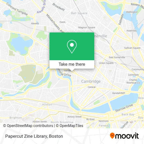
See Papercut Zine Library, Cambridge, on the map
Public Transit to Papercut Zine Library in Cambridge
Wondering how to get to Papercut Zine Library in Cambridge? Moovit helps you find the best way to get to Papercut Zine Library with step-by-step directions from the nearest public transit station.
Moovit provides free maps and live directions to help you navigate through your city. View schedules, routes, timetables, and find out how long does it take to get to Papercut Zine Library in real time.
Looking for the nearest stop or station to Papercut Zine Library? Check out this list of stops closest to your destination: 16 Eliot St; Harvard - Brattle St @ Palmer St; Quincy St @ Harvard St; Babcock Street; Harvard; Massachusetts Ave Opp Holyoke St; Broadway @ Felton St; Harvard Square; Porter; Union Square.
Bus: 1, 109, 66, 69, 71, 96, 86, RED LINE SHUTTLE, RED LINE SHUTTLE, RED LINE SHUTTLE, RED LINE SHUTTLE.Train: FITCHBURG, FRAMINGHAM/WORCESTER.Subway: RED LINE, GREEN LINE B, GREEN LINE D, GREEN LINE E.
Want to see if there’s another route that gets you there at an earlier time? Moovit helps you find alternative routes or times. Get directions from and directions to Papercut Zine Library easily from the Moovit App or Website.
We make riding to Papercut Zine Library easy, which is why over 1.7 million users, including users in Cambridge, trust Moovit as the best app for public transit. You don’t need to download an individual bus app or train app, Moovit is your all-in-one transit app that helps you find the best bus time or train time available.
For information on prices of bus, subway and train, costs and ride fares to Papercut Zine Library, please check the Moovit app.
Use the app to navigate to popular places including to the airport, hospital, stadium, grocery store, mall, coffee shop, school, college, and university.
Papercut Zine Library Address: 45 Mt Auburn St street in Cambridge
- Adams House,
- Saint Pauls Residence,
- 34 Mt Auburn St Parking,
- Harvard Catholic Center,
- St Paul Catholic Church (Stpaul Catholic Church),
- USPS Collection Box - Blue Box,
- Grafton Street Pub,
- Bushwang,
- Nexus Ir&D Laboratory,
- Small Planet Institute,
- The UPS Store,
- Harvard Book Store (Harvard Bookstore),
- Quincy Square,
- Faro Cafe,
- Mass Ave,
- Tatte Bakery & Cafe,
- Jose Mateo Ballet Theatre,
- Harvard Square,
- Leverett D-Hall,
- Block Denise S Psychothrpst
Places Near Papercut Zine Library (Cambridge)
- Massachusetts General Hospital, Boston,
- Quincy Market, Boston,
- Boston Children's Hospital, Boston,
- Wang Theater, Boston,
- Mgm Music Hall, Boston,
- Wilbur Theatre, Boston,
- Prudential Center, Boston,
- Boston Medical Center, Boston,
- Boston Common, Boston,
- Faneuil Hall, Boston,
- Cheers, Boston,
- Boston Convention & Exhibition Center, Boston,
- Museum Of Science, Boston,
- Seaport District, Boston,
- Castle Island, Boston,
- House Of Blues, Boston,
- Isabella Stewart Gardner Museum, Boston,
- Leader Bank Pavilion (Leader Bank Pavillion), Boston,
- Td Garden, Boston,
- North End, Boston
How to get to popular places in Boston with public transit
Get around Cambridge by public transit!
Traveling around Cambridge has never been so easy. See step by step directions as you travel to any attraction, street or major public transit station. View bus and train schedules, arrival times, service alerts and detailed routes on a map, so you know exactly how to get to anywhere in Cambridge.
When traveling to any destination around Cambridge use Moovit's Live Directions with Get Off Notifications to know exactly where and how far to walk, how long to wait for your line, and how many stops are left. Moovit will alert you when it's time to get off — no need to constantly re-check whether yours is the next stop.
Wondering how to use public transit in Cambridge or how to pay for public transit in Cambridge? Moovit public transit app can help you navigate your way with public transit easily, and at minimum cost. It includes public transit fees, ticket prices, and costs. Looking for a map of Cambridge public transit lines? Moovit public transit app shows all public transit maps in Cambridge with all Bus, Train, Subway and Ferry routes and stops on an interactive map.
Boston has 4 transit type(s), including: Bus, Train, Subway and Ferry, operated by several transit agencies, including MBTA, Southeastern Regional Transit Authority, MetroWest Regional Transit Authority, Rhode Island Public Transit Authority, WRTA, Lowell Regional Transit Authority, Merrimack Valley Transit, Montachusett Regional Transit Authority, Cape Cod Regional Transit Authority, Brockton Area Transit Authority, Martha's Vineyard Transit Authority, the WAVE - Nantucket Regional Transit Authority, GATRA, Cape Ann Transportation Authority and Massport