Directions to Parañaque City with public transportation
The following transit lines have routes that pass near Parañaque City
How to get to Parañaque City by bus?
Click on the bus route to see step by step directions with maps, line arrival times and updated time schedules.
Bus stations near Parañaque City
- Jerusalem Extension, Sacred Heart School, Paranaque City, 36 min walk,
- Sm Hypermarket, Dr A. Santos Ave, Parañaque City, 56 min walk,
Bus lines to Parañaque City
- JEEP, Multinational Avenue, Paranaque City,
- JEEP, Baclaran - Sucat/SSH via Quirino Ave.,
- JEEP, BACLARAN - SUCAT SSH via NINOY AQUINO AVE,
- JEEP, Alabang - Baclaran via Ninoy Aquino,
- JEEP, BACLARAN - ALABANG via N AQUINO AVE,
- JEEP, Kabihasnan Road - Sucat/SSH,
- JEEP, Sucat-SM MOA,
- JEEP, Baclaran - Sucat/SSH via Imelda Ave.,,
What are the closest stations to Parañaque City?
The closest stations to Parañaque City are:
- Jerusalem Extension, Sacred Heart School, Paranaque City is 2746 meters away, 36 min walk.
- Sm Hypermarket, Dr A. Santos Ave, Parañaque City is 4254 meters away, 56 min walk.
Which bus lines stop near Parañaque City?
These bus lines stop near Parañaque City: LTFRB-PUJ1014, LTFRB-PUJ1098, LTFRB-PUJ1381, LTFRB-PUJ2089.
See Parañaque City on the map
Public Transportation to Parañaque City
Wondering how to get to Parañaque City, Philippines? Moovit helps you find the best way to get to Parañaque City with step-by-step directions from the nearest public transit station.
Moovit provides free maps and live directions to help you navigate through your city. View schedules, routes, timetables, and find out how long does it take to get to Parañaque City in real time.
Looking for the nearest stop or station to Parañaque City? Check out this list of stops closest to your destination: Jerusalem Extension; Sm Hypermarket.
Bus: LTFRB-PUJ1014, LTFRB-PUJ1098, LTFRB-PUJ1381, LTFRB-PUJ2089, JEEP, JEEP, JEEP, JEEP, JEEP, JEEP.
Want to see if there’s another route that gets you there at an earlier time? Moovit helps you find alternative routes or times. Get directions from and directions to Parañaque City easily from the Moovit App or Website.
We make riding to Parañaque City easy, which is why over 1.5 million users, including users in Parañaque, trust Moovit as the best app for public transit. You don’t need to download an individual bus app or train app, Moovit is your all-in-one transit app that helps you find the best bus time or train time available.
For information on prices of bus, costs and ride fares to Parañaque City, please check the Moovit app.
Use the app to navigate to popular places including to the airport, hospital, stadium, grocery store, mall, coffee shop, school, college, and university.
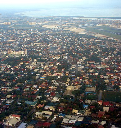
Location: Parañaque, Manila
Attractions near Parañaque City
Parañaque,Arara Compound,Levitown Estate,Delight,Bernabe,Paseo de Rey,MJS Ave,Pacific Rim Educational Foundation,Better Living Subdivision, Brgy. Don Bosco,Bliss,Giety,South Fileds International Christian Academy Centrum,Sycwin Coating & Wires Inc,M.J.S.Avenue,11 LPL Ave,Levitown Executive,Sir Conrad Rd,LPL Ave,Raw Houses,Levitown AveHow to get to popular attractions in Parañaque with public transit
LRT 1 (Blumentritt Station), Manila,DLTB Co.,Cartimar Pet Center,Starbucks Coffee, San Pedro,Coastal Road Foot Bridge, Parañaque,Robinsons MovieWorld, Manila,Army Navy Burger + Burrito, Muntinlupa,Starbucks Coffee, Dasmariñas,Pearl Drive Commercial Center, Quezon City,North Luzon Expressway (NLEX), Valenzuela,Balibago Complex, Sta. Rosa, Laguna, Santa Rosa City,Navotas, Malabon,BBL Trans (Buendia Terminal),Landbank Plaza, Manila,Bahayang Pag-asa Subdivision, Imus,SPi Global, Parañaque,Minor Basilica of St. Lorenzo Ruiz of Manila (Binondo Church), Manila,Starbucks Coffee,Valenzuela City, Valenzuela,BonChon Chicken, ParañaqueGet around Manila by public transit!
Traveling around Manila has never been so easy. See step by step directions as you travel to any attraction, street or major public transit station. View bus and train schedules, arrival times, service alerts and detailed routes on a map, so you know exactly how to get to anywhere in Manila.
When traveling to any destination around Manila use Moovit's Live Directions with Get Off Notifications to know exactly where and how far to walk, how long to wait for your line, and how many stops are left. Moovit will alert you when it's time to get off — no need to constantly re-check whether yours is the next stop.
Wondering how to use public transit in Manila or how to pay for public transit in Manila? Moovit public transit app can help you navigate your way with public transit easily, and at minimum cost. It includes public transit fees, ticket prices, and costs. Looking for a map of Manila public transit lines? Moovit public transit app shows all public transit maps in Manila with all Bus and Train routes and stops on an interactive map.
Manila has 2 transit type(s), including: Bus and Train, operated by several transit agencies, including MRTC, LRTA, PNR, LTFRB, BGC Bus, P2P, UV Express