Directions to Para Maria (Boston) with public transportation
The following transit lines have routes that pass near Para Maria
 Bus: 4, SL1, SL2, SL3, 7.
- Train: FRAMINGHAM/WORCESTER, NEWBURYPORT/ROCKPORT, PROVIDENCE/STOUGHTON, COMMUTER RAIL SHUTTLE, FAIRMOUNT LINE SHUTTLE.
- Subway: ORANGE LINE, RED LINE.
- Ferry: CHARLESTOWN FERRY, HINGHAM FERRY.
How to get to Para Maria by bus?
Click on the bus route to see step by step directions with maps, line arrival times and updated time schedules.
From Micro Center (Micro Elecronics), Cambridge
73 minFrom Agganis Arena, Boston
69 minFrom MBTA Jackson Square Station, Boston
47 minFrom Brighton District Court, Boston
56 minFrom Conte Forum, Boston
75 minFrom Alumni Stadium, Newton
76 minFrom Boston College, Boston
72 minFrom Boston College (BC), Boston
73 minFrom Chestnut Hill, Boston
74 minFrom Chelsea, MA, Chelsea
38 min
How to get to Para Maria by train?
Click on the train route to see step by step directions with maps, line arrival times and updated time schedules.
How to get to Para Maria by subway?
Click on the subway route to see step by step directions with maps, line arrival times and updated time schedules.
From Micro Center (Micro Elecronics), Cambridge
40 minFrom Agganis Arena, Boston
47 minFrom MBTA Jackson Square Station, Boston
30 minFrom Brighton District Court, Boston
72 minFrom Conte Forum, Boston
74 minFrom Alumni Stadium, Newton
74 minFrom Boston College, Boston
71 minFrom Boston College (BC), Boston
72 minFrom Chestnut Hill, Boston
73 min
Bus stops near Para Maria in Boston
Ferry stations near Para Maria in Boston
Train station near Para Maria in Boston
- South Station, 12 min walk,VIEW
Bus lines to Para Maria in Boston
- 4, Design Center - North Station via South Station,VIEW
- 7, Otis & Summer - City Point,VIEW
- 11, Chauncy & Summer - City Point,VIEW
- RED LINE SHUTTLE, Kendall/MIT - JFK/UMass,VIEW
- RED LINE SHUTTLE, Kendall/MIT - Broadway via Pearl Street,VIEW
- RED LINE SHUTTLE, Harvard - South Station,VIEW
- RED LINE SHUTTLE, Kendall/MIT - Broadway via Downtown Crossing,VIEW
- RED LINE SHUTTLE, Harvard - JFK/UMass via Congress Street,VIEW
- RED LINE SHUTTLE, JFK/UMass - Park Street via Post Office,VIEW
- RED LINE SHUTTLE, Harvard - Broadway,VIEW
- RED LINE SHUTTLE, JFK/UMass - Park Street,VIEW
- RED LINE SHUTTLE, JFK/UMass - Kendall/MIT (Shuttle),VIEW
- RED LINE SHUTTLE, Ashmont - Park Street via Post Office,VIEW
- RED LINE SHUTTLE, Harvard - JFK/UMass via State Street,VIEW
- SL1, South Station - Logan Airport,VIEW
- SL3, South Station - Chelsea,VIEW
- SL2, South Station - Design Center,VIEW
- SLW, South Station - Silver Line Way,VIEW
What are the closest stations to Para Maria?
The closest stations to Para Maria are:
- Summer St @ South Station - Red Line Entrance is 96 yards away, 2 min walk.
- Summer St @ Atlantic Ave is 110 yards away, 2 min walk.
- Long Wharf (South) is 486 yards away, 6 min walk.
- Courthouse is 564 yards away, 7 min walk.
- South Station is 1002 yards away, 12 min walk.
- Rowes Wharf is 1266 yards away, 16 min walk.
- Central Wharf (South) is 1711 yards away, 21 min walk.
- Seaport (Fan Pier) is 3150 yards away, 37 min walk.
Which bus lines stop near Para Maria?
These bus lines stop near Para Maria: 4, SL1, SL2, SL3.
Which train lines stop near Para Maria?
These train lines stop near Para Maria: FRAMINGHAM/WORCESTER, NEWBURYPORT/ROCKPORT, PROVIDENCE/STOUGHTON.
Which subway lines stop near Para Maria?
These subway lines stop near Para Maria: ORANGE LINE, RED LINE.
What’s the nearest train station to Para Maria in Boston?
The nearest train station to Para Maria in Boston is South Station. It’s a 12 min walk away.
What’s the nearest bus station to Para Maria in Boston?
The nearest bus stations to Para Maria in Boston are Summer St @ South Station - Red Line Entrance and Summer St @ Atlantic Ave. The closest one is a 2 min walk away.
What’s the nearest ferry station to Para Maria in Boston?
The nearest ferry station to Para Maria in Boston is Long Wharf (South). It’s a 6 min walk away.
What time is the first subway to Para Maria in Boston?
The RED LINE is the first subway that goes to Para Maria in Boston. It stops nearby at 5:30 AM.
What time is the last subway to Para Maria in Boston?
The RED LINE is the last subway that goes to Para Maria in Boston. It stops nearby at 1:49 AM.
What time is the first train to Para Maria in Boston?
The PROVIDENCE/STOUGHTON is the first train that goes to Para Maria in Boston. It stops nearby at 4:20 AM.
What time is the last train to Para Maria in Boston?
The LAKE SHORE LIMITED is the last train that goes to Para Maria in Boston. It stops nearby at 8:32 PM.
What time is the first bus to Para Maria in Boston?
The SLW is the first bus that goes to Para Maria in Boston. It stops nearby at 4:15 AM.
What time is the last bus to Para Maria in Boston?
The SL1 is the last bus that goes to Para Maria in Boston. It stops nearby at 1:31 AM.
What time is the first ferry to Para Maria in Boston?
The EAST is the first ferry that goes to Para Maria in Boston. It stops nearby at 6:01 AM.
What time is the last ferry to Para Maria in Boston?
The WINTHROP FERRY is the last ferry that goes to Para Maria in Boston. It stops nearby at 8:35 PM.
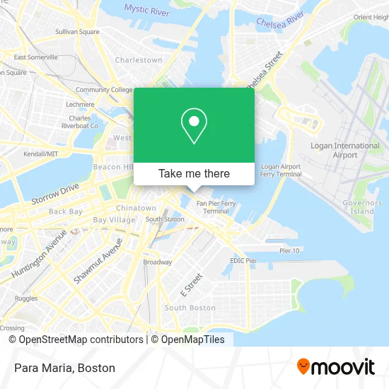
See Para Maria, Boston, on the map
Public Transit to Para Maria in Boston
Wondering how to get to Para Maria in Boston? Moovit helps you find the best way to get to Para Maria with step-by-step directions from the nearest public transit station.
Moovit provides free maps and live directions to help you navigate through your city. View schedules, routes, timetables, and find out how long does it take to get to Para Maria in real time.
Looking for the nearest stop or station to Para Maria? Check out this list of stops closest to your destination: Summer St @ South Station - Red Line Entrance; Summer St @ Atlantic Ave; Long Wharf (South); Courthouse; South Station; Rowes Wharf; Central Wharf (South); Seaport (Fan Pier).
Bus: 4, SL1, SL2, SL3, 7, 11, RED LINE SHUTTLE, RED LINE SHUTTLE, RED LINE SHUTTLE, SLW.Train: FRAMINGHAM/WORCESTER, NEWBURYPORT/ROCKPORT, PROVIDENCE/STOUGHTON, COMMUTER RAIL SHUTTLE, FAIRMOUNT LINE SHUTTLE, FRANKLIN LINE SHUTTLE, KINGSTON LINE SHUTTLE, WORCESTER LINE SHUTTLE.Subway: ORANGE LINE, RED LINE.Ferry: CHARLESTOWN FERRY, HINGHAM FERRY.
Want to see if there’s another route that gets you there at an earlier time? Moovit helps you find alternative routes or times. Get directions from and directions to Para Maria easily from the Moovit App or Website.
We make riding to Para Maria easy, which is why over 1.7 million users, including users in Boston, trust Moovit as the best app for public transit. You don’t need to download an individual bus app or train app, Moovit is your all-in-one transit app that helps you find the best bus time or train time available.
For information on prices of bus, subway and train, costs and ride fares to Para Maria, please check the Moovit app.
Use the app to navigate to popular places including to the airport, hospital, stadium, grocery store, mall, coffee shop, school, college, and university.
Para Maria Address: 70 Sleeper St street in Boston
- The Envoy Hotel, Autograph Collection,
- The Barking Crab,
- Envoy Hotel,
- Filson,
- L.L.Bean,
- Martin's Park,
- Equinox Seaport,
- The Daily Catch,
- John Joseph Moakley Us Courthouse,
- United States Court of Appeals (Tracy Jean Fink US Court of Appeals),
- Courthouse Station MBTA,
- Lincoln Property Company,
- John Joseph Moakley United States Courthouse,
- Tuscan Kitchen,
- Yotel,
- SEPHORA,
- Moakley Us Courthouse,
- Vertex Pharmaceuticals (Fan Pier),
- Komyuniti at Yotel (Yotel Boston First Floor),
- Via Seaport
Places Near Para Maria (Boston)
- House Of Blues, Boston,
- Prudential Center, Boston,
- Wang Theater, Boston,
- Boston Convention & Exhibition Center, Boston,
- Wilbur Theatre, Boston,
- Boston Children's Hospital, Boston,
- North End, Boston,
- Boston Medical Center, Boston,
- Boston Common, Boston,
- Museum Of Science, Boston,
- Td Garden, Boston,
- Mgm Music Hall, Boston,
- Massachusetts General Hospital, Boston,
- Faneuil Hall, Boston,
- Seaport District, Boston,
- Quincy Market, Boston,
- Isabella Stewart Gardner Museum, Boston,
- Cheers, Boston,
- Leader Bank Pavilion (Leader Bank Pavillion), Boston,
- Castle Island, Boston
How to get to popular places in Boston with public transit
Get around Boston by public transit!
Traveling around Boston has never been so easy. See step by step directions as you travel to any attraction, street or major public transit station. View bus and train schedules, arrival times, service alerts and detailed routes on a map, so you know exactly how to get to anywhere in Boston.
When traveling to any destination around Boston use Moovit's Live Directions with Get Off Notifications to know exactly where and how far to walk, how long to wait for your line, and how many stops are left. Moovit will alert you when it's time to get off — no need to constantly re-check whether yours is the next stop.
Wondering how to use public transit in Boston or how to pay for public transit in Boston? Moovit public transit app can help you navigate your way with public transit easily, and at minimum cost. It includes public transit fees, ticket prices, and costs. Looking for a map of Boston public transit lines? Moovit public transit app shows all public transit maps in Boston with all Bus, Train, Subway and Ferry routes and stops on an interactive map.
Boston has 4 transit type(s), including: Bus, Train, Subway and Ferry, operated by several transit agencies, including MBTA, Southeastern Regional Transit Authority, MetroWest Regional Transit Authority, Rhode Island Public Transit Authority, WRTA, Lowell Regional Transit Authority, Merrimack Valley Transit, Montachusett Regional Transit Authority, Cape Cod Regional Transit Authority, Brockton Area Transit Authority, Martha's Vineyard Transit Authority, the WAVE - Nantucket Regional Transit Authority, GATRA, Cape Ann Transportation Authority and Massport